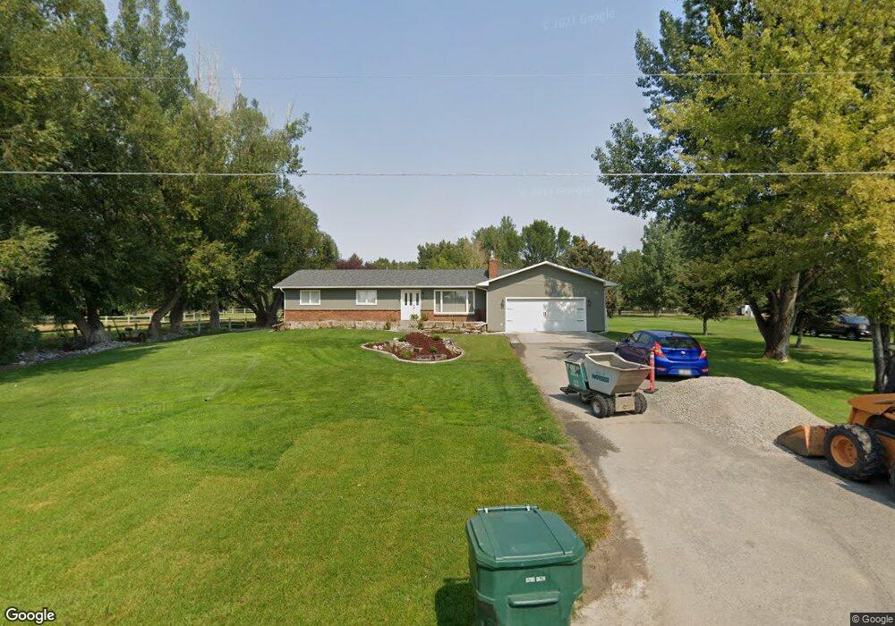
1409 E Maryland Ln Laurel, MT 59044
Estimated Value: $521,000 - $763,000
4
Beds
3
Baths
2,974
Sq Ft
$211/Sq Ft
Est. Value
About This Home
This home is located at 1409 E Maryland Ln, Laurel, MT 59044 and is currently estimated at $627,637, approximately $211 per square foot. 1409 E Maryland Ln is a home located in Yellowstone County with nearby schools including Fred W. Graff School, West School, and Laurel Middle School.
Ownership History
Date
Name
Owned For
Owner Type
Purchase Details
Closed on
Nov 13, 2020
Sold by
Bummer Daniel and Bummer Ariene
Bought by
Ronan Paul F and Ronan Audrey A
Current Estimated Value
Home Financials for this Owner
Home Financials are based on the most recent Mortgage that was taken out on this home.
Original Mortgage
$351,300
Outstanding Balance
$312,607
Interest Rate
2.8%
Mortgage Type
New Conventional
Estimated Equity
$315,030
Create a Home Valuation Report for This Property
The Home Valuation Report is an in-depth analysis detailing your home's value as well as a comparison with similar homes in the area
Home Values in the Area
Average Home Value in this Area
Purchase History
| Date | Buyer | Sale Price | Title Company |
|---|---|---|---|
| Ronan Paul F | -- | First American Title Company |
Source: Public Records
Mortgage History
| Date | Status | Borrower | Loan Amount |
|---|---|---|---|
| Open | Ronan Paul F | $351,300 |
Source: Public Records
Tax History
| Year | Tax Paid | Tax Assessment Tax Assessment Total Assessment is a certain percentage of the fair market value that is determined by local assessors to be the total taxable value of land and additions on the property. | Land | Improvement |
|---|---|---|---|---|
| 2025 | $3,343 | $561,500 | $119,080 | $442,420 |
| 2024 | $3,343 | $469,500 | $78,376 | $391,124 |
| 2023 | $3,267 | $469,500 | $78,376 | $391,124 |
| 2022 | $2,363 | $366,000 | $0 | $0 |
| 2021 | $2,500 | $348,700 | $0 | $0 |
| 2020 | $2,215 | $299,900 | $0 | $0 |
| 2019 | $2,134 | $299,900 | $0 | $0 |
| 2018 | $2,289 | $272,200 | $0 | $0 |
| 2017 | $2,096 | $272,200 | $0 | $0 |
| 2016 | $1,956 | $258,000 | $0 | $0 |
| 2015 | $1,928 | $258,000 | $0 | $0 |
| 2014 | $1,623 | $114,268 | $0 | $0 |
Source: Public Records
Map
Nearby Homes
- 1031 Fir Ave
- 1108 E 8th St
- 1104 E 8th St
- 605 Date Ave
- 717 E 5th, 506 Alder Ave
- 717 E 5th St
- 801 E 4th St
- 601 E 5th St
- 809 Pennsylvania Ave
- 1321 E Railroad St
- 414 Wyoming Ave
- 516 Pennsylvania Ave
- 1665 Wild Lupine Ln
- 110 E 5th St
- 1319 Valley Dr
- 603 5th Ave
- 1631 Valley Dr
- 1627 Brookway Cir
- 116 4th Ave
- 319 6th Ave
- 1505 E Maryland Ln
- 1333 E Maryland Ln
- 1424 Ridge Dr
- 1336 E Maryland Ln
- 1408 E Maryland Ln
- 1532 E Maryland Ln
- 1525 E Maryland Ln
- 1331 E Maryland Ln
- 1410 Ridge Dr
- 1326 E Maryland Ln
- 1328 Ridge Dr
- 1514 Ridge Dr
- 1329 E Maryland Ln
- 1515 Ridge Dr
- 1310 Ridge Dr
- 1310 E Maryland Ln
- 1607 E Maryland Ln
- 1606 Ridge Dr
- 1415 Ridge Dr
- 1331 Ridge Dr
Your Personal Tour Guide
Ask me questions while you tour the home.