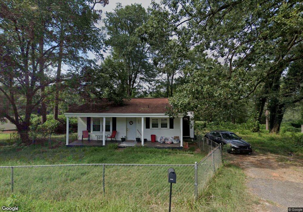
1409 P and N Dr Anderson, SC 29621
Estimated Value: $39,000 - $76,000
2
Beds
--
Bath
739
Sq Ft
$66/Sq Ft
Est. Value
About This Home
This home is located at 1409 P and N Dr, Anderson, SC 29621 and is currently estimated at $49,132, approximately $66 per square foot. 1409 P and N Dr is a home located in Anderson County with nearby schools including Nevitt Forest Elementary School, Glenview Middle School, and T.L. Hanna High School.
Ownership History
Date
Name
Owned For
Owner Type
Purchase Details
Closed on
Nov 25, 2024
Sold by
Stephens Jennifer L
Bought by
Hase Investments Inc
Current Estimated Value
Purchase Details
Closed on
Apr 8, 2013
Sold by
Transportation Alliance Bank Inc
Bought by
Home Opportunity Llc
Purchase Details
Closed on
Jun 12, 2012
Sold by
Home Solutions Partners Iii Reo Llc
Bought by
Transportation Alliance Bank Inc
Purchase Details
Closed on
Apr 14, 2011
Sold by
Crawford James Richard and Crawford Deborah A
Bought by
Home Solutions Partners Iii Reo Llc
Create a Home Valuation Report for This Property
The Home Valuation Report is an in-depth analysis detailing your home's value as well as a comparison with similar homes in the area
Home Values in the Area
Average Home Value in this Area
Purchase History
| Date | Buyer | Sale Price | Title Company |
|---|---|---|---|
| Hase Investments Inc | $40,000 | None Listed On Document | |
| Hase Investments Inc | $40,000 | None Listed On Document | |
| Home Opportunity Llc | -- | -- | |
| Transportation Alliance Bank Inc | $23,267 | -- | |
| Home Solutions Partners Iii Reo Llc | -- | -- |
Source: Public Records
Tax History Compared to Growth
Tax History
| Year | Tax Paid | Tax Assessment Tax Assessment Total Assessment is a certain percentage of the fair market value that is determined by local assessors to be the total taxable value of land and additions on the property. | Land | Improvement |
|---|---|---|---|---|
| 2024 | $1,044 | $2,930 | $610 | $2,320 |
| 2023 | $1,044 | $2,930 | $610 | $2,320 |
| 2022 | $319 | $1,000 | $610 | $390 |
| 2021 | $296 | $680 | $360 | $320 |
| 2020 | $290 | $680 | $360 | $320 |
| 2019 | $290 | $680 | $360 | $320 |
| 2018 | $287 | $680 | $360 | $320 |
| 2017 | -- | $2,450 | $480 | $1,970 |
| 2016 | $886 | $2,630 | $450 | $2,180 |
| 2015 | $893 | $2,630 | $450 | $2,180 |
| 2014 | $876 | $2,630 | $450 | $2,180 |
Source: Public Records
Map
Nearby Homes
- 1414 P and Dr N
- 109 Woodfern Cir
- 1313 Phyllis Dr
- 209 Blue Ridge Cir
- 1205 Ramona Dr
- 1425 Amity Rd
- 0 Highway 29 N Unit 20292906
- 0 Highway 29 N Unit 20292905
- 0 Highway 29 N Unit 20292904
- 0 Highway 29 N Unit 20292903
- 0 Highway 29 N Unit 22331558
- 0 Highway 29 N Unit 22331556
- 0 Highway 29 N Unit 22331557
- 606 Highway 29 Bypass N
- 2537 Belhaven Rd
- 701 Shamrock Ln
- 2335 Snow Rd
- 611 Wh Kay Ln
- 2703 Leftwich Ln
- 404 Sarah Dr
- 1407 P and N Dr
- 1411 P and N Dr
- 1406 P and N Dr
- 1410 P and N Dr
- 1410 P and N Dr
- 1410 P and N (Withdrawn) Dr
- 1410 P&n Dr
- 1410 P&n Dr Unit (WITHDRAWN)
- 1403 P and N Dr
- 1413 P and N Dr
- 1402 P and N Dr
- 1412 P and N Dr
- 1400 P and N Dr
- 1401 P and N Dr
- 1414 P and N Dr
- 1308 Robbins Dr
- 1416 P and N Dr
- 1510 P and N Dr
- 1306 Robbins Dr
- 1313 P and N Dr