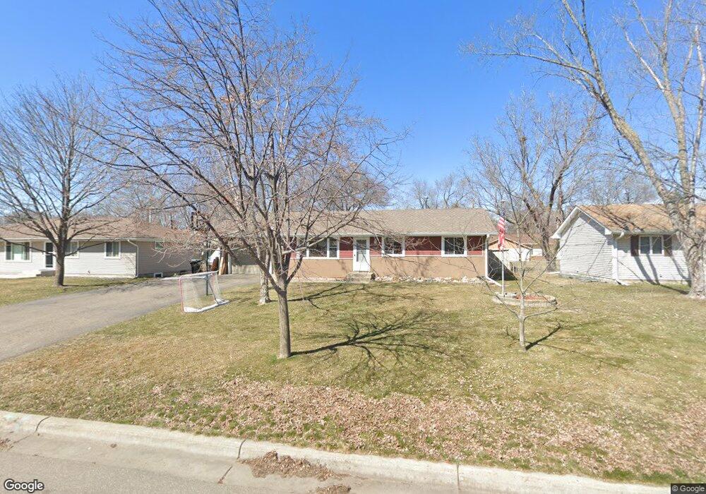
141 103rd Ave NW Coon Rapids, MN 55448
Estimated Value: $290,000 - $316,000
3
Beds
1
Bath
984
Sq Ft
$307/Sq Ft
Est. Value
About This Home
This home is located at 141 103rd Ave NW, Coon Rapids, MN 55448 and is currently estimated at $301,862, approximately $306 per square foot. 141 103rd Ave NW is a home located in Anoka County with nearby schools including Lucile Bruner Elementary School, University Elementary School, and Laughlin Junior/Senior High School.
Ownership History
Date
Name
Owned For
Owner Type
Purchase Details
Closed on
Jun 14, 2007
Sold by
Quinehan Gerald and Quinehan Linda
Bought by
Mckenzie Lonna L and Mckenzie Jason C
Current Estimated Value
Home Financials for this Owner
Home Financials are based on the most recent Mortgage that was taken out on this home.
Original Mortgage
$150,000
Interest Rate
6.26%
Mortgage Type
New Conventional
Create a Home Valuation Report for This Property
The Home Valuation Report is an in-depth analysis detailing your home's value as well as a comparison with similar homes in the area
Home Values in the Area
Average Home Value in this Area
Purchase History
| Date | Buyer | Sale Price | Title Company |
|---|---|---|---|
| Mckenzie Lonna L | $187,500 | -- |
Source: Public Records
Mortgage History
| Date | Status | Borrower | Loan Amount |
|---|---|---|---|
| Closed | Mckenzie Lonna L | $150,000 |
Source: Public Records
Tax History Compared to Growth
Tax History
| Year | Tax Paid | Tax Assessment Tax Assessment Total Assessment is a certain percentage of the fair market value that is determined by local assessors to be the total taxable value of land and additions on the property. | Land | Improvement |
|---|---|---|---|---|
| 2025 | $2,950 | $275,700 | $90,000 | $185,700 |
| 2024 | $2,950 | $269,200 | $86,000 | $183,200 |
| 2023 | $2,712 | $264,300 | $79,000 | $185,300 |
| 2022 | $2,630 | $261,100 | $65,000 | $196,100 |
| 2021 | $2,512 | $226,600 | $69,000 | $157,600 |
| 2020 | $2,484 | $212,100 | $65,000 | $147,100 |
| 2019 | $2,309 | $201,900 | $61,000 | $140,900 |
| 2018 | $2,200 | $183,100 | $0 | $0 |
| 2017 | $1,673 | $170,000 | $0 | $0 |
| 2016 | $1,608 | $138,500 | $0 | $0 |
| 2015 | -- | $138,500 | $46,000 | $92,500 |
| 2014 | -- | $119,000 | $36,900 | $82,100 |
Source: Public Records
Map
Nearby Homes
- 150 104th Ln NW
- 228 104th Ln NW
- 10419 Goldenrod St NW
- 122 106th Ave NW
- 424 106th Ave NW
- 10728 Ilex St NW
- 10248 Washington Ct NE
- 10200 Pleasure Creek Pkwy W
- 361 Territorial Rd NE
- 10650 Kumquat St NW Unit 504
- 341 109th Ave NW
- 10647 Washington Blvd NE
- 9931 Larch St NW
- 10011 Pleasure Creek Cir NE
- 9830 6th St NE
- 251 109th Ln NW
- 9872 7th St NE
- 413 Territorial Rd NE
- 826 104th Ave NW
- 484 98th Ln NE
- 133 103rd Ave NW
- 149 103rd Ave NW
- 125 103rd Ave NW
- 155 103rd Ave NW
- 140 104th Ave NW
- 140 103rd Ave NW
- 150 103rd Ave NW
- 132 104th Ave NW
- 132 103rd Ave NW
- 150 104th Ave NW
- 115 103rd Ave NW
- 126 103rd Ave NW
- 156 103rd Ave NW
- 126 104th Ave NW
- 156 104th Ave NW
- 116 104th Ave NW
- 110 103rd Ave NW
- 201 103rd Ave NW
- 107 103rd Ave NW
- 149 102nd Ln NW