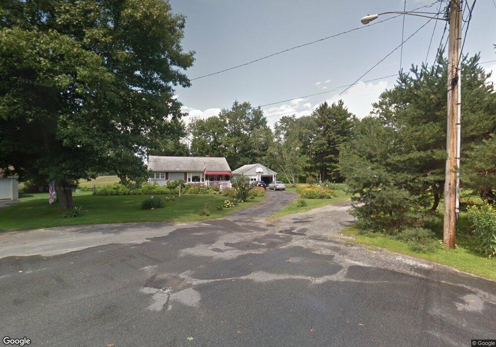
141 Birch Grove Dr Pittsfield, MA 01201
Estimated Value: $269,000 - $355,000
3
Beds
2
Baths
925
Sq Ft
$325/Sq Ft
Est. Value
About This Home
This home is located at 141 Birch Grove Dr, Pittsfield, MA 01201 and is currently estimated at $300,306, approximately $324 per square foot. 141 Birch Grove Dr is a home located in Berkshire County with nearby schools including Egremont Elementary School, Theodore Herberg Middle School, and Pittsfield High School.
Ownership History
Date
Name
Owned For
Owner Type
Purchase Details
Closed on
Nov 6, 1998
Sold by
Kelly Thomas J and Kelly Colleen M
Bought by
Furlano Thomas J and Phillips Richard
Current Estimated Value
Home Financials for this Owner
Home Financials are based on the most recent Mortgage that was taken out on this home.
Original Mortgage
$74,000
Interest Rate
6.64%
Mortgage Type
Purchase Money Mortgage
Purchase Details
Closed on
Sep 14, 1990
Sold by
Haswell Richard K
Bought by
Kelly Colleen M
Home Financials for this Owner
Home Financials are based on the most recent Mortgage that was taken out on this home.
Original Mortgage
$98,921
Interest Rate
9.76%
Mortgage Type
Purchase Money Mortgage
Create a Home Valuation Report for This Property
The Home Valuation Report is an in-depth analysis detailing your home's value as well as a comparison with similar homes in the area
Home Values in the Area
Average Home Value in this Area
Purchase History
| Date | Buyer | Sale Price | Title Company |
|---|---|---|---|
| Furlano Thomas J | $104,000 | -- | |
| Furlano Thomas J | $104,000 | -- | |
| Kelly Colleen M | $97,500 | -- | |
| Kelly Colleen M | $97,500 | -- |
Source: Public Records
Mortgage History
| Date | Status | Borrower | Loan Amount |
|---|---|---|---|
| Open | Kelly Colleen M | $63,000 | |
| Closed | Kelly Colleen M | $74,000 | |
| Previous Owner | Kelly Colleen M | $98,921 |
Source: Public Records
Tax History Compared to Growth
Tax History
| Year | Tax Paid | Tax Assessment Tax Assessment Total Assessment is a certain percentage of the fair market value that is determined by local assessors to be the total taxable value of land and additions on the property. | Land | Improvement |
|---|---|---|---|---|
| 2025 | $4,736 | $264,000 | $84,200 | $179,800 |
| 2024 | $4,400 | $238,500 | $84,200 | $154,300 |
| 2023 | $4,127 | $225,300 | $84,200 | $141,100 |
| 2022 | $3,736 | $201,300 | $79,200 | $122,100 |
| 2021 | $3,459 | $179,700 | $79,200 | $100,500 |
| 2020 | $3,504 | $177,800 | $79,200 | $98,600 |
| 2019 | $3,175 | $163,500 | $74,200 | $89,300 |
| 2018 | $3,132 | $156,500 | $69,200 | $87,300 |
| 2017 | $3,013 | $153,500 | $69,200 | $84,300 |
| 2016 | $2,908 | $155,000 | $69,200 | $85,800 |
| 2015 | $2,799 | $155,000 | $69,200 | $85,800 |
Source: Public Records
Map
Nearby Homes
- 157 Maple Grove Dr
- 44 Marcella Ave
- 0 Longview Terrace
- 72 Cleveland St
- 50 Grand Ave
- 25 Putnam Ave
- 3 Tampa Ct
- 30 Belvidere Ave
- 99 Cambridge Ave
- 14 Allessio St
- 63 Reuter Ave
- 51 Foote Ave
- 25 E New Lenox Rd
- 21 Huron St
- 106 Sampson Pkwy
- 787 Williams St
- 64 Elaine Dr
- 129 Newell St
- 40 Sampson Pkwy
- 100 Holmes Rd
- 135 Birch Grove Dr
- 148 Birch Grove Dr
- 129 Birch Grove Dr
- 134 Birch Grove Dr
- 181 Maple Grove Dr
- 125 Birch Grove Dr
- 163 Maple Grove Dr
- 151 Maple Grove Dr
- 169 Maple Grove Dr
- 124 Birch Grove Dr
- 2 Maple Ln
- 177 Maple Grove Dr
- 119 Birch Grove Dr
- 179 Maple Grove Dr
- 118 Birch Grove Dr
- 1 Maple Ln
- 115 Birch Grove Dr
- 112 Birch Grove Dr
- 127 Maple Grove Dr
- 158 Maple Grove Dr