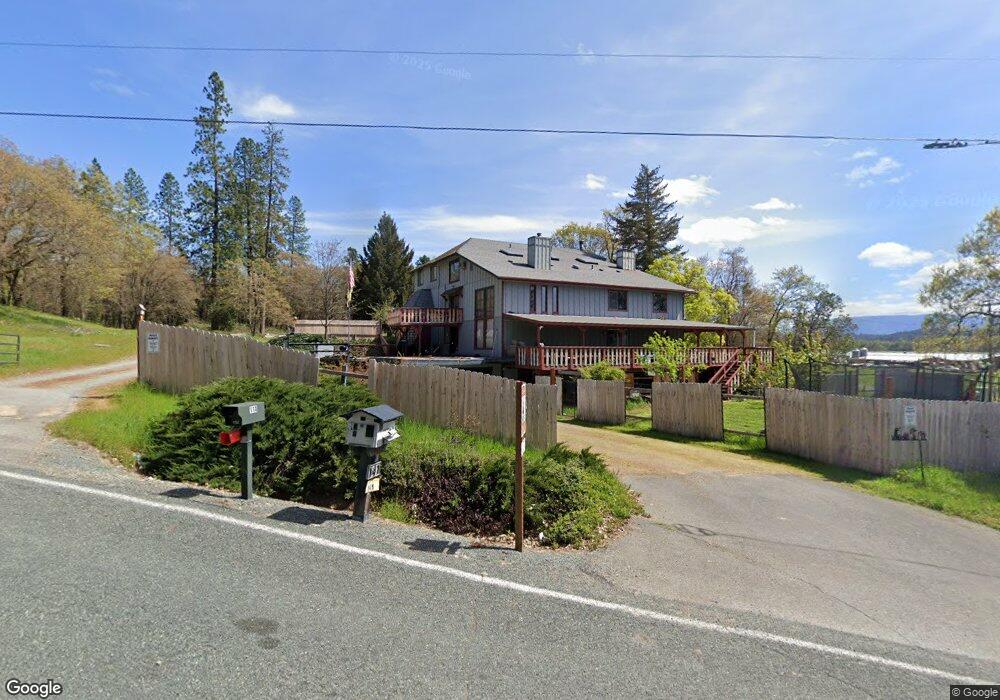
141 Buckskin Rd Grants Pass, OR 97526
Estimated Value: $560,999
6
Beds
4
Baths
3,936
Sq Ft
$143/Sq Ft
Est. Value
About This Home
This home is located at 141 Buckskin Rd, Grants Pass, OR 97526 and is currently estimated at $560,999, approximately $142 per square foot. 141 Buckskin Rd is a home located in Josephine County with nearby schools including Ft. Vannoy Elementary School, Fleming Middle School, and North Valley High School.
Ownership History
Date
Name
Owned For
Owner Type
Purchase Details
Closed on
Jun 26, 2025
Sold by
Bokor Arpad I
Bought by
Friedrichsmeyer Giovanni and Jacalone-Clewell Kayleigh
Current Estimated Value
Home Financials for this Owner
Home Financials are based on the most recent Mortgage that was taken out on this home.
Original Mortgage
$570,000
Outstanding Balance
$569,037
Interest Rate
6.86%
Mortgage Type
New Conventional
Estimated Equity
-$8,038
Purchase Details
Closed on
Jun 20, 2025
Sold by
Riverrain Michael J
Bought by
Larue John Ben and Bokor Arpad I
Home Financials for this Owner
Home Financials are based on the most recent Mortgage that was taken out on this home.
Original Mortgage
$570,000
Outstanding Balance
$569,037
Interest Rate
6.86%
Mortgage Type
New Conventional
Estimated Equity
-$8,038
Purchase Details
Closed on
May 11, 2011
Sold by
Riverrain Michael J
Bought by
Riverrain Michael J
Purchase Details
Closed on
Jun 3, 2010
Sold by
Trost Terry
Bought by
Trost Barbara Jean
Create a Home Valuation Report for This Property
The Home Valuation Report is an in-depth analysis detailing your home's value as well as a comparison with similar homes in the area
Home Values in the Area
Average Home Value in this Area
Purchase History
| Date | Buyer | Sale Price | Title Company |
|---|---|---|---|
| Friedrichsmeyer Giovanni | $535,000 | Ticor Title | |
| Friedrichsmeyer Giovanni | $267,500 | First American Title | |
| Larue John Ben | $420,000 | First American Title | |
| Riverrain Michael J | -- | None Available | |
| Trost Barbara Jean | $75,000 | First American | |
| Trost Barbara Jean | $75,000 | First American |
Source: Public Records
Mortgage History
| Date | Status | Borrower | Loan Amount |
|---|---|---|---|
| Open | Friedrichsmeyer Giovanni | $570,000 |
Source: Public Records
Tax History Compared to Growth
Tax History
| Year | Tax Paid | Tax Assessment Tax Assessment Total Assessment is a certain percentage of the fair market value that is determined by local assessors to be the total taxable value of land and additions on the property. | Land | Improvement |
|---|---|---|---|---|
| 2025 | $2,030 | $278,860 | -- | -- |
| 2024 | $2,030 | $270,740 | -- | -- |
| 2023 | $1,662 | $262,860 | $0 | $0 |
| 2022 | $1,678 | $255,210 | -- | -- |
| 2021 | $1,574 | $247,780 | $0 | $0 |
| 2020 | $1,640 | $240,570 | $0 | $0 |
| 2019 | $1,576 | $233,570 | $0 | $0 |
| 2018 | $1,598 | $226,770 | $0 | $0 |
| 2017 | $1,598 | $220,170 | $0 | $0 |
| 2016 | $1,356 | $213,760 | $0 | $0 |
| 2015 | $1,310 | $207,540 | $0 | $0 |
| 2014 | $1,277 | $201,500 | $0 | $0 |
Source: Public Records
Map
Nearby Homes
- 477 Roan Dr
- 6181 Lower River Rd
- 250 Cambridge Dr
- 5076 Leonard Rd Unit 69
- 5076 Leonard Rd Unit 117
- 770 Pass Creek Rd
- 225 Joshua St
- 4574 Lower River Rd
- 720 Azalea Dr
- 581 Azalea Dr
- 412 Teakwood Dr
- 1752 Rounds Ave
- 333 Beechwood Dr
- 306 Sandlewood Dr
- 4441 Upper River Rd
- 857 Azalea Dr
- 2100 Robinson Rd
- 4189 Upper River Rd
- 3597 Leonard Rd
- 1219 N Pinnon Rd
- 539 Roan Dr
- 114 Buckskin Rd
- 6240 Lower River Rd
- 150 Buckskin Rd
- 163 Buckskin Rd
- 6500 Lower River Rd
- 6206 Lower River Rd
- 6202 Lower River Rd
- 425 Roan Dr
- 184 Buckskin Rd
- 6134 Lower River Rd
- 6520 Lower River Rd
- 6170 Lower River Rd
- 478 Roan Dr
- 185 Stewart Rd
- 6531 Lower River Rd
- 369 Roan Dr
- 355 Roan Dr
- 175 Stewart Rd
- 195 Stewart Rd
