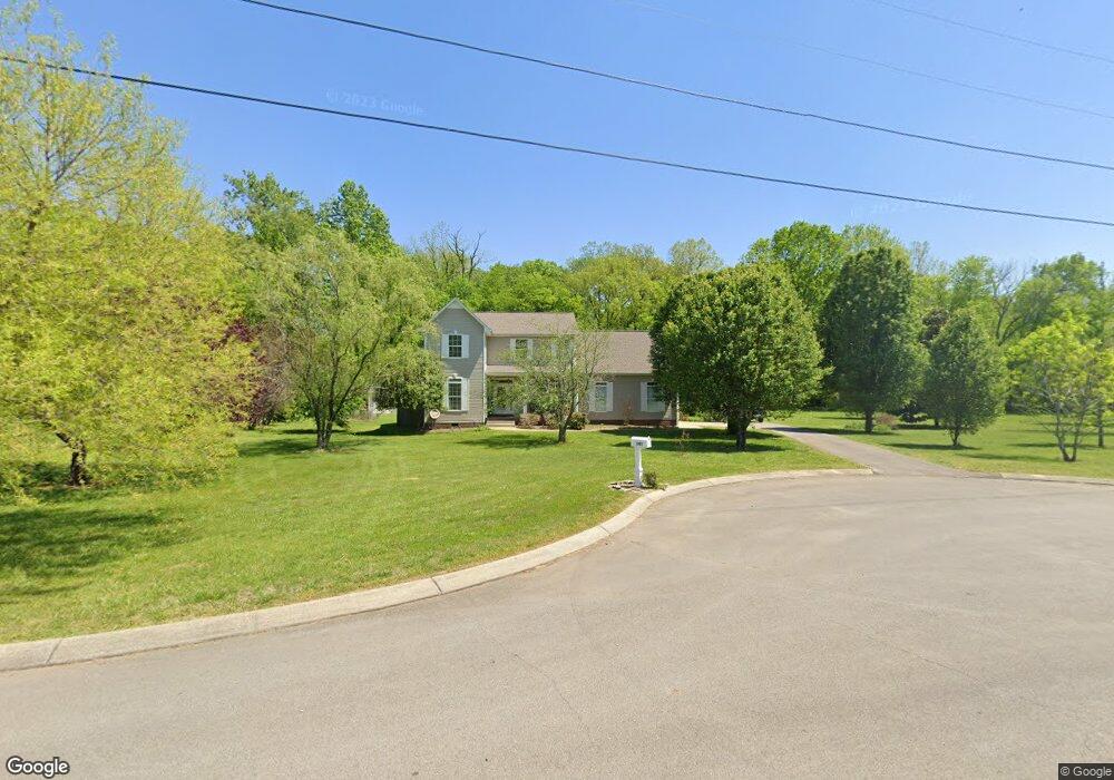
141 Carr Dr Spring Hill, TN 37174
--
Bed
2
Baths
2,328
Sq Ft
79,279
Sq Ft Lot
About This Home
This home is located at 141 Carr Dr, Spring Hill, TN 37174. 141 Carr Dr is a home located in Maury County with nearby schools including Spring Hill Elementary School, Spring Hill Middle School, and Spring Hill High School.
Create a Home Valuation Report for This Property
The Home Valuation Report is an in-depth analysis detailing your home's value as well as a comparison with similar homes in the area
Home Values in the Area
Average Home Value in this Area
Tax History
| Year | Tax Paid | Tax Assessment Tax Assessment Total Assessment is a certain percentage of the fair market value that is determined by local assessors to be the total taxable value of land and additions on the property. | Land | Improvement |
|---|---|---|---|---|
| 2022 | $2,502 | $94,475 | $20,000 | $74,475 |
Source: Public Records
Map
Nearby Homes
- 1001 Ewell Farm Cir
- 1064 Ewell Farm Cir
- 1065 Ewell Farm Cir
- 1038 Patriot Dr
- 308 Harvest Point Blvd
- 306 Harvest Point Blvd
- 298 Harvest Point Blvd
- 167 Harvest Point Blvd
- 304 Harvest Point Blvd
- 409 Rangeland Rd
- 305 Harvest Point Blvd
- 307 Harvest Point Blvd
- 309 Harvest Point Blvd
- 329 Harvest Point Blvd
- 333 Harvest Point Blvd
- 339 Harvest Point Blvd
- 328 Harvest Point Blvd
- 426 Wild Iris Way
- 293 Harvest Point Blvd
- 291 Harvest Point Blvd
Your Personal Tour Guide
Ask me questions while you tour the home.