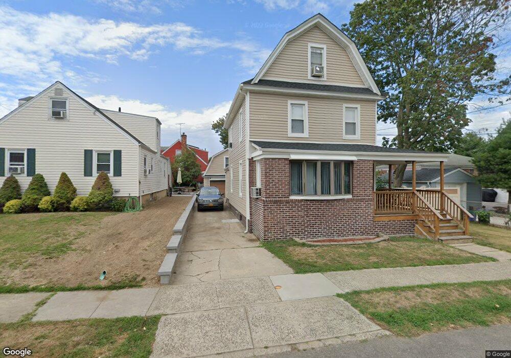
141 Central Ave Lynbrook, NY 11563
Estimated Value: $678,000 - $687,230
2
Beds
1
Bath
1,546
Sq Ft
$442/Sq Ft
Est. Value
About This Home
This home is located at 141 Central Ave, Lynbrook, NY 11563 and is currently estimated at $682,615, approximately $441 per square foot. 141 Central Ave is a home located in Nassau County with nearby schools including Lynbrook Senior High School, Our Lady Of Peace School, and Our Lady of Lourdes School.
Ownership History
Date
Name
Owned For
Owner Type
Purchase Details
Closed on
Jan 6, 2017
Sold by
Walsh William B
Bought by
Jagarnauth Samantha and Rippe George L
Current Estimated Value
Home Financials for this Owner
Home Financials are based on the most recent Mortgage that was taken out on this home.
Original Mortgage
$271,360
Outstanding Balance
$223,689
Interest Rate
4.13%
Mortgage Type
New Conventional
Estimated Equity
$458,926
Purchase Details
Closed on
Feb 11, 2005
Sold by
Walsh William
Create a Home Valuation Report for This Property
The Home Valuation Report is an in-depth analysis detailing your home's value as well as a comparison with similar homes in the area
Home Values in the Area
Average Home Value in this Area
Purchase History
| Date | Buyer | Sale Price | Title Company |
|---|---|---|---|
| Jagarnauth Samantha | $339,200 | Judicial Title | |
| -- | -- | -- |
Source: Public Records
Mortgage History
| Date | Status | Borrower | Loan Amount |
|---|---|---|---|
| Open | Jagarnauth Samantha | $271,360 |
Source: Public Records
Tax History
| Year | Tax Paid | Tax Assessment Tax Assessment Total Assessment is a certain percentage of the fair market value that is determined by local assessors to be the total taxable value of land and additions on the property. | Land | Improvement |
|---|---|---|---|---|
| 2025 | $10,359 | $452 | $189 | $263 |
| 2024 | $976 | $456 | $191 | $265 |
Source: Public Records
Map
Nearby Homes
- 42 Hendrickson Ave
- 40 Hendrickson Ave
- 64 Hodson Ave
- 90 Pearsall Ave
- 127 Smith St
- 29 Summit Ave
- 63 Central Ave
- 181 Walnut St
- 157 Hempstead Ave Unit B20
- 32 Franklin Ave
- 57 Nieman Ave
- 367 Vincent Ave
- 232 Sherman St
- 75 Noble St Unit 126
- 75 Noble St Unit 121
- 14 Hawthorne St
- 25 Centre St
- 20 Daley Place Unit 128
- 30 Daley Place Unit 136
- 30 Daley Place Unit 247
- 6 Kelsey Place
- 20 Green Ave
- 16 Green Ave
- 10 Kelsey Place
- 14 Kelsey Place
- 153 Central Ave
- 140 Central Ave Unit 1
- 146 Central Ave
- 148 Central Ave
- 12 Green Ave
- 18 Kelsey Place
- 34 Green Ave
- 7 Kelsey Place
- 152 Central Ave
- 157 Central Ave
- 11 Kelsey Place
- 19 Green Ave
- 15 Green Ave
- 23 Green Ave
- 156 Central Ave
Your Personal Tour Guide
Ask me questions while you tour the home.