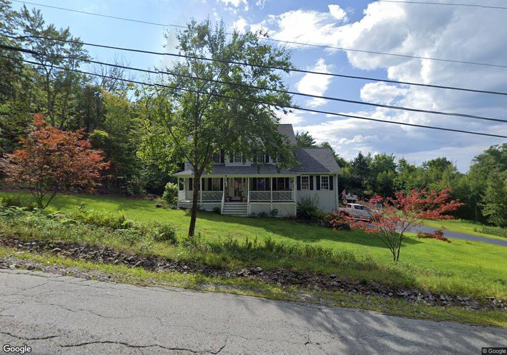
141 Dowboro Rd Pittsfield, NH 03263
Estimated Value: $498,000 - $582,000
3
Beds
3
Baths
2,268
Sq Ft
$234/Sq Ft
Est. Value
About This Home
This home is located at 141 Dowboro Rd, Pittsfield, NH 03263 and is currently estimated at $531,750, approximately $234 per square foot. 141 Dowboro Rd is a home located in Merrimack County with nearby schools including Pittsfield Elementary School and Pittsfield High School.
Ownership History
Date
Name
Owned For
Owner Type
Purchase Details
Closed on
Oct 6, 2022
Sold by
Couturier Danny J and Michaud Toni R
Bought by
M Couturier Ret 2022
Current Estimated Value
Purchase Details
Closed on
Aug 29, 2005
Sold by
Frenette Henry E
Bought by
Couturier Danny J
Home Financials for this Owner
Home Financials are based on the most recent Mortgage that was taken out on this home.
Original Mortgage
$229,500
Interest Rate
5.68%
Create a Home Valuation Report for This Property
The Home Valuation Report is an in-depth analysis detailing your home's value as well as a comparison with similar homes in the area
Home Values in the Area
Average Home Value in this Area
Purchase History
| Date | Buyer | Sale Price | Title Company |
|---|---|---|---|
| M Couturier Ret 2022 | -- | None Available | |
| Couturier Danny J | -- | None Available | |
| Couturier Danny J | $255,000 | -- | |
| Couturier Danny J | $255,000 | -- |
Source: Public Records
Mortgage History
| Date | Status | Borrower | Loan Amount |
|---|---|---|---|
| Previous Owner | Couturier Danny J | $229,500 |
Source: Public Records
Tax History Compared to Growth
Tax History
| Year | Tax Paid | Tax Assessment Tax Assessment Total Assessment is a certain percentage of the fair market value that is determined by local assessors to be the total taxable value of land and additions on the property. | Land | Improvement |
|---|---|---|---|---|
| 2024 | $9,281 | $310,700 | $82,800 | $227,900 |
| 2023 | $7,758 | $310,700 | $82,800 | $227,900 |
| 2022 | $7,388 | $310,700 | $82,800 | $227,900 |
| 2020 | $7,681 | $310,700 | $82,800 | $227,900 |
| 2019 | $7,663 | $233,200 | $62,100 | $171,100 |
| 2018 | $7,608 | $226,500 | $62,100 | $164,400 |
| 2017 | $7,468 | $223,200 | $62,100 | $161,100 |
| 2016 | $7,198 | $223,200 | $62,100 | $161,100 |
| 2015 | $6,758 | $223,200 | $62,100 | $161,100 |
| 2014 | $6,685 | $229,500 | $68,800 | $160,700 |
| 2013 | $6,999 | $227,400 | $68,800 | $158,600 |
Source: Public Records
Map
Nearby Homes
- 280 Webster Mills Rd
- 268 Mountain Rd
- 116 Webster Mills Rd
- 110 Main St
- 99 Fairview Dr
- 23 Concord Hill Rd
- 21 Concord Hill Rd
- 7 Cram Ave
- 67 Swiggey Brook Rd
- 28 Sanderson Dr
- 18 Catamount Rd
- 19 Depot Rd
- 804 Catamount Rd
- 449 Tilton Hill Rd
- 132 Chestnut Pond Rd
- 1310 & 1311 Upper City Rd
- L33 Province Rd
- M2-l29-2 Province Rd
- R11 07 Clough Rd
- 0 Shaw Rd Unit 36-1
- 137 Dowboro Rd
- 134 Dowboro Rd
- 13 Quail Ridge Rd
- 25 Quail Ridge Rd
- 121 Dowboro Rd
- 16 Quail Ridge Rd
- 130 Dowboro Rd
- 92 Quail Ridge Rd
- 30 Quail Ridge Rd
- 33 Quail Ridge Rd
- 117 Dowboro Rd
- 68 Quail Ridge Rd
- 110 Dowboro Rd
- 37 Quail Ridge Rd
- 100 Dowboro Rd
- 87 Quail Ridge Rd
- 103 Dowboro Rd
- 45 Quail Ridge Rd
- 186 Dowboro Rd
- 99 Dowboro Rd