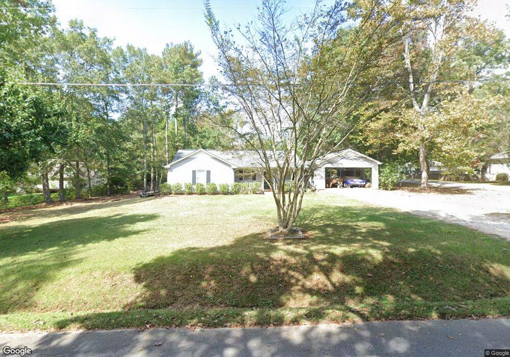
141 E Broad St Hoschton, GA 30548
Estimated Value: $261,512 - $298,000
--
Bed
2
Baths
1,308
Sq Ft
$217/Sq Ft
Est. Value
About This Home
This home is located at 141 E Broad St, Hoschton, GA 30548 and is currently estimated at $284,378, approximately $217 per square foot. 141 E Broad St is a home located in Jackson County with nearby schools including West Jackson Elementary School, West Jackson Middle School, and Jackson County High School.
Ownership History
Date
Name
Owned For
Owner Type
Purchase Details
Closed on
Sep 16, 2005
Sold by
Mcclure Viola
Bought by
Mcclure Pamela Kim
Current Estimated Value
Purchase Details
Closed on
Apr 30, 2003
Sold by
R Geratoni Properties Llc
Bought by
Mcclure Viola
Purchase Details
Closed on
Oct 3, 2002
Sold by
Lanier Aquisition Llc
Bought by
R Geratoni Properties Llc
Purchase Details
Closed on
Sep 3, 2002
Sold by
Roland Robert Calvin
Bought by
Lanier Aquisition Llc
Purchase Details
Closed on
Mar 11, 1998
Sold by
Roland Robert Calvin
Bought by
Roland Robert Calvin
Purchase Details
Closed on
Nov 4, 1996
Bought by
Roland Robert Calvin
Create a Home Valuation Report for This Property
The Home Valuation Report is an in-depth analysis detailing your home's value as well as a comparison with similar homes in the area
Home Values in the Area
Average Home Value in this Area
Purchase History
| Date | Buyer | Sale Price | Title Company |
|---|---|---|---|
| Mcclure Pamela Kim | -- | -- | |
| Mcclure Viola | $109,900 | -- | |
| R Geratoni Properties Llc | -- | -- | |
| Lanier Aquisition Llc | $82,900 | -- | |
| Roland Robert Calvin | -- | -- | |
| Roland Robert Calvin | $77,000 | -- |
Source: Public Records
Tax History Compared to Growth
Tax History
| Year | Tax Paid | Tax Assessment Tax Assessment Total Assessment is a certain percentage of the fair market value that is determined by local assessors to be the total taxable value of land and additions on the property. | Land | Improvement |
|---|---|---|---|---|
| 2024 | $2,166 | $69,812 | $21,120 | $48,692 |
| 2023 | $2,166 | $63,052 | $21,120 | $41,932 |
| 2022 | $1,539 | $43,532 | $10,560 | $32,972 |
| 2021 | $1,348 | $43,532 | $10,560 | $32,972 |
| 2020 | $1,252 | $37,452 | $10,560 | $26,892 |
| 2019 | $1,275 | $37,452 | $10,560 | $26,892 |
| 2018 | $1,353 | $39,316 | $10,560 | $28,756 |
| 2017 | $1,194 | $34,649 | $8,448 | $26,201 |
| 2016 | $1,198 | $34,649 | $8,448 | $26,201 |
| 2015 | $1,203 | $34,649 | $8,448 | $26,201 |
| 2014 | $1,150 | $33,804 | $8,448 | $25,356 |
| 2013 | -- | $33,804 | $8,448 | $25,356 |
Source: Public Records
Map
Nearby Homes
- 8422 Pendergrass Rd
- 74 White St
- 154 Serenity Ct
- 22 Huntley Trace Unit 230
- 60 Huntley Trace
- 22 Huntley Trace
- 38 Huntley Trace
- 176 Bell Ave
- 41 Huntley Trace
- 41 Huntley Trace Unit 5
- 49 Creekside Commons Dr
- 45 Creekside Commons Dr
- 41 Creekside Commons Dr
- 37 Creekside Commons Dr
- 58 Buckingham Ln Unit 236
- 58 Buckingham Ln
- 21 Creekside Commons Dr