Estimated Value: $374,000 - $420,562
About This Home
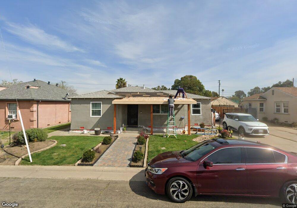
This home is located at 141 Franston St, Galt, CA 95632 and is currently estimated at $400,891, approximately $332 per square foot. 141 Franston St is a home located in Sacramento County with nearby schools including River Oaks Elementary School, Robert L. McCaffrey Middle School, and Galt High School.
Ownership History
We collect this data history from publicly available records. To have your information removed, we recommend requesting removal directly through your county’s website.
Purchase Details
Home Financials for this Owner
Home Financials are based on the most recent Mortgage that was taken out on this home.Home Values in the Area
Average Home Value in this Area
Purchase History
We collect this data history from publicly available records. To have your information removed, we recommend requesting removal directly through your county’s website.
| Date | Buyer | Sale Price | Title Company |
|---|---|---|---|
| $380,000 | First American Title |
Mortgage History
We collect this data history from publicly available records. To have your information removed, we recommend requesting removal directly through your county’s website.
| Date | Status | Borrower | Loan Amount |
|---|---|---|---|
| Open | $207,300 |
Tax History
We collect this data history from publicly available records. To have your information removed, we recommend requesting removal directly through your county’s website.
| Year | Tax Paid | Tax Assessment Tax Assessment Total Assessment is a certain percentage of the fair market value that is determined by local assessors to be the total taxable value of land and additions on the property. | Land | Improvement |
|---|---|---|---|---|
| 2025 | $4,637 | $403,258 | $95,508 | $307,750 |
| 2024 | $4,438 | $395,352 | $93,636 | $301,716 |
| 2023 | $4,363 | $387,600 | $91,800 | $295,800 |
| 2022 | $1,633 | $155,169 | $48,996 | $106,173 |
| 2021 | $1,633 | $152,128 | $48,036 | $104,092 |
| 2020 | $1,619 | $150,569 | $47,544 | $103,025 |
| 2019 | $1,577 | $147,617 | $46,612 | $101,005 |
| 2018 | $1,573 | $144,724 | $45,699 | $99,025 |
| 2017 | $1,510 | $141,887 | $44,803 | $97,084 |
| 2016 | $1,449 | $139,106 | $43,925 | $95,181 |
| 2015 | $1,398 | $137,018 | $43,266 | $93,752 |
| 2014 | $1,393 | $134,335 | $42,419 | $91,916 |
Map
- 1012 Hogan Rd
- 948 Hogan Rd
- 1136 Crenshaw Rd
- 944 Norman Rd
- 936 Norman Rd
- 932 Norman Rd
- 937 Norman Rd
- 945 Norman Rd
- 1152 Palmer Rd
- 929 Norman Rd
- 315 Maple St
- 1249 Mccabe Cir
- 1071 Hogan Rd
- 1266 Mccabe Cir
- 1270 Mccabe Cir
- 1080 Hogan Rd
- 1265 Mccabe Cir
- 1274 Mccabe Cir
- 1067 Honeysuckle Hill Ave
- 1079 Honeysuckle Hill Ave
- 147 Franston St
- 137 Franston St
- 151 Franston St
- 131 Franston St
- 127 Franston St
- 123 Franston St
- 124 Franston St
- 118 Franston St
- 117 Franston St
- 111 Franston St
- 110 Franston St
- 110 Crystal Way
- 109 Franston St
- 325 Pine St
- 10744 Boessow Rd
- 241 Crystal Way
- 430 Pine St
- 1405 C St
- 10749 Boessow Rd
- 1067 C St
Ask me questions while you tour the home.