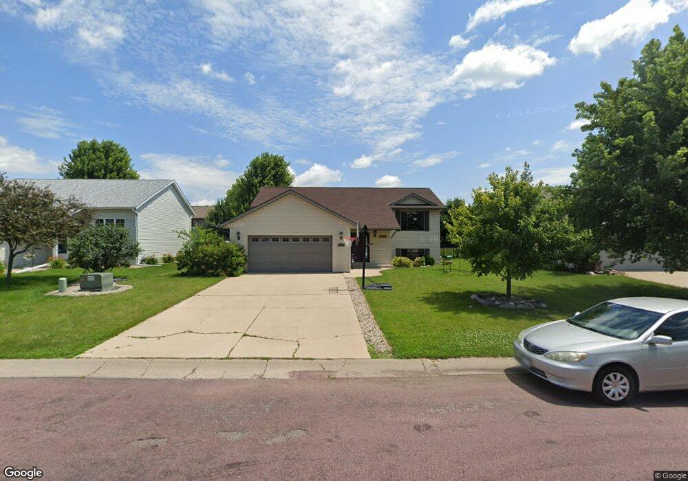
141 Quinion Dr Mankato, MN 56001
Buscher Park NeighborhoodEstimated Value: $343,000 - $363,000
5
Beds
2
Baths
1,184
Sq Ft
$297/Sq Ft
Est. Value
About This Home
This home is located at 141 Quinion Dr, Mankato, MN 56001 and is currently estimated at $351,881, approximately $297 per square foot. 141 Quinion Dr is a home located in Blue Earth County with nearby schools including Rosa Parks Elementary School, Prairie Winds Middle School, and Mankato East Senior High School.
Ownership History
Date
Name
Owned For
Owner Type
Purchase Details
Closed on
Nov 21, 2008
Sold by
Johnston Lucas C and Johnston Rachel
Bought by
Filter Kevin J and Filter Susan L
Current Estimated Value
Home Financials for this Owner
Home Financials are based on the most recent Mortgage that was taken out on this home.
Original Mortgage
$144,000
Outstanding Balance
$94,338
Interest Rate
6.04%
Mortgage Type
New Conventional
Estimated Equity
$257,543
Create a Home Valuation Report for This Property
The Home Valuation Report is an in-depth analysis detailing your home's value as well as a comparison with similar homes in the area
Home Values in the Area
Average Home Value in this Area
Purchase History
| Date | Buyer | Sale Price | Title Company |
|---|---|---|---|
| Filter Kevin J | $180,000 | -- |
Source: Public Records
Mortgage History
| Date | Status | Borrower | Loan Amount |
|---|---|---|---|
| Open | Filter Kevin J | $144,000 |
Source: Public Records
Tax History Compared to Growth
Tax History
| Year | Tax Paid | Tax Assessment Tax Assessment Total Assessment is a certain percentage of the fair market value that is determined by local assessors to be the total taxable value of land and additions on the property. | Land | Improvement |
|---|---|---|---|---|
| 2025 | $3,180 | $306,300 | $36,600 | $269,700 |
| 2024 | $3,180 | $296,900 | $36,600 | $260,300 |
| 2023 | $3,290 | $302,700 | $36,600 | $266,100 |
| 2022 | $2,874 | $289,800 | $36,600 | $253,200 |
| 2021 | $2,828 | $239,200 | $36,600 | $202,600 |
| 2020 | $2,654 | $221,700 | $36,600 | $185,100 |
| 2019 | $2,486 | $221,700 | $36,600 | $185,100 |
| 2018 | $2,270 | $208,900 | $33,300 | $175,600 |
| 2017 | $2,028 | $193,900 | $33,300 | $160,600 |
| 2016 | $1,978 | $183,700 | $33,300 | $150,400 |
| 2015 | $19 | $180,600 | $33,300 | $147,300 |
| 2014 | $1,904 | $173,000 | $33,300 | $139,700 |
Source: Public Records
Map
Nearby Homes
- 128 Timberwolf Ct
- TBD Woodridge
- 121 Savannah Ct
- 117 Savannah Ct
- 101 Wickfield Dr
- 108 Ella Ct
- 109 Emily Ln
- 111 Newton St
- 113 Sunburst Cir
- 124 Joshua Ct
- 216 S Brook Cir
- 112 Rosewood Dr Unit 108 Rosewood Drive
- 213 Rosewood Dr
- 20206 Monks Ave
- TBD S Brook Way
- 0 Tbd South Brook Way
- 317 Oak Marsh Dr
- 117 Sienna Cir
- 309 Viking Dr
- 136 Quail Path
- 145 Quinion Dr
- 137 Quinion Dr
- 124 Timberwolf Ct
- 149 Quinion Dr
- 120 Timberwolf Ct
- 133 Quinion Dr
- 120 Quinion Dr
- 116 Quinion Dr
- 124 Quinion Dr
- 124 124 Quinion Dr
- 132 Timberwolf Ct
- 153 Quinion Dr
- 153 Quinion Dr Unit 153 Quinion Drive
- 128 Quinion Dr
- 112 Timberwolf Ct
- 129 Quinion Dr
- 125 Quinion Dr
- 157 Quinion Dr
- 136 Timberwolf Ct
- 108 Timberwolf Ct