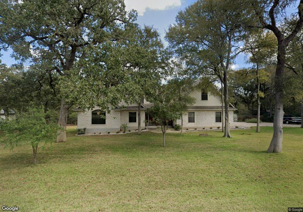
141 Spring Branch Bastrop, TX 78602
Estimated Value: $490,792 - $749,000
--
Bed
--
Bath
2,504
Sq Ft
$245/Sq Ft
Est. Value
About This Home
This home is located at 141 Spring Branch, Bastrop, TX 78602 and is currently estimated at $612,448, approximately $244 per square foot. 141 Spring Branch is a home located in Bastrop County with nearby schools including Mina Elementary School, Bastrop Intermediate School, and Bastrop Middle School.
Ownership History
Date
Name
Owned For
Owner Type
Purchase Details
Closed on
Mar 13, 2024
Sold by
Taylor Barbara and Taylor Forrest J
Bought by
Taylor Family Trust and Taylor
Current Estimated Value
Purchase Details
Closed on
Apr 16, 2021
Sold by
Taylor Barbara
Bought by
Taylor Barbara and Taylor J Forrest J
Purchase Details
Closed on
Jan 31, 2005
Sold by
Hudson Hack David Stuart and Hudson Hack Elizabeth
Bought by
Taylor Barbara Jean
Home Financials for this Owner
Home Financials are based on the most recent Mortgage that was taken out on this home.
Original Mortgage
$25,500
Interest Rate
5.71%
Mortgage Type
Purchase Money Mortgage
Create a Home Valuation Report for This Property
The Home Valuation Report is an in-depth analysis detailing your home's value as well as a comparison with similar homes in the area
Home Values in the Area
Average Home Value in this Area
Purchase History
| Date | Buyer | Sale Price | Title Company |
|---|---|---|---|
| Taylor Family Trust | -- | None Listed On Document | |
| Taylor Barbara | -- | Taylor Barbara | |
| Taylor Barbara Jean | -- | None Available |
Source: Public Records
Mortgage History
| Date | Status | Borrower | Loan Amount |
|---|---|---|---|
| Previous Owner | Taylor Barbara Jean | $25,500 |
Source: Public Records
Tax History
| Year | Tax Paid | Tax Assessment Tax Assessment Total Assessment is a certain percentage of the fair market value that is determined by local assessors to be the total taxable value of land and additions on the property. | Land | Improvement |
|---|---|---|---|---|
| 2025 | $6,553 | $539,813 | $150,024 | $389,789 |
| 2024 | $6,553 | $498,430 | -- | -- |
| 2023 | $6,553 | $453,118 | -- | -- |
| 2022 | $6,684 | $411,925 | $0 | $0 |
| 2021 | $7,412 | $387,443 | $57,703 | $329,740 |
| 2020 | $6,916 | $338,858 | $35,010 | $303,848 |
| 2019 | $7,208 | $340,147 | $35,010 | $305,137 |
| 2018 | $7,737 | $363,359 | $35,010 | $328,349 |
| 2017 | $7,432 | $332,130 | $38,511 | $301,742 |
| 2016 | $6,756 | $301,936 | $26,258 | $291,081 |
| 2015 | $5,195 | $274,487 | $35,011 | $250,200 |
| 2014 | $5,195 | $249,534 | $27,506 | $222,028 |
Source: Public Records
Map
Nearby Homes
- 104 Spring Branch
- 106 Spring Meadow
- 106 Fallow Way
- 117 Fallow Way
- 175 Cassena Ranch Dr
- 130 Axis Trail
- TBD (27 Acres) Shiloh Rd
- 156 Lone Star Cir
- 123 Lone Star Cir
- 203 Remington Run
- 203 Pheasant Trail
- 102 Thompson Trail
- 341 Bird Dog Bend
- 127 Eleanor Ln
- 100 Javelina Trail
- 235 El Camino River Rd
- 1133 Largemouth Ln
- 1125 Largemouth Ln
- 303 Bob's Trail
- 307 Sunfish Ln
- 137 Spring Branch
- 147 Spring Branch
- 268 Trigg Rd
- 262 Trigg Rd
- 272 Trigg Rd
- 144 Spring Branch
- 133 Spring Branch
- 152 Spring Branch
- 153 Spring Branch
- 132 Spring Branch
- 258 Trigg Rd
- 150 Spring Branch
- 150 Spring Meadow
- 282 Trigg Rd
- 110 Bobcat Trail
- 154 Spring Branch
- 155 Spring Branch
- 118 Spring Branch
- 252 Trigg Rd
- 121 Spring Branch
Your Personal Tour Guide
Ask me questions while you tour the home.