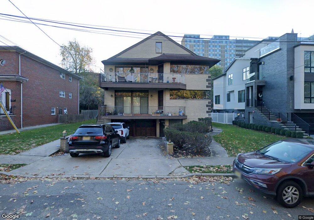
1410 14th St Fort Lee, NJ 07024
Estimated Value: $1,499,000 - $1,647,000
--
Bed
--
Bath
4,902
Sq Ft
$317/Sq Ft
Est. Value
About This Home
This home is located at 1410 14th St, Fort Lee, NJ 07024 and is currently estimated at $1,552,738, approximately $316 per square foot. 1410 14th St is a home located in Bergen County with nearby schools including Fort Lee High School, Christ the Teacher Academy, and Notre Dame Academy.
Ownership History
Date
Name
Owned For
Owner Type
Purchase Details
Closed on
Jul 24, 2009
Sold by
Roth Jacob and Roth Victoria
Bought by
Heo Sam Do and Heo Jung Hae
Current Estimated Value
Home Financials for this Owner
Home Financials are based on the most recent Mortgage that was taken out on this home.
Original Mortgage
$520,000
Interest Rate
5.36%
Mortgage Type
Purchase Money Mortgage
Purchase Details
Closed on
Jun 21, 2004
Sold by
Glezer Ronnet Roth
Bought by
Roth Jacob and Roth Victoria
Home Financials for this Owner
Home Financials are based on the most recent Mortgage that was taken out on this home.
Original Mortgage
$500,000
Interest Rate
6.25%
Purchase Details
Closed on
Dec 1, 1997
Sold by
Roth Jacob and Roth Victoria
Bought by
Roth Ronnet
Home Financials for this Owner
Home Financials are based on the most recent Mortgage that was taken out on this home.
Original Mortgage
$459,000
Interest Rate
7.15%
Create a Home Valuation Report for This Property
The Home Valuation Report is an in-depth analysis detailing your home's value as well as a comparison with similar homes in the area
Home Values in the Area
Average Home Value in this Area
Purchase History
| Date | Buyer | Sale Price | Title Company |
|---|---|---|---|
| Heo Sam Do | $890,000 | -- | |
| Roth Jacob | $775,000 | -- | |
| Roth Ronnet | $580,000 | Chicago Title Insurance Co |
Source: Public Records
Mortgage History
| Date | Status | Borrower | Loan Amount |
|---|---|---|---|
| Closed | Heo Sam Do | $520,000 | |
| Previous Owner | Roth Jacob | $500,000 | |
| Previous Owner | Roth Ronnet | $459,000 |
Source: Public Records
Tax History Compared to Growth
Tax History
| Year | Tax Paid | Tax Assessment Tax Assessment Total Assessment is a certain percentage of the fair market value that is determined by local assessors to be the total taxable value of land and additions on the property. | Land | Improvement |
|---|---|---|---|---|
| 2025 | $22,319 | $856,100 | $415,000 | $441,100 |
| 2024 | $21,180 | $856,100 | $415,000 | $441,100 |
| 2023 | $21,257 | $856,100 | $415,000 | $441,100 |
| 2022 | $21,257 | $856,100 | $415,000 | $441,100 |
| 2021 | $20,820 | $856,100 | $415,000 | $441,100 |
| 2020 | $20,623 | $856,100 | $415,000 | $441,100 |
| 2019 | $20,144 | $856,100 | $415,000 | $441,100 |
| 2018 | $19,673 | $856,100 | $415,000 | $441,100 |
| 2017 | $19,451 | $856,100 | $415,000 | $441,100 |
| 2016 | $19,296 | $856,100 | $415,000 | $441,100 |
| 2015 | $18,851 | $856,100 | $415,000 | $441,100 |
| 2014 | $18,500 | $856,100 | $415,000 | $441,100 |
Source: Public Records
Map
Nearby Homes
- 1406 14th St
- 581 Windsor Dr
- 592 Windsor Dr
- 1315 Anderson Ave Unit 32
- 1355 Abbott Blvd
- 600 12th St Unit 901
- 1273 16th St Unit 13
- 1265 15th St Unit 4E
- 1265 15th St Unit 11L
- 800 12th St Unit 1019
- 1545 13th St
- 1227 Inwood Terrace
- 448 North Ave Unit A
- 1561 Anderson Ave
- 1255 Anderson Ave Unit 14
- 1565 Center Ave Unit 4E
- 1547 11th St Unit B
- 226 Mohegan Way
- 324 E Palisades Blvd
- 322 E Palisades Blvd Unit B
- 1410 14th St Unit 1st Floor
- 1412 14th St
- 1412 14th St Unit 2fl
- 1408 14th St
- 1363 15th St
- 1365 15th St
- 1404 14th St
- 1385 15th St
- 1359 15th St
- 1359 15th St Unit 2nd Floor
- 1361 15th St
- 1416 14th St
- 1387 15th St
- 1357 15th St
- 551A 14th St
- 1418 14th St
- 551B 14th St
- 551B 14th St Unit B
- 1389 15th St
- 1389 15th St Unit 2