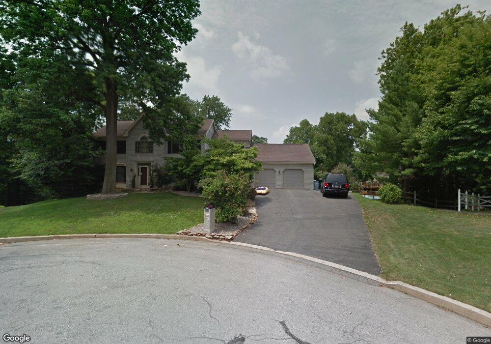
1410 Abbas Ave Lancaster, PA 17602
Conestoga Woods NeighborhoodEstimated Value: $591,055 - $709,000
4
Beds
4
Baths
2,888
Sq Ft
$227/Sq Ft
Est. Value
About This Home
This home is located at 1410 Abbas Ave, Lancaster, PA 17602 and is currently estimated at $655,264, approximately $226 per square foot. 1410 Abbas Ave is a home located in Lancaster County with nearby schools including Lampeter Elementary School, Hans Herr Elementary School, and Martin Meylin Middle School.
Ownership History
Date
Name
Owned For
Owner Type
Purchase Details
Closed on
Sep 19, 2002
Sold by
Deiter Eugene C and Deiter Patricia A
Bought by
Parido Matthew E and Parido Tracy S
Current Estimated Value
Home Financials for this Owner
Home Financials are based on the most recent Mortgage that was taken out on this home.
Original Mortgage
$198,400
Interest Rate
6.25%
Create a Home Valuation Report for This Property
The Home Valuation Report is an in-depth analysis detailing your home's value as well as a comparison with similar homes in the area
Home Values in the Area
Average Home Value in this Area
Purchase History
| Date | Buyer | Sale Price | Title Company |
|---|---|---|---|
| Parido Matthew E | $224,000 | First American Title Ins Co |
Source: Public Records
Mortgage History
| Date | Status | Borrower | Loan Amount |
|---|---|---|---|
| Previous Owner | Parido Matthew E | $198,400 | |
| Closed | Parido Matthew E | $18,000 |
Source: Public Records
Tax History Compared to Growth
Tax History
| Year | Tax Paid | Tax Assessment Tax Assessment Total Assessment is a certain percentage of the fair market value that is determined by local assessors to be the total taxable value of land and additions on the property. | Land | Improvement |
|---|---|---|---|---|
| 2025 | $9,967 | $297,400 | $72,900 | $224,500 |
| 2024 | $9,967 | $297,400 | $72,900 | $224,500 |
| 2023 | $9,852 | $297,400 | $72,900 | $224,500 |
| 2022 | $9,475 | $297,400 | $72,900 | $224,500 |
| 2021 | $9,379 | $297,400 | $72,900 | $224,500 |
| 2020 | $9,379 | $297,400 | $72,900 | $224,500 |
| 2019 | $9,295 | $297,400 | $72,900 | $224,500 |
| 2018 | $4,843 | $297,400 | $72,900 | $224,500 |
| 2017 | $8,672 | $225,700 | $46,600 | $179,100 |
| 2016 | $8,577 | $225,700 | $46,600 | $179,100 |
| 2015 | $4,007 | $225,700 | $46,600 | $179,100 |
| 2014 | $7,261 | $225,700 | $46,600 | $179,100 |
Source: Public Records
Map
Nearby Homes
- 305 Conestoga Blvd
- 235 Landis Dr
- 154 River Bend Park
- 415 Lampeter Rd
- 452 Longfellow Dr
- 6 Woodlyn Ct
- 1560 S Jefferson Ct
- 257 Longfellow Dr
- 11 Clayton Ave
- 516 Conestoga Greenway Trail
- 1153 S Duke St
- 1036 E King St
- 1827 Krystle Dr
- 1624 Morningside Dr
- 911 E King St
- 728 E End Ave
- 980 E Orange St
- 121 S Marshall St
- 604 E End Ave
- 1864 Lincoln Hwy E
- 1420 Abbas Ave
- 1415 Putnam Dr
- 1430 Abbas Ave
- 1405 Putnam Dr
- 1425 Putnam Dr
- 1440 Abbas Ave
- 1455 Abbas Ave
- 1450 Abbas Ave
- 335 Walter Ave
- 325 Walter Ave
- 1465 Abbas Ave
- 79 River Bend Park Unit 79
- 80 River Bend Park
- 76 River Bend Park
- 78 River Bend Park
- 1435 Putnam Dr
- 77 River Bend Park
- 1445 Putnam Dr
- 75 River Bend Park
- 1470 Putnam Dr