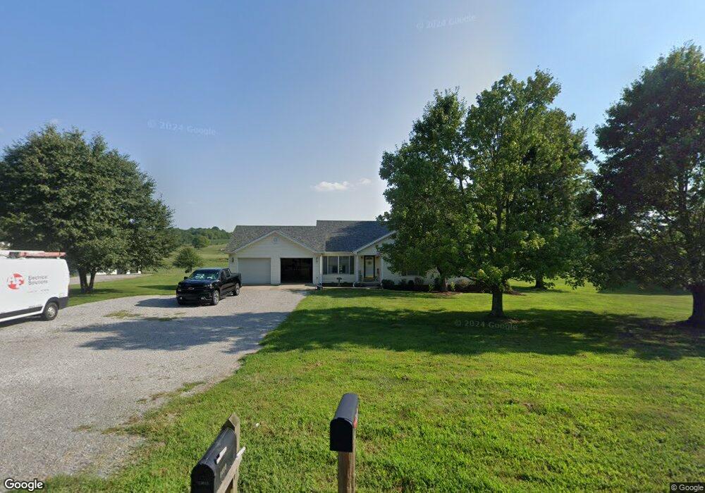
1410 Cummins Ferry Rd Salvisa, KY 40372
Estimated Value: $273,497 - $351,000
3
Beds
2
Baths
1,700
Sq Ft
$184/Sq Ft
Est. Value
About This Home
This home is located at 1410 Cummins Ferry Rd, Salvisa, KY 40372 and is currently estimated at $313,374, approximately $184 per square foot. 1410 Cummins Ferry Rd is a home located in Mercer County with nearby schools including Mercer County Elementary School, Mercer County Intermediate School, and King Middle School.
Ownership History
Date
Name
Owned For
Owner Type
Purchase Details
Closed on
Oct 18, 2018
Sold by
Standrea Farms Inc
Bought by
Darland Randall Edwin and Darland Brandi Renee
Current Estimated Value
Home Financials for this Owner
Home Financials are based on the most recent Mortgage that was taken out on this home.
Original Mortgage
$100,000
Outstanding Balance
$81,296
Interest Rate
4.6%
Mortgage Type
New Conventional
Estimated Equity
$232,078
Purchase Details
Closed on
Jun 19, 2009
Sold by
Baker Brad L
Bought by
Baker Brandi R
Purchase Details
Closed on
May 10, 2007
Sold by
Adkinson Waldon and Adkinson Ina
Bought by
Baker Brad L and Baker Brandi R
Home Financials for this Owner
Home Financials are based on the most recent Mortgage that was taken out on this home.
Original Mortgage
$113,750
Interest Rate
6.17%
Create a Home Valuation Report for This Property
The Home Valuation Report is an in-depth analysis detailing your home's value as well as a comparison with similar homes in the area
Home Values in the Area
Average Home Value in this Area
Purchase History
| Date | Buyer | Sale Price | Title Company |
|---|---|---|---|
| Darland Randall Edwin | $120,000 | None Available | |
| Baker Brandi R | -- | -- | |
| Baker Brad L | $153,750 | -- |
Source: Public Records
Mortgage History
| Date | Status | Borrower | Loan Amount |
|---|---|---|---|
| Open | Darland Randall Edwin | $100,000 | |
| Previous Owner | Baker Brad L | $113,750 |
Source: Public Records
Tax History Compared to Growth
Tax History
| Year | Tax Paid | Tax Assessment Tax Assessment Total Assessment is a certain percentage of the fair market value that is determined by local assessors to be the total taxable value of land and additions on the property. | Land | Improvement |
|---|---|---|---|---|
| 2024 | $2,076 | $173,749 | $10,000 | $163,749 |
| 2023 | $2,095 | $173,749 | $0 | $0 |
| 2022 | $1,953 | $165,349 | $0 | $0 |
| 2021 | $1,966 | $165,349 | $0 | $0 |
| 2020 | $1,820 | $153,750 | $10,000 | $143,750 |
| 2019 | $1,848 | $153,750 | $10,000 | $143,750 |
| 2018 | $1,807 | $153,750 | $0 | $0 |
| 2017 | $1,745 | $153,750 | $0 | $0 |
| 2016 | $1,713 | $153,750 | $0 | $0 |
| 2015 | $1,665 | $153,750 | $10,000 | $143,750 |
| 2014 | $1,665 | $153,750 | $10,000 | $143,750 |
| 2010 | -- | $153,750 | $10,000 | $143,750 |
Source: Public Records
Map
Nearby Homes
- 110 Station Dr
- 3540 Oregon Rd
- 3890 Oregon Rd
- 2309 Oregon Rd
- 143 Providence Rd
- 3062 Louisville Rd
- 125 Talmage-Mayo Rd
- 2315 Oregon Rd
- 4605 Oregon Rd
- 110 Gracelynn Cir
- 4560 Louisville Rd
- 280 Talmage Mayo Rd
- 500 Patterson Rd
- 236 Main St
- 151 Man-O-war Dr
- 155 Man-O-war Dr
- 127 Man-O-war Dr
- 5400 Louisville Rd
- 241 Cottonwood St
- 2 Kirkwood Rd
- 1420 Cummins Ferry Rd
- 1405 Cummins Ferry Rd
- 1440 Cummins Ferry Rd
- 1391 Cummins Ferry Rd
- 1437 Cummins Ferry Rd
- 1450 Cummins Ferry Rd
- 1376 Cummins Ferry Rd
- 1390 Cummins Ferry Rd
- 1349 Cummins Ferry Rd
- 1333 Cummins Ferry Rd
- 2675 Cummins Ferry Rd
- 1485 Cummins Ferry Rd
- 1315 Cummins Ferry Rd
- 1421 Cummins Ferry Rd
- 1429 Cummins Ferry Rd
- 2589 Oregon Rd
- 1146 Cummins Ferry Rd
- 1178 Cummins Ferry Rd
- 1178 Cummins Ferry Rd
- 2584 Oregon Rd