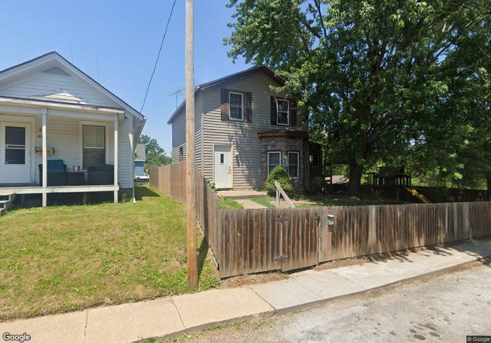
1410 E 12 1/2 St Davenport, IA 52803
East End NeighborhoodEstimated Value: $108,000 - $141,000
3
Beds
1
Bath
1,040
Sq Ft
$115/Sq Ft
Est. Value
About This Home
This home is located at 1410 E 12 1/2 St, Davenport, IA 52803 and is currently estimated at $119,615, approximately $115 per square foot. 1410 E 12 1/2 St is a home located in Scott County with nearby schools including McKinley Elementary School, Sudlow Intermediate School, and Central High School.
Ownership History
Date
Name
Owned For
Owner Type
Purchase Details
Closed on
Aug 26, 2005
Sold by
Ackerland Geraldine L
Bought by
Ackerland Matt J and Ackerland Brianne N
Current Estimated Value
Home Financials for this Owner
Home Financials are based on the most recent Mortgage that was taken out on this home.
Original Mortgage
$35,000
Interest Rate
5.82%
Mortgage Type
New Conventional
Create a Home Valuation Report for This Property
The Home Valuation Report is an in-depth analysis detailing your home's value as well as a comparison with similar homes in the area
Home Values in the Area
Average Home Value in this Area
Purchase History
| Date | Buyer | Sale Price | Title Company |
|---|---|---|---|
| Ackerland Matt J | $15,000 | None Available |
Source: Public Records
Mortgage History
| Date | Status | Borrower | Loan Amount |
|---|---|---|---|
| Closed | Ackerland Matt J | $35,000 |
Source: Public Records
Tax History Compared to Growth
Tax History
| Year | Tax Paid | Tax Assessment Tax Assessment Total Assessment is a certain percentage of the fair market value that is determined by local assessors to be the total taxable value of land and additions on the property. | Land | Improvement |
|---|---|---|---|---|
| 2025 | $1,432 | $112,520 | $16,280 | $96,240 |
| 2024 | $1,392 | $90,310 | $16,280 | $74,030 |
| 2023 | $1,360 | $90,310 | $16,280 | $74,030 |
| 2022 | $1,364 | $72,560 | $7,440 | $65,120 |
| 2021 | $1,364 | $72,560 | $7,440 | $65,120 |
| 2020 | $1,243 | $61,710 | $7,440 | $54,270 |
| 2019 | $1,295 | $62,430 | $7,440 | $54,990 |
| 2018 | $1,768 | $62,430 | $7,440 | $54,990 |
| 2017 | $1,630 | $59,540 | $7,440 | $52,100 |
| 2016 | $1,350 | $59,540 | $0 | $0 |
| 2015 | $1,114 | $61,620 | $0 | $0 |
| 2014 | $1,176 | $61,620 | $0 | $0 |
| 2013 | $1,150 | $0 | $0 | $0 |
| 2012 | -- | $43,770 | $8,100 | $35,670 |
Source: Public Records
Map
Nearby Homes
- 1220 College Ave
- 1102 College Ave
- 1224 E 11th St
- 1202 Adams St
- 1004 College Ave
- 1501 Bridge Ave
- 1012 Bridge Ave
- 1233 Eastern Ave
- 1207 Tremont Ave
- 1616 Esplanade Ave
- 1814 E 13th St
- 1020 E 15th St
- 1134 Tremont Ave
- 924 Kirkwood Blvd
- 916 Kirkwood Blvd
- 1920 Carey Ave
- 2122 E 12th St
- 637 E 15th St
- 2030 Esplanade Ave
- 1504 Christie St
- 1408 E 12 1 2 St
- 1408 E 12 1/2 St
- 1217 Esplanade Ave
- 1414 E 12th St
- 1404 E 12 1/2 St
- 1203 Esplanade Ave
- 1221 Esplanade Ave
- 1220 Mississippi Ave
- 1227 Esplanade Ave
- 1330 E 12th St
- 1224 Mississippi Ave
- 1328 E 12th St
- 1228 Mississippi Ave
- 1326 E 12th St
- 1411 E 12th St
- 1218 Esplanade Ave
- 1405 E 12th St
- 1301 Esplanade Ave
- 1333 E 12th St
- 1120 Mississippi Ave