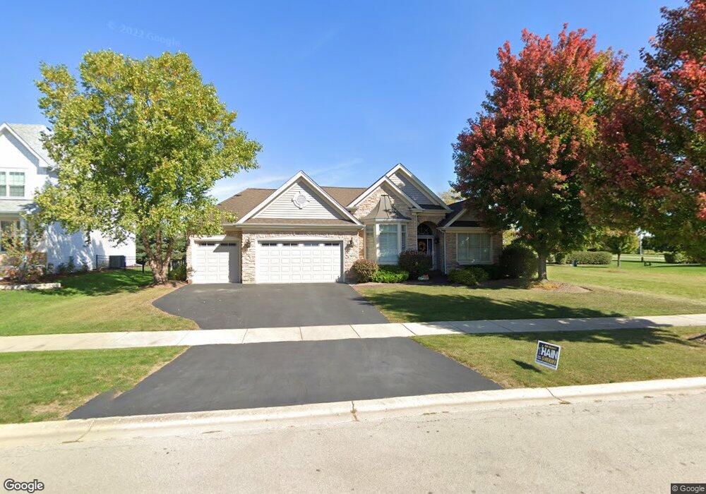
1410 Lance Ave Elburn, IL 60119
Estimated Value: $500,180 - $662,000
3
Beds
2
Baths
2,284
Sq Ft
$252/Sq Ft
Est. Value
About This Home
This home is located at 1410 Lance Ave, Elburn, IL 60119 and is currently estimated at $574,795, approximately $251 per square foot. 1410 Lance Ave is a home located in Kane County with nearby schools including Kaneland Blackberry Creek Elementary School, Harter Middle School, and Kaneland High School.
Ownership History
Date
Name
Owned For
Owner Type
Purchase Details
Closed on
Sep 18, 2006
Sold by
Dupage National Bank
Bought by
Bolger John M and Bolger Anna M
Current Estimated Value
Home Financials for this Owner
Home Financials are based on the most recent Mortgage that was taken out on this home.
Original Mortgage
$387,000
Outstanding Balance
$231,394
Interest Rate
6.59%
Mortgage Type
Purchase Money Mortgage
Estimated Equity
$343,401
Create a Home Valuation Report for This Property
The Home Valuation Report is an in-depth analysis detailing your home's value as well as a comparison with similar homes in the area
Home Values in the Area
Average Home Value in this Area
Purchase History
| Date | Buyer | Sale Price | Title Company |
|---|---|---|---|
| Bolger John M | $472,500 | Chicago Title Insurance Co |
Source: Public Records
Mortgage History
| Date | Status | Borrower | Loan Amount |
|---|---|---|---|
| Open | Bolger John M | $387,000 |
Source: Public Records
Tax History
| Year | Tax Paid | Tax Assessment Tax Assessment Total Assessment is a certain percentage of the fair market value that is determined by local assessors to be the total taxable value of land and additions on the property. | Land | Improvement |
|---|---|---|---|---|
| 2024 | $12,054 | $148,430 | $18,723 | $129,707 |
| 2023 | $11,621 | $133,962 | $16,898 | $117,064 |
| 2022 | $12,060 | $132,790 | $15,508 | $117,282 |
| 2021 | $11,624 | $127,096 | $14,843 | $112,253 |
| 2020 | $11,414 | $124,117 | $14,495 | $109,622 |
| 2019 | $11,422 | $122,295 | $14,282 | $108,013 |
| 2018 | $11,667 | $122,480 | $14,282 | $108,198 |
| 2017 | $11,671 | $121,088 | $14,120 | $106,968 |
| 2016 | $11,973 | $120,801 | $13,747 | $107,054 |
| 2015 | -- | $107,952 | $9,285 | $98,667 |
| 2014 | -- | $106,173 | $15,216 | $90,957 |
| 2013 | -- | $106,173 | $15,216 | $90,957 |
Source: Public Records
Map
Nearby Homes
- 1383 Dodson Ave
- 1171 Souders Ave
- 1038 Veteran Ave
- 1076 Freedom Rd
- 1074 Freedom Rd
- 801 Citizen Ave
- 765 Carolyn Ct
- 671 Virginia St
- 713 Elizabeth St
- 645 Virginia St
- 634 Virginia St
- 607 Virginia St
- 42W613 Meadowsweet Dr
- 16 Derek Dr
- 803 Station Blvd
- Lot #11 Derek Dr
- Lot #12 Derek Dr
- Lot #5 Derek Dr
- Lot #6 Derek Dr
- Lot #4 Derek Dr
- 1392 Lance Ave
- 1432 Lance Ave
- 1435 Spalding Ave
- 1403 Spalding Ave
- 1380 Lance Ave
- 1409 Lance Ave
- 1421 Lance Ave
- 1393 Lance Ave
- 1445 Lance Ave
- 1385 Lance Ave
- 1378 Lance Ave
- 1419 Spalding Ave
- 1457 Spalding Ave
- 1444 Fairfield Dr
- 1390 Souders Ave
- 1471 Spalding Ave
- 1402 Souders Ave
- 1430 Souders Ave
- 1418 Souders Ave
- 1346 Lance Ave
Your Personal Tour Guide
Ask me questions while you tour the home.