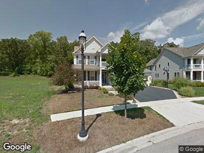
1410 Walnut Dr West Dundee, IL 60118
Estimated Value: $573,000 - $623,000
5
Beds
3
Baths
3,320
Sq Ft
$178/Sq Ft
Est. Value
About This Home
This home is located at 1410 Walnut Dr, West Dundee, IL 60118 and is currently estimated at $591,626, approximately $178 per square foot. 1410 Walnut Dr is a home located in Kane County with nearby schools including Dundee Highlands Elementary School, Dundee Middle School, and Harry D Jacobs High School.
Ownership History
Date
Name
Owned For
Owner Type
Purchase Details
Closed on
Nov 28, 2005
Sold by
Grand Pointe Meadows Llc
Bought by
Guenther Dale J and Guenther Marianna J
Current Estimated Value
Home Financials for this Owner
Home Financials are based on the most recent Mortgage that was taken out on this home.
Original Mortgage
$325,000
Interest Rate
6.17%
Mortgage Type
Fannie Mae Freddie Mac
Create a Home Valuation Report for This Property
The Home Valuation Report is an in-depth analysis detailing your home's value as well as a comparison with similar homes in the area
Home Values in the Area
Average Home Value in this Area
Purchase History
| Date | Buyer | Sale Price | Title Company |
|---|---|---|---|
| Guenther Dale J | $427,000 | Ticor Title Insurance Co |
Source: Public Records
Mortgage History
| Date | Status | Borrower | Loan Amount |
|---|---|---|---|
| Open | Guenther Dale J | $267,000 | |
| Closed | Guenther Dale J | $30,000 | |
| Closed | Guenther Dale J | $293,250 | |
| Closed | Guenther Dale J | $310,500 | |
| Closed | Guenther Dale J | $50,000 | |
| Closed | Guenther Dale J | $318,000 | |
| Closed | Guenther Dale | $30,000 | |
| Closed | Guenther Dale J | $325,000 |
Source: Public Records
Tax History Compared to Growth
Tax History
| Year | Tax Paid | Tax Assessment Tax Assessment Total Assessment is a certain percentage of the fair market value that is determined by local assessors to be the total taxable value of land and additions on the property. | Land | Improvement |
|---|---|---|---|---|
| 2023 | $12,133 | $149,780 | $25,895 | $123,885 |
| 2022 | $10,899 | $129,707 | $25,895 | $103,812 |
| 2021 | $10,187 | $122,469 | $24,450 | $98,019 |
| 2020 | $10,001 | $119,715 | $23,900 | $95,815 |
| 2019 | $10,321 | $120,492 | $22,688 | $97,804 |
| 2018 | $11,076 | $125,528 | $22,239 | $103,289 |
| 2017 | $10,560 | $114,250 | $20,804 | $93,446 |
| 2016 | $10,770 | $110,621 | $20,143 | $90,478 |
| 2015 | -- | $111,955 | $21,296 | $90,659 |
| 2014 | -- | $108,863 | $20,708 | $88,155 |
| 2013 | -- | $112,195 | $21,342 | $90,853 |
Source: Public Records
Map
Nearby Homes
- 36W461 Binnie Rd
- Lot 133 Walnut Dr
- Lot 132 Walnut Dr
- Lot 131 Walnut Dr
- Lot 129 Walnut Dr
- Lot 128 Walnut Dr
- Lot 108 Walnut Dr
- Lot 26 Walnut Dr
- Lot 24 Walnut Dr
- Lot 84 Spruce Dr
- Lot 83 Spruce Dr
- Lot 80 Ash Dr
- Lot 79 Ash Dr
- Lot 120 Oak Dr
- 2687 Acorn Ct Unit 4
- 1338 Maple Cir
- 2618 Maple Cir Unit 4
- 36W340 Huntley Rd
- lot 009 Huntley Rd
- 6850 Huntley Rd