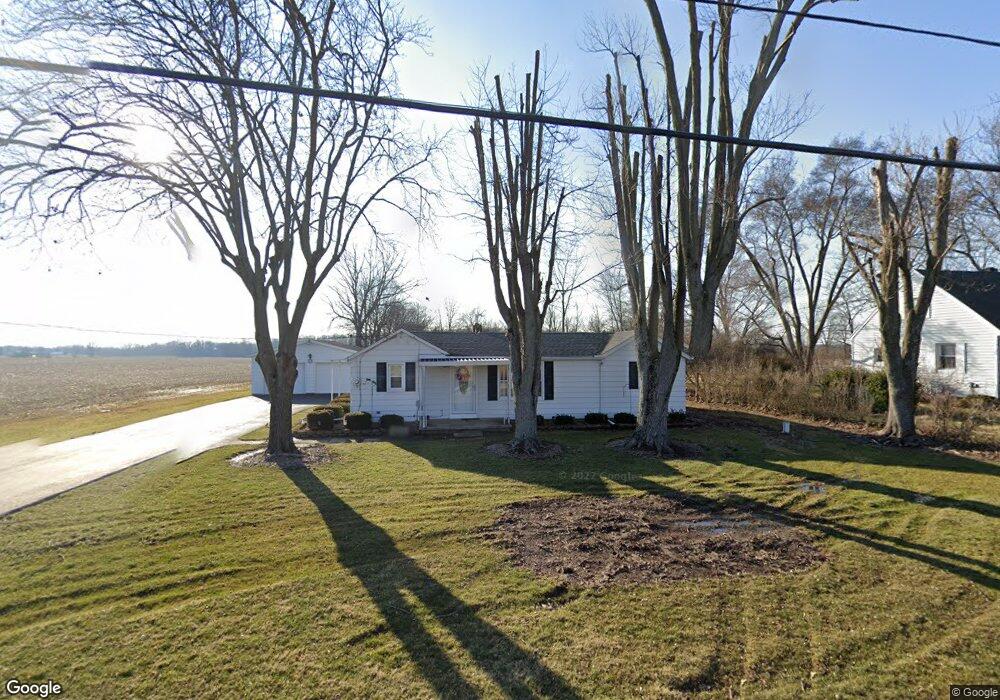
1411 Folk Ream Rd New Carlisle, OH 45344
Cedar Hills/Broadview NeighborhoodEstimated Value: $175,000 - $203,000
3
Beds
1
Bath
1,168
Sq Ft
$158/Sq Ft
Est. Value
About This Home
This home is located at 1411 Folk Ream Rd, New Carlisle, OH 45344 and is currently estimated at $184,545, approximately $158 per square foot. 1411 Folk Ream Rd is a home located in Clark County with nearby schools including Donnelsville Elementary School, Park Layne Elementary School, and New Carlisle Elementary School.
Ownership History
Date
Name
Owned For
Owner Type
Purchase Details
Closed on
Feb 6, 2025
Sold by
Hasting Tamera R
Bought by
Hasting Tamera R
Current Estimated Value
Purchase Details
Closed on
Apr 19, 2024
Sold by
Hensley Larry W and Hensley Valerie
Bought by
Hasting Tamera R
Purchase Details
Closed on
Jun 27, 2022
Sold by
Charles A Hensley And Etta M Hensley Tru
Bought by
Hensley Etta M
Purchase Details
Closed on
Sep 11, 2000
Sold by
Charles Hensley
Bought by
Hensley Charles A and Hensley Etta M
Purchase Details
Closed on
Aug 2, 2000
Sold by
Hensley Charles A and Hensley Etta M
Bought by
Hensley Charles A and Hensley Etta M
Create a Home Valuation Report for This Property
The Home Valuation Report is an in-depth analysis detailing your home's value as well as a comparison with similar homes in the area
Home Values in the Area
Average Home Value in this Area
Purchase History
| Date | Buyer | Sale Price | Title Company |
|---|---|---|---|
| Hasting Tamera R | -- | None Listed On Document | |
| Hasting Tamera R | $170,000 | None Listed On Document | |
| Hensley Etta M | -- | Cole Acton Harmon Dunn | |
| Hensley Charles A | -- | -- | |
| Hensley Charles A | -- | -- | |
| Hensley Charles A | -- | -- |
Source: Public Records
Tax History Compared to Growth
Tax History
| Year | Tax Paid | Tax Assessment Tax Assessment Total Assessment is a certain percentage of the fair market value that is determined by local assessors to be the total taxable value of land and additions on the property. | Land | Improvement |
|---|---|---|---|---|
| 2024 | $1,465 | $40,440 | $9,340 | $31,100 |
| 2023 | $1,465 | $40,440 | $9,340 | $31,100 |
| 2022 | $1,488 | $40,440 | $9,340 | $31,100 |
| 2021 | $1,157 | $31,310 | $7,130 | $24,180 |
| 2020 | $1,160 | $31,310 | $7,130 | $24,180 |
| 2019 | $1,192 | $31,310 | $7,130 | $24,180 |
| 2018 | $907 | $24,980 | $7,130 | $17,850 |
| 2017 | $901 | $24,980 | $7,133 | $17,847 |
| 2016 | $864 | $24,980 | $7,133 | $17,847 |
| 2015 | $396 | $23,121 | $7,133 | $15,988 |
| 2014 | $788 | $23,121 | $7,133 | $15,988 |
| 2013 | $395 | $23,121 | $7,133 | $15,988 |
Source: Public Records
Map
Nearby Homes
- 6439 Greenridge Ave
- 6105 New Carlisle Pike
- 2430 Myers Rd
- 4904 Alpha Rd
- 5171 New Carlisle Pike
- 96 Eastwood Dr
- 1 Folk Ream Rd
- 00 Folk Ream Rd
- 245 Gordon Rd
- 5095 W National Rd
- 4 E Main St
- 3172 Folk Ream Rd
- 4461 New Carlisle Pike
- 1255 Bischoff Rd
- 323 Saint Paul Ave
- 17 Sunset Dr
- 224 E Downey Dr
- 3390 Spence Rd
- 6580 Shaler Dr
- 2470 Leon Ln
- 1423 Folk Ream Rd
- 1410 Folk Ream Rd
- 1485 Folk Ream Rd
- 1501 Folk Ream Rd
- 1529 Folk Ream Rd
- 6483 Brush Hollow Dr
- 6467 Brush Hollow Dr
- 1583 Folk Ream Rd
- 1589 Bending Tree Dr
- 1571 Bending Tree Dr
- 1494 Folk Ream Rd
- 1631 Bending Tree Dr
- 1550 Bending Tree Dr
- 1633 Folk Ream Rd
- 1572 Bending Tree Dr
- 1596 Bending Tree Dr
- 6344 New Carlisle Pike
- 1667 Bending Tree Dr
- 1498 Folk Ream Rd
- 1661 Folk Ream Rd