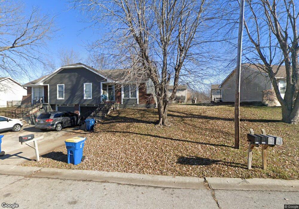
1411 Laurel St Kearney, MO 64060
Estimated Value: $197,543 - $258,000
3
Beds
1
Bath
788
Sq Ft
$288/Sq Ft
Est. Value
About This Home
This home is located at 1411 Laurel St, Kearney, MO 64060 and is currently estimated at $226,636, approximately $287 per square foot. 1411 Laurel St is a home located in Clay County with nearby schools including Kearney Junior High School, Kearney High School, and Northern Hills Christian Academy.
Ownership History
Date
Name
Owned For
Owner Type
Purchase Details
Closed on
Oct 6, 2021
Sold by
Rinkenbaugh Ronald L and Rinkenbaugh Janet L
Bought by
Kelsey Investments Property Llc
Current Estimated Value
Home Financials for this Owner
Home Financials are based on the most recent Mortgage that was taken out on this home.
Original Mortgage
$83,533
Outstanding Balance
$19,103
Interest Rate
2.8%
Mortgage Type
Future Advance Clause Open End Mortgage
Estimated Equity
$207,533
Purchase Details
Closed on
Nov 1, 2006
Sold by
Vangerpen William J and Vangerpen Susan D
Bought by
Rinkenbaugh Ronald L and Rinkenbaugh Janet L
Purchase Details
Closed on
Sep 11, 1997
Sold by
Vangerpen William J
Bought by
Vangerpen William J
Home Financials for this Owner
Home Financials are based on the most recent Mortgage that was taken out on this home.
Original Mortgage
$10,300
Interest Rate
7.56%
Create a Home Valuation Report for This Property
The Home Valuation Report is an in-depth analysis detailing your home's value as well as a comparison with similar homes in the area
Home Values in the Area
Average Home Value in this Area
Purchase History
| Date | Buyer | Sale Price | Title Company |
|---|---|---|---|
| Kelsey Investments Property Llc | -- | Security 1St Title Llc | |
| Rinkenbaugh Ronald L | -- | Thomson Title Corporation | |
| Vangerpen William J | -- | -- |
Source: Public Records
Mortgage History
| Date | Status | Borrower | Loan Amount |
|---|---|---|---|
| Open | Kelsey Investments Property Llc | $83,533 | |
| Previous Owner | Vangerpen William J | $10,300 |
Source: Public Records
Tax History
| Year | Tax Paid | Tax Assessment Tax Assessment Total Assessment is a certain percentage of the fair market value that is determined by local assessors to be the total taxable value of land and additions on the property. | Land | Improvement |
|---|---|---|---|---|
| 2025 | $1,410 | $27,190 | -- | -- |
| 2024 | $1,410 | $20,580 | -- | -- |
| 2023 | $1,406 | $20,580 | $0 | $0 |
| 2022 | $1,218 | $17,250 | $0 | $0 |
| 2021 | $1,194 | $17,252 | $4,750 | $12,502 |
| 2020 | $1,213 | $15,940 | $0 | $0 |
| 2019 | $1,207 | $15,940 | $0 | $0 |
Source: Public Records
Map
Nearby Homes
- 1304 S Jefferson St
- 1404 Colony Dr
- 1300 Robin Cir
- 1505 Emerald Cir
- 623 E 13th St
- 1204 Noah's Ln
- 200 E 10th St
- 1202 Noah Ln
- 1209 Noah's Ln
- 1710 Rockwater Ln
- 1302 Regency Dr
- 1933 Meadowlane
- 307 W 11th Terrace
- 1307 Stonecrest Dr
- 801 Southbrook Pkwy
- 1104 Regency Dr
- 1845 Falcon Ct
- 901 Pine Crest Ave
- 709 Feldspar St
- 200 E 20th Terrace
- 1409 Laurel St
- 1501 Laurel St
- 1405 Laurel St
- 308 Southbrook Pkwy
- 304 Southbrook Pkwy
- 312 Southbrook Pkwy
- 1422 Laurel St
- 1416 Laurel St
- 1412 Laurel St
- 1505 Laurel St
- 1420 Laurel St
- 316 Southbrook Pkwy
- 1408 Laurel St
- 1401 Laurel St
- 1424 Laurel St
- 1404 Laurel St
- 1428 Laurel St
- 403 Southbrook Pkwy
- 401 Southbrook Pkwy
- 1400 Laurel St
Your Personal Tour Guide
Ask me questions while you tour the home.