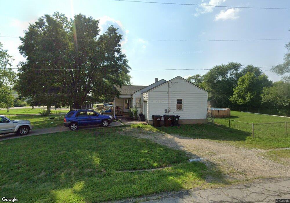
1411 Oxford State Rd Middletown, OH 45044
Amanda-Oneida NeighborhoodEstimated Value: $174,000 - $194,000
3
Beds
1
Bath
1,300
Sq Ft
$140/Sq Ft
Est. Value
About This Home
This home is located at 1411 Oxford State Rd, Middletown, OH 45044 and is currently estimated at $181,357, approximately $139 per square foot. 1411 Oxford State Rd is a home located in Butler County with nearby schools including Amanda Elementary School, Highview 6th Grade Center, and Middletown Middle School.
Ownership History
Date
Name
Owned For
Owner Type
Purchase Details
Closed on
Feb 29, 2008
Sold by
Carroll Laura V
Bought by
Mcglone Patricia L
Current Estimated Value
Home Financials for this Owner
Home Financials are based on the most recent Mortgage that was taken out on this home.
Original Mortgage
$50,000
Outstanding Balance
$31,166
Interest Rate
5.75%
Mortgage Type
Purchase Money Mortgage
Estimated Equity
$150,191
Create a Home Valuation Report for This Property
The Home Valuation Report is an in-depth analysis detailing your home's value as well as a comparison with similar homes in the area
Home Values in the Area
Average Home Value in this Area
Purchase History
| Date | Buyer | Sale Price | Title Company |
|---|---|---|---|
| Mcglone Patricia L | $90,000 | Chicago Title Insurance Co |
Source: Public Records
Mortgage History
| Date | Status | Borrower | Loan Amount |
|---|---|---|---|
| Open | Mcglone Patricia L | $50,000 |
Source: Public Records
Tax History Compared to Growth
Tax History
| Year | Tax Paid | Tax Assessment Tax Assessment Total Assessment is a certain percentage of the fair market value that is determined by local assessors to be the total taxable value of land and additions on the property. | Land | Improvement |
|---|---|---|---|---|
| 2024 | $1,702 | $42,430 | $8,610 | $33,820 |
| 2023 | $1,708 | $40,950 | $8,610 | $32,340 |
| 2022 | $1,198 | $29,360 | $8,610 | $20,750 |
| 2021 | $1,152 | $29,360 | $8,610 | $20,750 |
| 2020 | $1,260 | $29,360 | $8,610 | $20,750 |
| 2019 | $1,473 | $20,320 | $8,250 | $12,070 |
| 2018 | $730 | $20,320 | $8,250 | $12,070 |
| 2017 | $731 | $20,320 | $8,250 | $12,070 |
| 2016 | $603 | $17,890 | $8,250 | $9,640 |
| 2015 | $594 | $17,890 | $8,250 | $9,640 |
| 2014 | $991 | $17,890 | $8,250 | $9,640 |
| 2013 | $991 | $25,350 | $8,250 | $17,100 |
Source: Public Records
Map
Nearby Homes
- 3209 Rufus St
- 3113 Rufus St
- 3107 Rufus St
- 1602 Oxford State Rd
- 1102 Forrer St
- 3004 Judy Dr
- 1709 Oxford State Rd
- 2900 Morgan St
- 1613 Sheridan Ave
- 0 Jackson St Unit 895859
- 0 Jackson St Unit 1780028
- 1702 Glenwood Ave
- 3221 Yankee Rd
- 1717 Pershing Ave
- 3102 Omaha St
- 3111 Omaha St
- 720 Diamond Loop
- 1511 Meadow Ave
- 3620 S Main St
- 3009 Seneca St
- 1409 Oxford State Rd
- 1415 Oxford State Rd
- 1407 Oxford State Rd
- 1417 Oxford State Rd
- 1410 Hood Ave
- 1405 Oxford State Rd
- 1404 Oxford State Rd
- 3205 Roslyn Dr
- 1408 Hood Ave
- 3203 Roslyn Dr
- 1419 Oxford State Rd
- 1403 Oxford State Rd
- 1410 Oxford State Rd
- 1406 Hood Ave
- 1412 Oxford State Rd
- 3201 Roslyn Dr
- 1404 Hood Ave
- 1401 Oxford State Rd
- 1421 Oxford State Rd
- 1402 Hood Ave