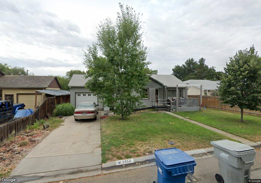
1412 S Empire Way Boise, ID 83709
Central Bench NeighborhoodEstimated Value: $395,000 - $424,000
3
Beds
1
Bath
1,223
Sq Ft
$335/Sq Ft
Est. Value
About This Home
This home is located at 1412 S Empire Way, Boise, ID 83709 and is currently estimated at $409,287, approximately $334 per square foot. 1412 S Empire Way is a home located in Ada County with nearby schools including Grace Jordan Elementary School, West Junior High School, and Borah Senior High School.
Ownership History
Date
Name
Owned For
Owner Type
Purchase Details
Closed on
Dec 2, 2020
Sold by
Lightfield Ralph and Lightfield Lynda
Bought by
Lightfield Ralph and Lightfield Lynda
Current Estimated Value
Home Financials for this Owner
Home Financials are based on the most recent Mortgage that was taken out on this home.
Original Mortgage
$75,000
Outstanding Balance
$60,784
Interest Rate
2.8%
Mortgage Type
Credit Line Revolving
Estimated Equity
$348,503
Purchase Details
Closed on
Sep 14, 1998
Sold by
Radloff Lynda and Lightfield Lynda
Bought by
Lightfield Ralph and Lightfield Lynda
Purchase Details
Closed on
May 28, 1998
Sold by
Anderson Karl K
Bought by
Countrywide Home Loans
Purchase Details
Closed on
May 14, 1998
Sold by
Countrywide Home Loan
Bought by
Hud
Create a Home Valuation Report for This Property
The Home Valuation Report is an in-depth analysis detailing your home's value as well as a comparison with similar homes in the area
Home Values in the Area
Average Home Value in this Area
Purchase History
| Date | Buyer | Sale Price | Title Company |
|---|---|---|---|
| Lightfield Ralph | -- | Empire Title Llc | |
| Lightfield Ralph | -- | -- | |
| Countrywide Home Loans | $89,542 | Alliance Title Company | |
| Hud | -- | Alliance Title Company |
Source: Public Records
Mortgage History
| Date | Status | Borrower | Loan Amount |
|---|---|---|---|
| Open | Lightfield Ralph | $75,000 |
Source: Public Records
Tax History Compared to Growth
Tax History
| Year | Tax Paid | Tax Assessment Tax Assessment Total Assessment is a certain percentage of the fair market value that is determined by local assessors to be the total taxable value of land and additions on the property. | Land | Improvement |
|---|---|---|---|---|
| 2025 | $1,744 | $357,700 | -- | -- |
| 2024 | $1,776 | $317,200 | -- | -- |
| 2023 | $1,776 | $311,000 | $0 | $0 |
| 2022 | $1,875 | $341,200 | $0 | $0 |
| 2021 | $1,735 | $283,700 | $0 | $0 |
| 2020 | $1,507 | $226,900 | $0 | $0 |
| 2019 | $1,489 | $209,700 | $0 | $0 |
| 2018 | $1,338 | $176,200 | $0 | $0 |
| 2017 | $1,254 | $156,900 | $0 | $0 |
| 2016 | $1,178 | $143,900 | $0 | $0 |
| 2015 | $968 | $125,500 | $0 | $0 |
| 2012 | -- | $85,700 | $0 | $0 |
Source: Public Records
Map
Nearby Homes
- 6424 W Fairfield Ave
- 6430 W Fairfield Ave
- 6302 W Dorian St
- 5821 W Randolph Dr
- 6517 Hummel Dr
- 5805 W Robertson Dr
- 5802 Randolph Dr
- 1829 S Empire Way
- 1815 S Senator St
- 6726 W Overland Rd
- 5605 W Randolph Dr
- 815 S Curtis Rd Unit 27
- 6482 Oreana Dr
- 6500 W Oreana Dr
- 6711 Hummel Dr
- 6525 Grandview Dr
- 5960 W Twin Springs Dr
- 854 S Curtis Rd
- 824 S Curtis Rd
- 3319 W Tahoe Dr Unit Lot 2/6
- 1408 S Empire Way
- 1402 S Empire Way
- 1424 S Empire Way
- 1413 Rand St
- 1407 Rand St
- 1419 Rand St
- 1413 S Rand St
- 1415 S Empire Way
- 1419 S Empire Way
- 1500 S Empire Way
- 1403 Rand St
- 1322 S Empire Way
- 1407 S Empire Way
- 1423 Rand St
- 1423 S Empire Way
- 1401 S Empire Way
- 1503 Rand St
- 1401 Rand St
- 1506 S Empire Way
- 1316 S Empire Way