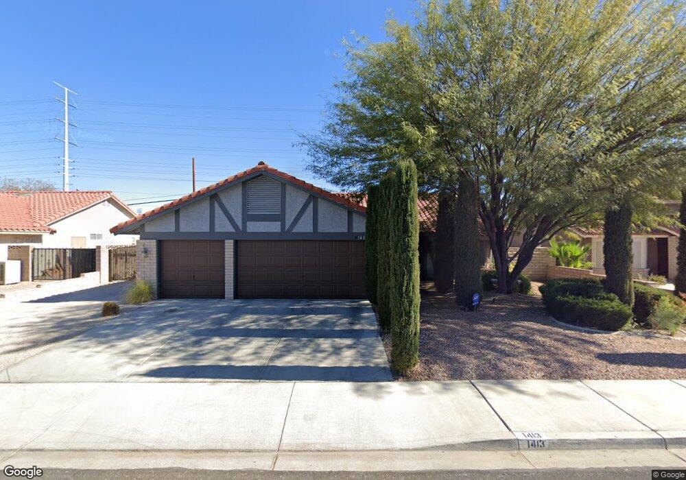
1413 Brocado Ln Las Vegas, NV 89117
Canyon Gate NeighborhoodEstimated Value: $515,000 - $549,000
3
Beds
2
Baths
1,888
Sq Ft
$282/Sq Ft
Est. Value
About This Home
This home is located at 1413 Brocado Ln, Las Vegas, NV 89117 and is currently estimated at $531,676, approximately $281 per square foot. 1413 Brocado Ln is a home located in Clark County with nearby schools including Clarence A. Piggott Academy of International Studies, D'Vorre & Hal Ober Elementary School, and Walter Johnson Junior High School Academy of International Studies.
Ownership History
Date
Name
Owned For
Owner Type
Purchase Details
Closed on
Jan 22, 2021
Sold by
Robbins Bozena and Robbins Mark S
Bought by
Robbins Bozena and Robbins Mark S
Current Estimated Value
Home Financials for this Owner
Home Financials are based on the most recent Mortgage that was taken out on this home.
Original Mortgage
$245,500
Outstanding Balance
$218,955
Interest Rate
2.67%
Mortgage Type
New Conventional
Estimated Equity
$312,721
Purchase Details
Closed on
Apr 13, 1994
Sold by
Sheehan Kenneth R and Sheehan Marilyn V
Bought by
Robbins Mark S and Robbins Bozena
Home Financials for this Owner
Home Financials are based on the most recent Mortgage that was taken out on this home.
Original Mortgage
$18,600
Interest Rate
7.59%
Mortgage Type
Seller Take Back
Create a Home Valuation Report for This Property
The Home Valuation Report is an in-depth analysis detailing your home's value as well as a comparison with similar homes in the area
Home Values in the Area
Average Home Value in this Area
Purchase History
| Date | Buyer | Sale Price | Title Company |
|---|---|---|---|
| Robbins Bozena | -- | Lawyers Title Las Vegas | |
| Robbins Mark S | $147,000 | Land Title |
Source: Public Records
Mortgage History
| Date | Status | Borrower | Loan Amount |
|---|---|---|---|
| Open | Robbins Bozena | $245,500 | |
| Closed | Robbins Mark S | $18,600 |
Source: Public Records
Tax History Compared to Growth
Tax History
| Year | Tax Paid | Tax Assessment Tax Assessment Total Assessment is a certain percentage of the fair market value that is determined by local assessors to be the total taxable value of land and additions on the property. | Land | Improvement |
|---|---|---|---|---|
| 2025 | $2,420 | $102,762 | $45,850 | $56,912 |
| 2024 | $2,350 | $102,762 | $45,850 | $56,912 |
| 2023 | $1,917 | $97,908 | $43,050 | $54,858 |
| 2022 | $2,392 | $86,471 | $35,700 | $50,771 |
| 2021 | $2,316 | $80,456 | $31,850 | $48,606 |
| 2020 | $2,148 | $77,292 | $28,700 | $48,592 |
| 2019 | $2,085 | $75,508 | $27,300 | $48,208 |
| 2018 | $2,024 | $71,670 | $24,850 | $46,820 |
| 2017 | $2,359 | $71,973 | $24,150 | $47,823 |
| 2016 | $1,917 | $67,516 | $19,250 | $48,266 |
| 2015 | $1,913 | $58,631 | $15,050 | $43,581 |
| 2014 | $1,857 | $54,971 | $11,200 | $43,771 |
Source: Public Records
Map
Nearby Homes
- 1517 Kirby Dr
- 8505 Custer Ct
- 1536 Brocado Ln
- 1209 Emerywood Ct
- 1613 Iron Ridge Dr
- 1805 Quail Point Ct
- 8600 W Charleston Blvd Unit 1079
- 8600 W Charleston Blvd Unit 2058
- 8600 W Charleston Blvd Unit 1030
- 8600 W Charleston Blvd Unit 1075
- 8600 W Charleston Blvd Unit 2195
- 8600 W Charleston Blvd Unit 2101
- 8400 W Charleston Blvd Unit 237
- 8400 W Charleston Blvd Unit 111
- 1813 Skyline Dr
- 900 Heavenly Hills Ct Unit 219
- 805 Overview Dr
- 8721 Robinson Ridge Dr
- 8324 W Charleston Blvd Unit 2002
- 8324 W Charleston Blvd Unit 1047
- 1409 Brocado Ln
- 1417 Brocado Ln
- 8609 Cremona Dr
- 1405 Brocado Ln
- 1421 Brocado Ln
- 8608 Cremona Dr
- 8600 Abanico Ct
- 8613 Cremona Dr
- 1401 Brocado Ln
- 1501 Brocado Ln
- 1413 Kirby Dr
- 1409 Kirby Dr
- 8612 Cremona Dr
- 1417 Kirby Dr
- 8604 Abanico Ct
- 1405 Kirby Dr
- 8609 Soneto Ln
- 8617 Cremona Dr
- 1505 Brocado Ln
- 1421 Kirby Dr