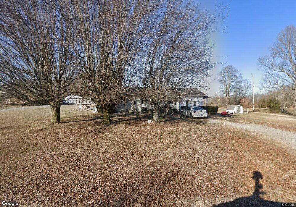
1413 Cross Lanes Rd Westmoreland, TN 37186
Estimated Value: $235,000 - $263,000
3
Beds
1
Bath
1,269
Sq Ft
$196/Sq Ft
Est. Value
About This Home
This home is located at 1413 Cross Lanes Rd, Westmoreland, TN 37186 and is currently estimated at $248,541, approximately $195 per square foot. 1413 Cross Lanes Rd is a home located in Macon County with nearby schools including Lighthouse Academy.
Ownership History
Date
Name
Owned For
Owner Type
Purchase Details
Closed on
Dec 6, 2013
Sold by
Brock Nancy L
Bought by
Dodson Michael and Dodson Sharon
Current Estimated Value
Purchase Details
Closed on
Dec 29, 2003
Sold by
Nicky Wix
Bought by
Brock Nancy L
Purchase Details
Closed on
Oct 2, 2003
Sold by
Dale Hix
Bought by
Nicky Wix
Purchase Details
Closed on
Oct 1, 2003
Sold by
Secretary Of Housing And U
Bought by
Dale Hix
Purchase Details
Closed on
Aug 1, 2000
Sold by
Oxford William J
Bought by
Tommy Mccoy and Tommy Karen
Purchase Details
Closed on
Oct 17, 1996
Sold by
Wanda Likens
Bought by
Oxford William J
Purchase Details
Closed on
Nov 3, 1994
Sold by
Barber David W
Bought by
Wanda Likens
Purchase Details
Closed on
Jul 1, 1989
Bought by
Barber David W and Barber Pamela K
Create a Home Valuation Report for This Property
The Home Valuation Report is an in-depth analysis detailing your home's value as well as a comparison with similar homes in the area
Home Values in the Area
Average Home Value in this Area
Purchase History
| Date | Buyer | Sale Price | Title Company |
|---|---|---|---|
| Dodson Michael | $84,900 | -- | |
| Brock Nancy L | $61,000 | -- | |
| Nicky Wix | $42,107 | -- | |
| Dale Hix | $34,000 | -- | |
| Tommy Mccoy | $69,900 | -- | |
| Oxford William J | -- | -- | |
| Wanda Likens | $42,500 | -- | |
| Barber David W | -- | -- |
Source: Public Records
Tax History Compared to Growth
Tax History
| Year | Tax Paid | Tax Assessment Tax Assessment Total Assessment is a certain percentage of the fair market value that is determined by local assessors to be the total taxable value of land and additions on the property. | Land | Improvement |
|---|---|---|---|---|
| 2024 | $591 | $41,850 | $4,250 | $37,600 |
| 2023 | $591 | $41,850 | $0 | $0 |
| 2022 | $536 | $22,350 | $2,125 | $20,225 |
| 2021 | $536 | $22,350 | $2,125 | $20,225 |
| 2020 | $536 | $22,350 | $2,125 | $20,225 |
| 2019 | $536 | $22,350 | $2,125 | $20,225 |
| 2018 | $495 | $22,350 | $2,125 | $20,225 |
| 2017 | $521 | $20,675 | $1,500 | $19,175 |
| 2016 | $496 | $20,675 | $1,500 | $19,175 |
| 2015 | $496 | $20,675 | $1,500 | $19,175 |
| 2014 | $496 | $20,667 | $0 | $0 |
Source: Public Records
Map
Nearby Homes
- 2134 Oakdale Rd
- 2486 Oakdale Rd
- 779 Oakdale Rd
- 2590 Oakdale Rd
- 98 Andrea Ln
- 1701 Wixtown Rd
- 221 Creekside Ln
- 1733 Wixtown Rd
- 6606 Highway 52 W
- 6704 Highway 52 W
- 0 Carter Rd
- 0 Highway 52 W Unit RTC2515576
- 2134 Shrum Cemetery Rd
- 0 Old Hwy 52 W Unit RTC2619135
- 0 Hwy 52 Bypass West W
- 5071 Old Highway 52
- 2166 Shrum Cemetery Rd
- 2192 Shrum Cemetery Rd
- 0 Johnson Rd
- 4901 Highway 52 W
- 1389 Cross Lanes Rd
- 1389 Cross Lanes Rd
- 1371 Cross Lanes Rd
- 391 Wixtown Rd
- 475 Wixtown Rd
- 1293 Cross Lanes Rd
- 514 Wixtown Rd
- 368 Wixtown Rd
- 529 Wixtown Rd
- 550 Wixtown Rd
- 560 Wixtown Rd
- 404 Wixtown Rd
- 1063 Cross Lanes Rd
- 555 Wixtown Rd
- 594 Wixtown Rd
- 444 Wixtown Rd
- 626 Wixtown Rd
- 646 Wixtown Rd
- 985 Cross Lanes Rd
- 695 Wixtown Rd