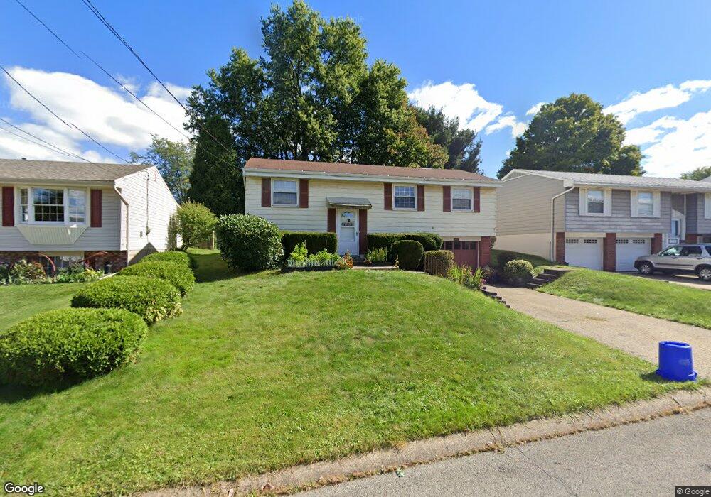
1413 Dupont St Conway, PA 15027
Estimated Value: $151,000 - $226,000
2
Beds
1
Bath
912
Sq Ft
$216/Sq Ft
Est. Value
About This Home
This home is located at 1413 Dupont St, Conway, PA 15027 and is currently estimated at $196,712, approximately $215 per square foot. 1413 Dupont St is a home located in Beaver County with nearby schools including Freedom Area Elementary School, Freedom Area Middle School, and Freedom Area Senior High School.
Ownership History
Date
Name
Owned For
Owner Type
Purchase Details
Closed on
Jan 21, 2025
Sold by
Phillips Larry G and Phillips Dolores E
Bought by
Larry And Dolores Phillips Living Trust and Phillips
Current Estimated Value
Purchase Details
Closed on
Feb 3, 2016
Sold by
Phillips Larry G and Phillips Dolores E
Bought by
Phillips Larry G and Phillips Dolores E
Purchase Details
Closed on
Jan 1, 2001
Sold by
Phillips Aloha M
Bought by
Phillips Larry G
Create a Home Valuation Report for This Property
The Home Valuation Report is an in-depth analysis detailing your home's value as well as a comparison with similar homes in the area
Home Values in the Area
Average Home Value in this Area
Purchase History
| Date | Buyer | Sale Price | Title Company |
|---|---|---|---|
| Larry And Dolores Phillips Living Trust | -- | None Listed On Document | |
| Phillips Larry G | -- | None Available | |
| Phillips Larry G | $40,000 | -- |
Source: Public Records
Tax History Compared to Growth
Tax History
| Year | Tax Paid | Tax Assessment Tax Assessment Total Assessment is a certain percentage of the fair market value that is determined by local assessors to be the total taxable value of land and additions on the property. | Land | Improvement |
|---|---|---|---|---|
| 2025 | $613 | $83,450 | $16,700 | $66,750 |
| 2024 | $2,859 | $83,450 | $16,700 | $66,750 |
| 2023 | $2,495 | $20,300 | $3,650 | $16,650 |
| 2022 | $2,424 | $20,300 | $3,650 | $16,650 |
| 2021 | $2,424 | $20,300 | $3,650 | $16,650 |
| 2020 | $2,259 | $20,300 | $3,650 | $16,650 |
| 2019 | $2,259 | $20,300 | $3,650 | $16,650 |
| 2018 | $2,172 | $20,300 | $3,650 | $16,650 |
| 2017 | $2,172 | $20,300 | $3,650 | $16,650 |
| 2016 | $1,981 | $20,300 | $3,650 | $16,650 |
| 2015 | $451 | $20,300 | $3,650 | $16,650 |
| 2014 | $451 | $20,300 | $3,650 | $16,650 |
Source: Public Records
Map
Nearby Homes
- 1517 Foote St
- 1113 Foote St
- 1408 4th Ave
- 1416 Sampson St
- 1401 3rd Ave
- 1001 7th Ave
- 744 N Gross St
- 354 11th St
- 1341 2nd Ave
- 1040 Catherine Dr
- 1025 Catherine Dr
- 1079 Catherine Dr
- 110 13th St
- 1001 2nd Ave
- 500 Conway Wallrose Rd
- 149 Shady River Blvd Unit 40 B
- 328 River Ridge Ct Unit 47B
- 154 Shady River Blvd
- 150 Shady River Blvd Unit 56A
- 899 19th St
- 1409 Dupont St
- 1417 Dupont St
- LOT 74 Dupont St
- 1405 Dupont St
- 1412 Dupont St
- 1408 Dupont St
- 1416 Dupont St
- 1404 Dupont St
- 1401 Dupont St
- 1425 Dupont St
- 1412 Porter St
- 1408 Porter St
- 1420 Dupont St
- 1416 Porter St
- 1400 Dupont St
- 1420 Porter St
- 1404 Porter St
- 1424 Dupont St
- 1429 Dupont St
- 1400 Porter St