Estimated Value: $564,000 - $643,000
3
Beds
2
Baths
2,064
Sq Ft
$296/Sq Ft
Est. Value
About This Home
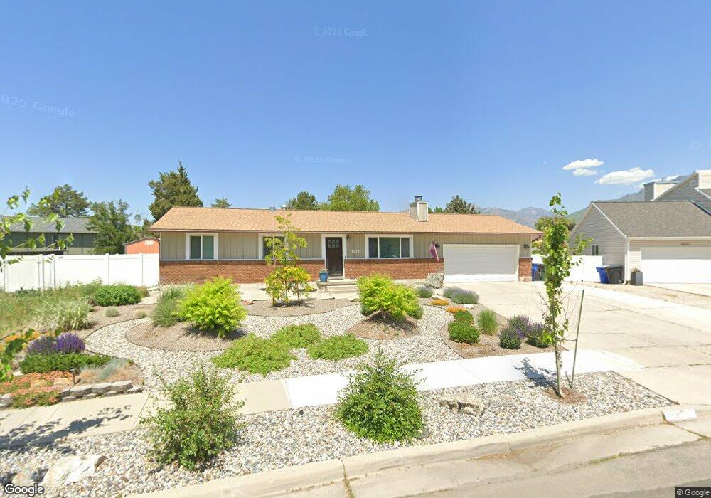
This home is located at 1413 E Cedar Crest Dr, Sandy, UT 84092 and is currently estimated at $611,660, approximately $296 per square foot. 1413 E Cedar Crest Dr is a home located in Salt Lake County with nearby schools including Willow Canyon Elementary School, Eastmont Middle School, and Jordan High.
Ownership History
Date
Name
Owned For
Owner Type
Purchase Details
Closed on
Mar 6, 2023
Sold by
Morrison Kate Louise and Mac Joshua
Bought by
Mac Gilbert And Kate Morrison Trust
Current Estimated Value
Purchase Details
Closed on
Aug 19, 2019
Sold by
Foulger Erik and Curtis Brook
Bought by
Morrison Kate Louise and Gilbert Mac Joshua
Home Financials for this Owner
Home Financials are based on the most recent Mortgage that was taken out on this home.
Original Mortgage
$351,215
Interest Rate
3.7%
Mortgage Type
New Conventional
Purchase Details
Closed on
Oct 31, 2002
Sold by
Hunsaker Martin E and Hunsaker Ilona
Bought by
Hunsaker Martin E and Hunsaker Ilona
Home Financials for this Owner
Home Financials are based on the most recent Mortgage that was taken out on this home.
Original Mortgage
$107,250
Interest Rate
5.99%
Purchase Details
Closed on
May 9, 2000
Sold by
Petersberger April L
Bought by
Petersberger John J
Purchase Details
Closed on
Dec 9, 1998
Sold by
Hunsaker Martin and Hunsaker Ilona
Bought by
Hunsaker Martin E and Hunsaker Ilona
Create a Home Valuation Report for This Property
The Home Valuation Report is an in-depth analysis detailing your home's value as well as a comparison with similar homes in the area
Home Values in the Area
Average Home Value in this Area
Purchase History
| Date | Buyer | Sale Price | Title Company |
|---|---|---|---|
| Mac Gilbert And Kate Morrison Trust | -- | -- | |
| Morrison Kate Louise | -- | Old Republic Ttl Draper Orem | |
| Hunsaker Martin E | -- | Backman Stewart Title Servic | |
| Petersberger John J | -- | -- | |
| Hunsaker Martin E | -- | Bonneville Title Company |
Source: Public Records
Mortgage History
| Date | Status | Borrower | Loan Amount |
|---|---|---|---|
| Previous Owner | Morrison Kate Louise | $351,215 | |
| Previous Owner | Hunsaker Martin E | $107,250 |
Source: Public Records
Tax History
| Year | Tax Paid | Tax Assessment Tax Assessment Total Assessment is a certain percentage of the fair market value that is determined by local assessors to be the total taxable value of land and additions on the property. | Land | Improvement |
|---|---|---|---|---|
| 2025 | $3,488 | $536,300 | $240,100 | $296,200 |
| 2024 | $3,488 | $530,100 | $231,100 | $299,000 |
| 2023 | $3,268 | $486,100 | $222,200 | $263,900 |
| 2022 | $3,176 | $470,500 | $217,800 | $252,700 |
| 2021 | $2,952 | $383,500 | $174,200 | $209,300 |
| 2020 | $2,878 | $349,900 | $174,200 | $175,700 |
| 2019 | $2,567 | $310,200 | $164,300 | $145,900 |
| 2016 | $1,947 | $230,300 | $148,100 | $82,200 |
Source: Public Records
Map
Nearby Homes
- 9633 S 1210 E
- 1584 Petunia Way
- 1492 E Sandy Hills Dr
- 9968 S Blossom Dr
- 1133 E Wright Way
- 1100 E Webster Dr
- 1630 E Plata Way
- 1779 E Mombo Dr
- 1798 E Sunrise Meadow Dr
- 9206 Sterling Dr
- 10172 Snow Iris Way
- 10158 Buttercup Dr
- 1062 E Diamond Way
- 9886 S Antimony Ln
- 1952 E Bluffside Cir
- 1012 E Bell Dr
- 9957 Barium Ln
- 1107 E Serpentine Way
- 1138 E Quarry Stone Way
- 956 E Sego Lily Dr
- 1413 Cedar Crest Dr
- 1403 Cedar Crest Dr
- 1403 E Cedar Crest Dr
- 9657 Cedar Crest Dr
- 1416 Eastpoint Dr
- 1430 Eastpoint Dr
- 1404 Eastpoint Dr
- 1428 E Cedar Crest Dr
- 1444 Eastpoint Dr
- 1391 Cedar Crest Dr
- 1428 Cedar Crest Dr
- 1402 Cedar Crest Dr
- 9665 Cedar Crest Dr
- 1392 Eastpoint Dr
- 9640 Eastpoint Dr
- 1390 Cedar Crest Dr
- 1390 E Cedar S
- 1390 E Cedar Crest Dr
- 9678 Cedar Crest Dr
- 1379 Cedar Crest Dr
Your Personal Tour Guide
Ask me questions while you tour the home.