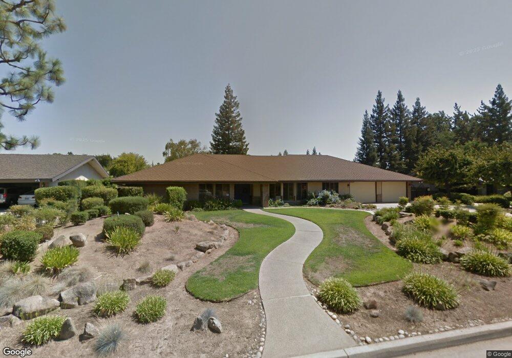
1413 W Alluvial Ave Fresno, CA 93711
Bullard NeighborhoodEstimated Value: $726,575 - $1,203,000
4
Beds
3
Baths
3,421
Sq Ft
$263/Sq Ft
Est. Value
About This Home
This home is located at 1413 W Alluvial Ave, Fresno, CA 93711 and is currently estimated at $900,894, approximately $263 per square foot. 1413 W Alluvial Ave is a home located in Fresno County with nearby schools including Nelson Elementary School, Kastner Intermediate School, and Clovis West High School.
Ownership History
Date
Name
Owned For
Owner Type
Purchase Details
Closed on
Jan 9, 1994
Sold by
Boust Dale Eugene and Boust Patricia Ann
Bought by
Boust Dale Eugene and Boust Patricia Ann
Current Estimated Value
Home Financials for this Owner
Home Financials are based on the most recent Mortgage that was taken out on this home.
Original Mortgage
$88,500
Interest Rate
6.67%
Purchase Details
Closed on
Dec 14, 1993
Sold by
Boust Dale Eugene and Boust Patricia Ann
Bought by
Boust Dale Eugene and Boust Patricia Ann
Home Financials for this Owner
Home Financials are based on the most recent Mortgage that was taken out on this home.
Original Mortgage
$88,500
Interest Rate
6.67%
Create a Home Valuation Report for This Property
The Home Valuation Report is an in-depth analysis detailing your home's value as well as a comparison with similar homes in the area
Home Values in the Area
Average Home Value in this Area
Purchase History
| Date | Buyer | Sale Price | Title Company |
|---|---|---|---|
| Boust Dale Eugene | -- | -- | |
| Boust Dale Eugene | -- | Central Title Company |
Source: Public Records
Mortgage History
| Date | Status | Borrower | Loan Amount |
|---|---|---|---|
| Previous Owner | Boust Dale Eugene | $88,500 |
Source: Public Records
Tax History Compared to Growth
Tax History
| Year | Tax Paid | Tax Assessment Tax Assessment Total Assessment is a certain percentage of the fair market value that is determined by local assessors to be the total taxable value of land and additions on the property. | Land | Improvement |
|---|---|---|---|---|
| 2025 | $4,033 | $345,896 | $63,732 | $282,164 |
| 2023 | $3,954 | $332,466 | $61,258 | $271,208 |
| 2022 | $3,900 | $325,948 | $60,057 | $265,891 |
| 2021 | $3,790 | $319,558 | $58,880 | $260,678 |
| 2020 | $3,774 | $316,283 | $58,277 | $258,006 |
| 2019 | $3,699 | $310,083 | $57,135 | $252,948 |
| 2018 | $3,617 | $304,004 | $56,015 | $247,989 |
| 2017 | $3,553 | $298,044 | $54,917 | $243,127 |
| 2016 | $3,432 | $292,201 | $53,841 | $238,360 |
| 2015 | $3,379 | $287,813 | $53,033 | $234,780 |
| 2014 | $3,315 | $282,176 | $51,995 | $230,181 |
Source: Public Records
Map
Nearby Homes
- 7355 N Pacific Ave
- 7334 N Teilman Ave
- 7166 N Fruit Ave Unit 160
- 7166 N Fruit Ave Unit 132
- 7166 N Fruit Ave Unit 133
- 7178 N Fruit Ave Unit 108
- 7166 N Fruit Ave Unit 127
- 1110 W Bedford Ave
- 7258 N Channing Way
- 7047 N Teilman Ave Unit 101
- 7047 N Teilman Ave Unit 102
- 6753 N Durant Ave
- 6737 N Harrison Ave
- 6658 N Thorne Ave
- 6671 N Channing Way
- 1 Palm Ave
- 0 0 Unit 633401
- 0 0 Unit 631266
- 6569 N Teilman Ave
- 6594 N Farris Ave
- 1427 W Alluvial Ave
- 1388 W Northridge Ave
- 1396 W Northridge Ave
- 1382 W Northridge Ave
- 1404 W Northridge Ave
- 1418 W Alluvial Ave
- 1370 W Northridge Ave
- 1385 W Alluvial Ave
- 1441 W Alluvial Ave
- 1404 W Alluvial Ave
- 1442 W Alluvial Ave
- 1358 W Northridge Ave
- 1408 W Northridge Ave
- 1381 W Northridge Ave
- 1390 W Alluvial Ave
- 1373 W Northridge Ave
- 1371 W Alluvial Ave
- 1467 W Alluvial Ave
- 1389 W Northridge Ave
- 1350 W Northridge Ave