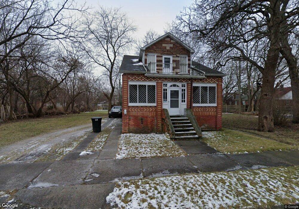
14136 Manning St Detroit, MI 48205
Franklin NeighborhoodEstimated Value: $55,000 - $90,943
--
Bed
2
Baths
1,680
Sq Ft
$43/Sq Ft
Est. Value
About This Home
This home is located at 14136 Manning St, Detroit, MI 48205 and is currently estimated at $72,736, approximately $43 per square foot. 14136 Manning St is a home located in Wayne County with nearby schools including Casimir Pulaski Elementary-Middle School, Edward 'Duke' Ellington Conservatory of Music and Art, and Charles L. Spain Elementary-Middle School.
Ownership History
Date
Name
Owned For
Owner Type
Purchase Details
Closed on
Jul 27, 2006
Sold by
Randolph Sharice
Bought by
Steele Javon
Current Estimated Value
Purchase Details
Closed on
Nov 13, 2003
Sold by
Simmons Sylvester
Bought by
Ameriquest Mortgage Co
Purchase Details
Closed on
Jul 23, 2003
Sold by
Squiers Robert and Squiers Nicole M
Bought by
Randolph Sharice
Purchase Details
Closed on
Feb 12, 2002
Sold by
Squiers Robert
Bought by
Simmons Sylvester
Purchase Details
Closed on
Mar 9, 2001
Sold by
Capital Real Estate Llc
Bought by
Squiers Robert
Purchase Details
Closed on
Jul 25, 1994
Sold by
Tatangelo Mario
Bought by
Wayne D Wright
Create a Home Valuation Report for This Property
The Home Valuation Report is an in-depth analysis detailing your home's value as well as a comparison with similar homes in the area
Home Values in the Area
Average Home Value in this Area
Purchase History
| Date | Buyer | Sale Price | Title Company |
|---|---|---|---|
| Steele Javon | $34,500 | Metropolitan Title Company | |
| Ameriquest Mortgage Co | $97,620 | -- | |
| Randolph Sharice | $90,000 | Manzo Title Insurance Agency | |
| Simmons Sylvester | $5,000 | -- | |
| Squiers Robert | $20,000 | -- | |
| Wayne D Wright | $28,900 | -- |
Source: Public Records
Tax History Compared to Growth
Tax History
| Year | Tax Paid | Tax Assessment Tax Assessment Total Assessment is a certain percentage of the fair market value that is determined by local assessors to be the total taxable value of land and additions on the property. | Land | Improvement |
|---|---|---|---|---|
| 2025 | $628 | $45,400 | $0 | $0 |
| 2024 | $628 | $40,700 | $0 | $0 |
| 2023 | $607 | $32,100 | $0 | $0 |
| 2022 | $651 | $24,200 | $0 | $0 |
| 2021 | $768 | $19,800 | $0 | $0 |
| 2020 | $671 | $17,900 | $0 | $0 |
| 2019 | $626 | $16,500 | $0 | $0 |
| 2018 | $655 | $16,700 | $0 | $0 |
| 2017 | $99 | $16,300 | $0 | $0 |
| 2016 | $708 | $6,100 | $0 | $0 |
| 2015 | $610 | $6,100 | $0 | $0 |
| 2013 | $852 | $8,523 | $0 | $0 |
| 2010 | -- | $12,497 | $833 | $11,664 |
Source: Public Records
Map
Nearby Homes
- 14153 Manning St
- 14404 Manning St
- 14405 Manning St
- 14110 E State Fair St
- 14124 Rossini Dr
- 14076 Rossini Dr
- 14141 Rossini Dr
- 14024 Rossini Dr
- 14504 Coram St
- 14390 Lappin St
- 14140 Fairmount Dr
- 14467 Rossini Dr
- 13832 Pinewood St
- 14531 Lappin St
- 14741 Coram St
- 14007 Fairmount Dr
- 14772 Tacoma St
- 14578 Lappin St
- 14445 Seven Mile E
- 13672 E State Fair St
- 14143 Liberal St
- 14123 Liberal St
- 14151 Liberal St
- 14144 Manning St
- 14157 Liberal St
- 14137 Liberal St
- 19642 Anvil St
- 19622 Anvil St
- 19632 Anvil St
- 19646 Anvil St
- 19654 Anvil St
- 14165 Liberal St
- 19618 Anvil St
- 14164 Manning St
- 19660 Anvil St
- 14115 Liberal St
- 19600 Anvil St
- 14170 Manning St
- 14171 Liberal St
- 14179 Liberal St