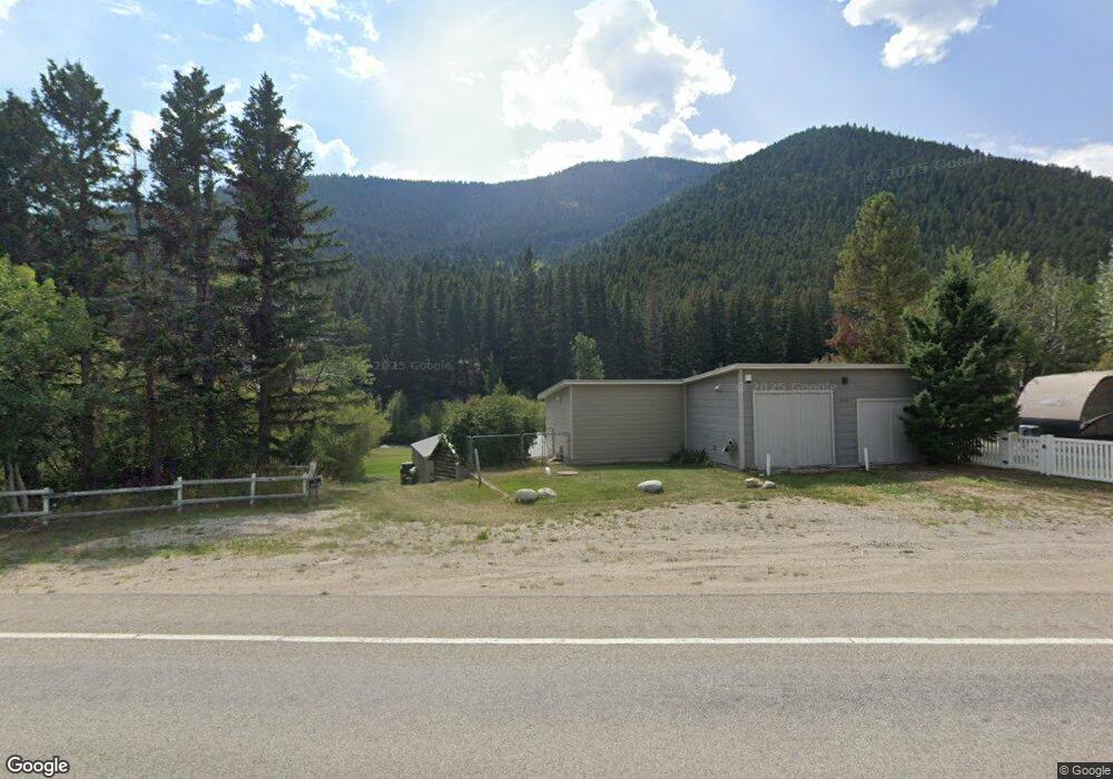
14139 Mt Highway 1 Anaconda, MT 59711
Estimated Value: $249,000 - $401,000
1
Bed
1
Bath
911
Sq Ft
$335/Sq Ft
Est. Value
About This Home
This home is located at 14139 Mt Highway 1, Anaconda, MT 59711 and is currently estimated at $305,519, approximately $335 per square foot. 14139 Mt Highway 1 is a home located in Deer Lodge County with nearby schools including Lincoln Elementary School, Fred Moodry Intermediate School, and Anaconda Junior High School.
Ownership History
Date
Name
Owned For
Owner Type
Purchase Details
Closed on
Aug 14, 2025
Sold by
Family Trust Of Keith J Hobson and Hobson Brandon
Bought by
Family Trust and Davidson
Current Estimated Value
Purchase Details
Closed on
Dec 11, 2020
Sold by
Hobson Nellie L and Family Trust Of Keith J Hobson
Bought by
Family Trust Of Nellie L Hobson
Purchase Details
Closed on
May 26, 2020
Sold by
Family Trust Of Keith J Hobson
Bought by
Family Trust Of Nellie L Hobson
Purchase Details
Closed on
Jun 20, 2013
Sold by
Hobson Nellie L
Bought by
Family Trust Of Nellie L Hobson
Create a Home Valuation Report for This Property
The Home Valuation Report is an in-depth analysis detailing your home's value as well as a comparison with similar homes in the area
Home Values in the Area
Average Home Value in this Area
Purchase History
| Date | Buyer | Sale Price | Title Company |
|---|---|---|---|
| Family Trust | -- | None Listed On Document | |
| Family Trust | -- | None Listed On Document | |
| Family Trust Of Nellie L Hobson | -- | None Available | |
| Family Trust Of Nellie L Hobson | -- | None Available | |
| Family Trust Of Nellie L Hobson | -- | None Available | |
| Family Trust Of Nellie L Hobson | -- | None Available | |
| Family Trust Of Keith Hobson | -- | None Available |
Source: Public Records
Tax History Compared to Growth
Tax History
| Year | Tax Paid | Tax Assessment Tax Assessment Total Assessment is a certain percentage of the fair market value that is determined by local assessors to be the total taxable value of land and additions on the property. | Land | Improvement |
|---|---|---|---|---|
| 2025 | $1,478 | $278,300 | $0 | $0 |
| 2024 | $1,369 | $160,498 | $0 | $0 |
| 2023 | $1,319 | $174,600 | $0 | $0 |
| 2022 | $1,083 | $100,488 | $0 | $0 |
| 2021 | $1,008 | $100,488 | $0 | $0 |
| 2020 | $983 | $92,149 | $0 | $0 |
| 2019 | $1,000 | $92,149 | $0 | $0 |
| 2018 | $937 | $87,196 | $0 | $0 |
| 2017 | $802 | $87,196 | $0 | $0 |
| 2016 | $813 | $75,814 | $0 | $0 |
| 2015 | $712 | $75,814 | $0 | $0 |
| 2014 | $731 | $43,210 | $0 | $0 |
Source: Public Records
Map
Nearby Homes
- Tbd Montana 1
- NHN (2) Montana 1
- 212 Rumsey St
- Lot 38 Mountain View Estates
- NHN Old Georgetown
- lt 13 Prosperity St
- 1131 Outlaw Trail
- TBD Tbd
- TBD Prosperity St
- 504 N Cable Rd
- 2105 Lincoln St
- 2102 Lincoln St
- Lot 1 TBD Harris Rd
- Lot 2 TBD Harris Rd
- Lot 3 TBD Harris Rd
- 120 Balsam St
- Lot 6 TBD Harris Rd
- 1812 Ogden St
- Lot 10 TBD Harris Rd
- 120 Juniper St
- 4451 N Cable Rd
- 4309 N Cable Rd
- 134 Cross Creek Dr
- 14277 Mt Highway 1
- 116 Cross Creek Dr
- 4243 N Cable Rd
- 13917 Mt Highway 1
- 13904 Mt Highway 1
- 13898 Mt Highway 1
- Tbd Lot 3 Montana 1
- Nhn Montana 1
- 18213 Montana 1
- Nhn MT Hwy 1 W Montana 1
- 13800 Montana 1
- - Montana 1
- 24005 Montana 1
- 4618 N Cable Rd
- 13751 Mt Highway 1
- 13751 Mt Highway 1
- 35 Phillip Rd