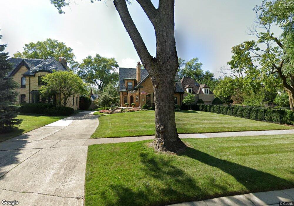
1414 Lathrop Ave River Forest, IL 60305
Estimated Value: $1,276,000 - $1,427,000
4
Beds
4
Baths
3,334
Sq Ft
$408/Sq Ft
Est. Value
About This Home
This home is located at 1414 Lathrop Ave, River Forest, IL 60305 and is currently estimated at $1,359,011, approximately $407 per square foot. 1414 Lathrop Ave is a home located in Cook County with nearby schools including Willard Elementary School, Roosevelt Middle School, and Oak Park and River Forest High School.
Ownership History
Date
Name
Owned For
Owner Type
Purchase Details
Closed on
Oct 23, 1997
Sold by
Harris Bank Hinsdale
Bought by
Domanowski Gregory E and Domanowski Lorraine
Current Estimated Value
Home Financials for this Owner
Home Financials are based on the most recent Mortgage that was taken out on this home.
Original Mortgage
$214,600
Outstanding Balance
$35,084
Interest Rate
7.65%
Estimated Equity
$1,323,927
Purchase Details
Closed on
Sep 9, 1997
Sold by
Hisaw J Richard and Hisaw Patricia A
Bought by
Harris Bank Hinsdale and Trust #L-489
Home Financials for this Owner
Home Financials are based on the most recent Mortgage that was taken out on this home.
Original Mortgage
$214,600
Outstanding Balance
$35,084
Interest Rate
7.65%
Estimated Equity
$1,323,927
Create a Home Valuation Report for This Property
The Home Valuation Report is an in-depth analysis detailing your home's value as well as a comparison with similar homes in the area
Home Values in the Area
Average Home Value in this Area
Purchase History
| Date | Buyer | Sale Price | Title Company |
|---|---|---|---|
| Domanowski Gregory E | $186,666 | -- | |
| Harris Bank Hinsdale | $116,666 | -- |
Source: Public Records
Mortgage History
| Date | Status | Borrower | Loan Amount |
|---|---|---|---|
| Open | Domanowski Gregory E | $214,600 | |
| Previous Owner | Harris Bank Hinsdale | $250,000 |
Source: Public Records
Tax History Compared to Growth
Tax History
| Year | Tax Paid | Tax Assessment Tax Assessment Total Assessment is a certain percentage of the fair market value that is determined by local assessors to be the total taxable value of land and additions on the property. | Land | Improvement |
|---|---|---|---|---|
| 2024 | $25,090 | $97,617 | $20,702 | $76,915 |
| 2023 | $20,260 | $108,523 | $20,702 | $87,821 |
| 2022 | $20,260 | $68,898 | $17,987 | $50,911 |
| 2021 | $19,562 | $68,896 | $17,986 | $50,910 |
| 2020 | $19,472 | $69,663 | $17,986 | $51,677 |
| 2019 | $19,038 | $67,500 | $16,290 | $51,210 |
| 2018 | $18,020 | $67,500 | $16,290 | $51,210 |
| 2017 | $18,592 | $69,567 | $16,290 | $53,277 |
| 2016 | $17,598 | $58,984 | $13,575 | $45,409 |
| 2015 | $19,095 | $64,918 | $13,575 | $51,343 |
| 2014 | $17,933 | $66,352 | $13,575 | $52,777 |
| 2013 | $16,914 | $64,452 | $13,575 | $50,877 |
Source: Public Records
Map
Nearby Homes
- 1310 Lathrop Ave
- 1314 Franklin Ave
- 1543 Franklin Ave Unit B
- 1601 N 76th Ct Unit 307
- 1515 Monroe Ave
- 1614 N 76th Ave
- 1424 Park Ave
- 1535 Park Ave Unit 304
- 1206 Lathrop Ave
- 1535 Forest Ave Unit 305
- 1535 Forest Ave Unit 301
- 1415 Keystone Ave
- 7830 W North Ave Unit 415
- 7830 W North Ave Unit 505
- 1719 N 77th Ct
- 1707 N 78th Ave
- 1625 N 73rd Ct
- 1727 N 74th Ct
- 7234 W North Ave Unit 1214
- 7234 W North Ave Unit 1902
- 1410 Lathrop Ave
- 1420 Lathrop Ave
- 1404 Lathrop Ave
- 1402 Lathrop Ave
- 1415 Ashland Ave
- 1430 Lathrop Ave
- 1425 Ashland Ave
- 1407 Ashland Ave
- 1415 Lathrop Ave
- 1419 Lathrop Ave
- 1438 Lathrop Ave
- 1423 Lathrop Ave
- 1431 Ashland Ave
- 1407 Lathrop Ave
- 1427 Lathrop Ave
- 1344 Lathrop Ave
- 1403 Lathrop Ave
- 1431 Lathrop Ave
- 1442 Lathrop Ave
- 1345 Ashland Ave
