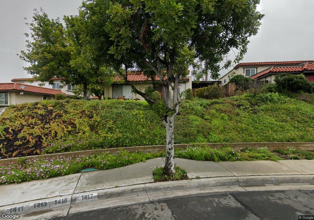
1415 1st St Unit C Duarte, CA 91010
Estimated Value: $540,000 - $576,286
3
Beds
2
Baths
1,178
Sq Ft
$477/Sq Ft
Est. Value
About This Home
This home is located at 1415 1st St Unit C, Duarte, CA 91010 and is currently estimated at $561,322, approximately $476 per square foot. 1415 1st St Unit C is a home located in Los Angeles County with nearby schools including Royal Oaks Elementary School, Duarte High School, and California School Of The Arts - San Gabriel Valley.
Ownership History
Date
Name
Owned For
Owner Type
Purchase Details
Closed on
Nov 29, 1995
Sold by
Orange National Bank
Bought by
Williams Zandra
Current Estimated Value
Home Financials for this Owner
Home Financials are based on the most recent Mortgage that was taken out on this home.
Original Mortgage
$90,650
Interest Rate
7.18%
Mortgage Type
FHA
Purchase Details
Closed on
Jun 28, 1995
Sold by
Turner Anna P and Lyons Donald R
Bought by
Lyons Donald R and Lyons Karen L
Create a Home Valuation Report for This Property
The Home Valuation Report is an in-depth analysis detailing your home's value as well as a comparison with similar homes in the area
Home Values in the Area
Average Home Value in this Area
Purchase History
| Date | Buyer | Sale Price | Title Company |
|---|---|---|---|
| Williams Zandra | $93,000 | Southland Title Corporation | |
| Lyons Donald R | $50,651 | -- |
Source: Public Records
Mortgage History
| Date | Status | Borrower | Loan Amount |
|---|---|---|---|
| Previous Owner | Williams Zandra | $90,650 |
Source: Public Records
Tax History Compared to Growth
Tax History
| Year | Tax Paid | Tax Assessment Tax Assessment Total Assessment is a certain percentage of the fair market value that is determined by local assessors to be the total taxable value of land and additions on the property. | Land | Improvement |
|---|---|---|---|---|
| 2025 | $2,387 | $154,465 | $30,884 | $123,581 |
| 2024 | $2,387 | $151,437 | $30,279 | $121,158 |
| 2023 | $2,323 | $148,469 | $29,686 | $118,783 |
| 2022 | $2,268 | $145,558 | $29,104 | $116,454 |
| 2021 | $2,234 | $142,705 | $28,534 | $114,171 |
| 2019 | $2,070 | $138,475 | $27,689 | $110,786 |
| 2018 | $2,013 | $135,761 | $27,147 | $108,614 |
| 2016 | $1,925 | $130,492 | $26,094 | $104,398 |
| 2015 | $1,887 | $128,533 | $25,703 | $102,830 |
| 2014 | $1,874 | $126,016 | $25,200 | $100,816 |
Source: Public Records
Map
Nearby Homes
- 1462 Lemon Ave
- 1214 Huntington Dr Unit I
- 1672 3rd St
- 540 Hacienda Dr
- 238 Barranca Rd
- 1035 E Huntington Dr Unit 28
- 1035 E Huntington Dr Unit 67
- 1832 Huntington Dr Unit 13
- 165 Circle Dr
- 682 Deodar Ln
- 1305 1/2 Santo Domingo Ave
- 1245 Oliva Ct
- 1619 Shepherd Dr
- 1835 Royal Oaks Dr
- 1020 S Mountain Ave Unit 15
- 1927 Huntington Dr Unit H
- 1931 E Huntington Dr Unit F
- 18 Dovetail Ln
- 1934 Baylor St
- 1901 Royal Oaks Dr
- 1417 1st St
- 1413 1st St
- 1411 1st St Unit A
- 1427 1st St Unit D
- 1425 1st St Unit C
- 1423 1st St
- 1421 1st St Unit A
- 1401 1st St Unit A
- 1407 1st St
- 1405 1st St
- 1403 1st St
- 1433 1st St Unit B
- 1437 1st St Unit D
- 1435 1st St
- 1431 1st St
- 905 Cabrillo Dr Unit C
- 905 Cabrillo Dr
- 903 Cabrillo Dr
- 901 Cabrillo Dr Unit 32A
- 901 Cabrillo Dr Unit A
