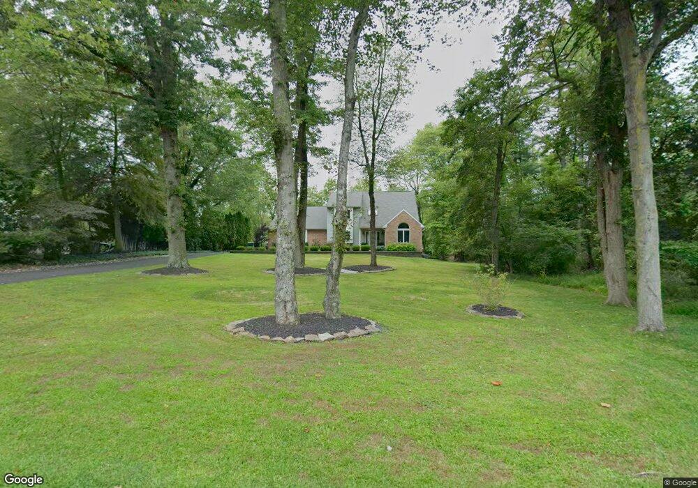
1415 Taylor Rd Lansdale, PA 19446
Estimated Value: $643,000 - $707,224
4
Beds
3
Baths
2,106
Sq Ft
$317/Sq Ft
Est. Value
About This Home
This home is located at 1415 Taylor Rd, Lansdale, PA 19446 and is currently estimated at $667,306, approximately $316 per square foot. 1415 Taylor Rd is a home located in Montgomery County with nearby schools including Bridle Path Elementary School, Penndale Middle School, and North Penn Senior High School.
Ownership History
Date
Name
Owned For
Owner Type
Purchase Details
Closed on
Nov 19, 2013
Sold by
Engro Joseph M and Engro Janet L
Bought by
Denitz Michael J and Denitz Lynn S
Current Estimated Value
Home Financials for this Owner
Home Financials are based on the most recent Mortgage that was taken out on this home.
Original Mortgage
$346,500
Outstanding Balance
$257,786
Interest Rate
4.17%
Mortgage Type
New Conventional
Estimated Equity
$409,520
Purchase Details
Closed on
Jun 23, 2005
Sold by
Garner William H and Garner Darlene D
Bought by
Engro Joseph M and Engro Janet L
Home Financials for this Owner
Home Financials are based on the most recent Mortgage that was taken out on this home.
Original Mortgage
$336,000
Interest Rate
5.59%
Mortgage Type
New Conventional
Purchase Details
Closed on
Feb 27, 1998
Sold by
Dachino Thomas L and Dachino Margaret A
Bought by
Garner William H and Garner Darlene D
Create a Home Valuation Report for This Property
The Home Valuation Report is an in-depth analysis detailing your home's value as well as a comparison with similar homes in the area
Home Values in the Area
Average Home Value in this Area
Purchase History
| Date | Buyer | Sale Price | Title Company |
|---|---|---|---|
| Denitz Michael J | $385,000 | None Available | |
| Engro Joseph M | $420,000 | -- | |
| Garner William H | $215,000 | -- |
Source: Public Records
Mortgage History
| Date | Status | Borrower | Loan Amount |
|---|---|---|---|
| Open | Denitz Michael J | $346,500 | |
| Previous Owner | Engro Joseph M | $336,000 |
Source: Public Records
Tax History Compared to Growth
Tax History
| Year | Tax Paid | Tax Assessment Tax Assessment Total Assessment is a certain percentage of the fair market value that is determined by local assessors to be the total taxable value of land and additions on the property. | Land | Improvement |
|---|---|---|---|---|
| 2025 | $7,777 | $208,500 | -- | -- |
| 2024 | $7,777 | $208,500 | -- | -- |
| 2023 | $7,419 | $208,500 | $0 | $0 |
| 2022 | $7,160 | $208,500 | $0 | $0 |
| 2021 | $6,732 | $208,500 | $0 | $0 |
| 2020 | $6,554 | $208,500 | $0 | $0 |
| 2019 | $6,432 | $208,500 | $0 | $0 |
| 2018 | $1,113 | $208,500 | $0 | $0 |
| 2017 | $6,157 | $208,500 | $0 | $0 |
| 2016 | $6,075 | $208,500 | $0 | $0 |
| 2015 | $5,801 | $208,500 | $0 | $0 |
| 2014 | $5,801 | $208,500 | $0 | $0 |
Source: Public Records
Map
Nearby Homes
- 6 Lantern Ln
- 100 Victoria Dr
- 583 Bethlehem Pike
- 107 David Ln
- 219 Pinecrest Ln
- 1823 N Line St
- 405 Country Club Dr
- 4 Mele Ave
- 000 Lenape Dr
- Augusta Plan at Stonebridge at Longwood
- Woodford Plan at Holly Drive
- 700 Shagbark Dr Unit HAWTHORNE
- Hawthorne Plan at Stonebridge at Longwood
- Augusta Plan at Holly Drive
- Magnolia Plan at Enclave at Tattersall
- Woodford Plan at Stonebridge at Longwood
- Kipling Plan at Stonebridge at Longwood
- Devonshire Plan at Enclave at Tattersall
- Covington Plan at Holly Drive
- Ethan Plan at Stonebridge at Longwood
- 1413 Taylor Rd
- 1411 Taylor Rd Unit 29
- 112 Cedar Ln
- 1416 Taylor Rd
- 110 Cedar Ln
- 1414 Taylor Rd
- 1409 Taylor Rd
- 108 Cedar Ln
- 1412 Taylor Rd
- 114 Cedar Ln
- 1425 Taylor Rd
- 104 Brookshyre Way
- 106 Cedar Ln
- 1410 Taylor Rd
- 307 Bridle Path Rd
- 1424 Taylor Rd
- 1407 Taylor Rd
- 110 Brookshyre Way
- 311 Bridle Path Rd
- 313 Bridle Path Rd