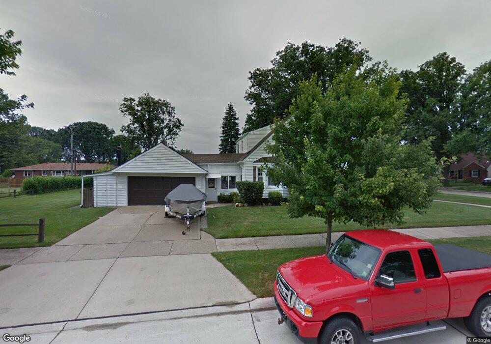
14168 Burns St Southgate, MI 48195
Estimated Value: $228,000 - $273,000
--
Bed
--
Bath
1,756
Sq Ft
$144/Sq Ft
Est. Value
About This Home
This home is located at 14168 Burns St, Southgate, MI 48195 and is currently estimated at $253,046, approximately $144 per square foot. 14168 Burns St is a home located in Wayne County with nearby schools including Grogan Elementary School, Davidson Middle School, and Southgate Anderson High School.
Ownership History
Date
Name
Owned For
Owner Type
Purchase Details
Closed on
Apr 28, 2025
Sold by
Malcolm Gerald W and Malcolm Judith A
Bought by
Malcolm Gerald W and Malcolm Judith A
Current Estimated Value
Purchase Details
Closed on
Jun 22, 2017
Sold by
Malcolm Gerald W and Malcolm Judith A
Bought by
Malcolm Gerald W
Purchase Details
Closed on
Feb 13, 2014
Sold by
Malcolm Gerald W and Malcolm Judith A
Bought by
Malcolm Gerald W
Purchase Details
Closed on
Sep 29, 2010
Sold by
Malcolm Gerald W and Malcolm Judith A
Bought by
Malcolm Gerald W and Malcolm Judith A
Create a Home Valuation Report for This Property
The Home Valuation Report is an in-depth analysis detailing your home's value as well as a comparison with similar homes in the area
Home Values in the Area
Average Home Value in this Area
Purchase History
| Date | Buyer | Sale Price | Title Company |
|---|---|---|---|
| Malcolm Gerald W | -- | None Listed On Document | |
| Malcolm Gerald W | -- | None Listed On Document | |
| Malcolm Gerald W | -- | None Available | |
| Malcolm Gerald W | -- | None Available | |
| Malcolm Gerald W | -- | None Available |
Source: Public Records
Tax History Compared to Growth
Tax History
| Year | Tax Paid | Tax Assessment Tax Assessment Total Assessment is a certain percentage of the fair market value that is determined by local assessors to be the total taxable value of land and additions on the property. | Land | Improvement |
|---|---|---|---|---|
| 2025 | $3,481 | $137,800 | $0 | $0 |
| 2024 | $3,481 | $129,500 | $0 | $0 |
| 2023 | $3,317 | $116,500 | $0 | $0 |
| 2022 | $3,835 | $105,100 | $0 | $0 |
| 2021 | $3,734 | $94,800 | $0 | $0 |
| 2020 | $3,672 | $85,200 | $0 | $0 |
| 2019 | $3,626 | $77,200 | $0 | $0 |
| 2018 | $2,771 | $67,700 | $0 | $0 |
| 2017 | $1,621 | $63,000 | $0 | $0 |
| 2016 | $3,356 | $63,800 | $0 | $0 |
| 2015 | $5,750 | $61,800 | $0 | $0 |
| 2013 | $5,570 | $58,300 | $0 | $0 |
| 2012 | $2,457 | $54,700 | $9,500 | $45,200 |
Source: Public Records
Map
Nearby Homes
- 13480 Argyle St
- 13460 Chestnut St
- 13440 Phelps St
- 13459 Jobin St
- 13650 Jobin St
- 14555 Burns St
- 14567 Longtin St
- 14620 Trenton Rd
- 13546 Trenton Rd
- 14370 Pearl St
- 13311 Castle St
- 13787 Irene St
- 14548 Pearl St
- 13632 Pearl St
- 13847 Helen St
- 12937 Walnut St
- 12753 Backus St
- 13395 Pullman St
- 12745 Phelps St
- 12773 Walnut St
- 14136 Burns St
- 14118 Burns St
- 13649 Commonwealth St
- 13648 Argyle St
- 13669 Commonwealth St
- 14157 Burns St
- 14145 Burns St
- 14171 Burns St
- 14133 Burns St
- 13645 Argyle St
- 14234 Burns St
- 14215 Burns St
- 13661 Argyle St
- 13672 Argyle St
- 13644 Commonwealth St
- 14233 Burns St
- 13554 Argyle St
- 13557 Commonwealth St
- 14075 Burns St
- 14245 Burns St