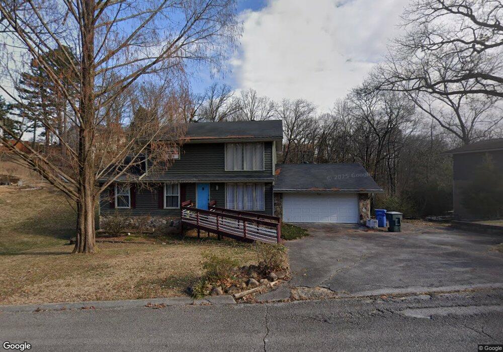
1417 Highcrest Dr Hixson, TN 37343
Dupont NeighborhoodEstimated Value: $342,672 - $395,000
Studio
1
Bath
2,304
Sq Ft
$158/Sq Ft
Est. Value
About This Home
This home is located at 1417 Highcrest Dr, Hixson, TN 37343 and is currently estimated at $364,668, approximately $158 per square foot. 1417 Highcrest Dr is a home located in Hamilton County with nearby schools including DuPont Elementary School, Hixson Middle School, and Hixson High School.
Ownership History
Date
Name
Owned For
Owner Type
Purchase Details
Closed on
Sep 23, 2005
Sold by
Mages Richard J and Mages Jane A
Bought by
Mitchell Morris C and Mitchell Martha Stein
Current Estimated Value
Create a Home Valuation Report for This Property
The Home Valuation Report is an in-depth analysis detailing your home's value as well as a comparison with similar homes in the area
Home Values in the Area
Average Home Value in this Area
Purchase History
| Date | Buyer | Sale Price | Title Company |
|---|---|---|---|
| Mitchell Morris C | $159,900 | -- |
Source: Public Records
Tax History
| Year | Tax Paid | Tax Assessment Tax Assessment Total Assessment is a certain percentage of the fair market value that is determined by local assessors to be the total taxable value of land and additions on the property. | Land | Improvement |
|---|---|---|---|---|
| 2025 | $1,539 | $101,550 | $0 | $0 |
| 2024 | $1,272 | $56,875 | $0 | $0 |
| 2023 | $1,272 | $56,875 | $0 | $0 |
| 2022 | $1,272 | $56,875 | $0 | $0 |
| 2021 | $1,272 | $56,875 | $0 | $0 |
| 2020 | $1,345 | $48,625 | $0 | $0 |
| 2019 | $1,345 | $48,625 | $0 | $0 |
| 2018 | $1,234 | $48,625 | $0 | $0 |
| 2017 | $1,345 | $48,625 | $0 | $0 |
| 2016 | $1,324 | $0 | $0 | $0 |
| 2015 | $2,544 | $47,875 | $0 | $0 |
| 2014 | $2,544 | $0 | $0 | $0 |
Source: Public Records
Map
Nearby Homes
- 1416 Highcrest Dr
- 1426 Highcrest Dr
- 607 Mountain Wood Dr
- 0 Mountain Wood Ln
- 541 Treetop Ln
- 5227 Lawana Ln
- 4714 Metro Park Ln
- 545 Leafwood Dr
- 4607 Cloverdale Loop
- 1313 Michael Ln
- 5416 Crestview Dr
- 810 Forest Dale Ln
- 421 Gadd Rd
- 410 Paragon Dr
- 4810 Delashmitt Rd
- 1331 Cloverdale Cir
- 4832 Stagg Rd
- 420 Marlow Dr
- 430 Appian Way
- 815 Sutton Dr
- 1415 Highcrest Dr
- 1419 Highcrest Dr
- 1413 Highcrest Dr
- 1402 Highcrest Ct
- 1406 Highcrest Ct
- 1400 Highcrest Ct
- 1418 Highcrest Dr
- 1408 Highcrest Ct
- 1411 Highcrest Dr
- 1420 Highcrest Dr
- 1414 Highcrest Dr
- 1422 Highcrest Dr
- 1409 Highcrest Dr
- 1412 Highcrest Dr
- 1412 Highcrest Dr Unit 36
- 1403 Highcrest Ct
- 615 Mountain Wood Dr
- 1401 Highcrest Ct
- 1405 Highcrest Ct
- 1409 Highcrest Ct
Your Personal Tour Guide
Ask me questions while you tour the home.