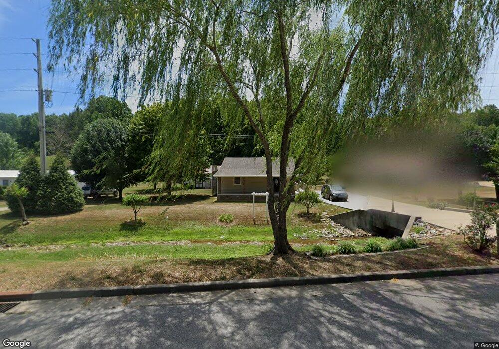
1417 Highway 13 S Waverly, TN 37185
Estimated Value: $123,617 - $285,000
--
Bed
1
Bath
900
Sq Ft
$227/Sq Ft
Est. Value
About This Home
This home is located at 1417 Highway 13 S, Waverly, TN 37185 and is currently estimated at $204,654, approximately $227 per square foot. 1417 Highway 13 S is a home located in Humphreys County.
Ownership History
Date
Name
Owned For
Owner Type
Purchase Details
Closed on
Mar 22, 2023
Sold by
Dotson James Corey
Bought by
Dotson Emily
Current Estimated Value
Purchase Details
Closed on
Jun 2, 2020
Sold by
Curtis Brian Craig and Curtis Cathy D
Bought by
Dotson Emily
Home Financials for this Owner
Home Financials are based on the most recent Mortgage that was taken out on this home.
Original Mortgage
$151,313
Interest Rate
3.3%
Mortgage Type
New Conventional
Purchase Details
Closed on
Sep 6, 2002
Sold by
Richardson Mamie B
Bought by
Craig Curtis Brian
Purchase Details
Closed on
Feb 15, 1957
Bought by
Curtis Hubert and Curtis Daisy
Create a Home Valuation Report for This Property
The Home Valuation Report is an in-depth analysis detailing your home's value as well as a comparison with similar homes in the area
Home Values in the Area
Average Home Value in this Area
Purchase History
| Date | Buyer | Sale Price | Title Company |
|---|---|---|---|
| Dotson Emily | -- | -- | |
| Dotson Emily | $149,800 | None Available | |
| Craig Curtis Brian | -- | -- | |
| Curtis Hubert | -- | -- |
Source: Public Records
Mortgage History
| Date | Status | Borrower | Loan Amount |
|---|---|---|---|
| Previous Owner | Dotson Emily | $151,313 |
Source: Public Records
Tax History Compared to Growth
Tax History
| Year | Tax Paid | Tax Assessment Tax Assessment Total Assessment is a certain percentage of the fair market value that is determined by local assessors to be the total taxable value of land and additions on the property. | Land | Improvement |
|---|---|---|---|---|
| 2025 | $432 | $23,500 | $0 | $0 |
| 2024 | $432 | $23,500 | $5,450 | $18,050 |
| 2023 | $432 | $23,500 | $5,450 | $18,050 |
| 2022 | $444 | $20,375 | $5,225 | $15,150 |
| 2021 | $423 | $20,375 | $5,225 | $15,150 |
| 2020 | $429 | $19,425 | $5,225 | $14,200 |
| 2019 | $344 | $16,900 | $5,425 | $11,475 |
| 2018 | $344 | $16,900 | $5,425 | $11,475 |
| 2017 | $344 | $16,900 | $5,425 | $11,475 |
| 2016 | $270 | $12,250 | $5,425 | $6,825 |
| 2015 | $270 | $12,250 | $5,425 | $6,825 |
| 2014 | $269 | $12,246 | $0 | $0 |
Source: Public Records
Map
Nearby Homes
- 1825 Highway 13 S
- 781 Highway 13 S
- 0 Old Skyline Dr Unit RTC3015061
- 205 Hillwood Dr
- 413 E Main St
- 205 Armstrong St
- 130 Fairground Dr
- 126 Fairground Dr
- 116 Fairground Dr
- 120 Joe St
- 101 Slayden Ave
- 0 Bear Hollow Dr Unit RTC3002566
- 0 Bear Hollow Dr Unit 24022394
- 0 Bear Hollow Dr Unit 24022393
- 0 Bear Hollow Dr Unit RTC2817194
- 0 Bear Hollow Dr Unit RTC2747935
- 213 E Wyly St
- 307 E Commerce St
- 0 Mill St
- 100 Browning St
- 1375 Highway 13 S
- 1467 Highway 13 S
- 1371 Highway 13 S
- 1339 Highway 13 S
- 1291 Highway 13 S
- 266 Dub Ln
- 1150 Highway 13 S
- 1719 Highway 13 S
- 1120 Highway 13 S
- 398 Old Linden Rd
- 1823 Highway 13 S
- 1906 Highway 13 S
- 370 Old Linden Rd
- 85 Amanda Cove
- 299 Old Linden Rd
- 293 Old Linden Rd
- 837 Highway 13 S
- 2049 Highway 13 S
- 96 Potter Ln
- 120 E Blue Creek Rd