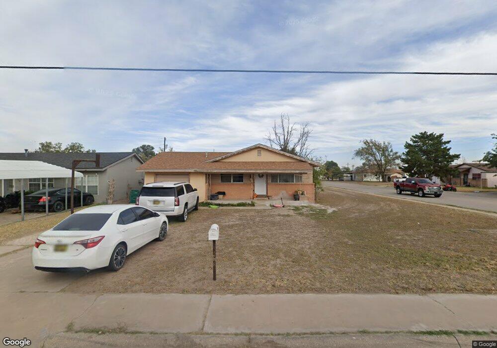
1417 S 2nd St Lovington, NM 88260
Estimated Value: $114,000 - $150,000
3
Beds
2
Baths
1,135
Sq Ft
$115/Sq Ft
Est. Value
About This Home
This home is located at 1417 S 2nd St, Lovington, NM 88260 and is currently estimated at $131,086, approximately $115 per square foot. 1417 S 2nd St is a home located in Lea County with nearby schools including Llano Elementary School, Ben Alexander Elementary School, and Jefferson Elementary School.
Ownership History
Date
Name
Owned For
Owner Type
Purchase Details
Closed on
Jul 22, 2024
Sold by
Yielding Karen Leigh and Robinson Cheryl Lynn
Bought by
Arciniega Brenda and Arciniega Juan Arciniega Sa
Current Estimated Value
Purchase Details
Closed on
Aug 8, 2022
Sold by
Larry Kann
Bought by
Alvarez Zabdi Banda and Alvarez Marcos Ortiz
Purchase Details
Closed on
Jan 25, 2021
Sold by
Boland Jr Lloyd Dale
Bought by
Yeilding Karen Leigh
Purchase Details
Closed on
Jun 16, 2019
Sold by
Boland Lloyd Dale
Bought by
Yeilding Karen and Yeilding Ronald
Purchase Details
Closed on
Mar 5, 2015
Sold by
Dale Dale and Boland Dorothea
Bought by
Boland Dale and Yielding Karen
Purchase Details
Closed on
Feb 13, 2015
Sold by
Lloyd D Lloyd D
Bought by
Boland Dale and Yielding Karen L
Create a Home Valuation Report for This Property
The Home Valuation Report is an in-depth analysis detailing your home's value as well as a comparison with similar homes in the area
Home Values in the Area
Average Home Value in this Area
Purchase History
| Date | Buyer | Sale Price | Title Company |
|---|---|---|---|
| Arciniega Brenda | -- | Pioneer Title | |
| Alvarez Zabdi Banda | -- | -- | |
| Alvarez Zabdi Banda | -- | First American Title | |
| Yeilding Karen Leigh | -- | None Available | |
| Yeilding Karen | -- | None Available | |
| Boland Dale | -- | -- | |
| Boland Dale | -- | -- |
Source: Public Records
Tax History Compared to Growth
Tax History
| Year | Tax Paid | Tax Assessment Tax Assessment Total Assessment is a certain percentage of the fair market value that is determined by local assessors to be the total taxable value of land and additions on the property. | Land | Improvement |
|---|---|---|---|---|
| 2024 | $378 | $12,293 | $1,103 | $11,190 |
| 2023 | $372 | $11,935 | $1,071 | $10,864 |
| 2022 | $362 | $11,935 | $1,071 | $10,864 |
| 2021 | $349 | $11,251 | $1,010 | $10,241 |
| 2020 | $341 | $10,924 | $981 | $9,943 |
| 2019 | $166 | $10,605 | $952 | $9,653 |
| 2018 | $320 | $10,296 | $924 | $9,372 |
| 2017 | $308 | $29,988 | $2,691 | $27,297 |
| 2016 | $297 | $29,115 | $2,613 | $26,502 |
| 2015 | $291 | $28,269 | $2,538 | $25,731 |
| 2014 | -- | $27,444 | $2,463 | $24,981 |
Source: Public Records
Map
Nearby Homes
- 1302 S 2nd St
- 401 W Avenue L
- TBD Urlacher Dr
- 1010 S 5th St
- TBD LOT 13 & 14 Main St
- TBD LOT 23 & 24 Main St
- TBD S Main
- lot 8A block 8 W Avenue K
- 819 W Avenue I
- 2121 Dencoe Dr
- 806 W Avenue H
- TBD Dencoe Dr
- 1410 W Avenue K
- TBD Lots 13 & 14 Ave D
- 111 S 5th St
- 114 S Commercial St
- 7 S Commercial St
- 311 N 6th St
- TBD N East St
- 812 E Monroe Ave