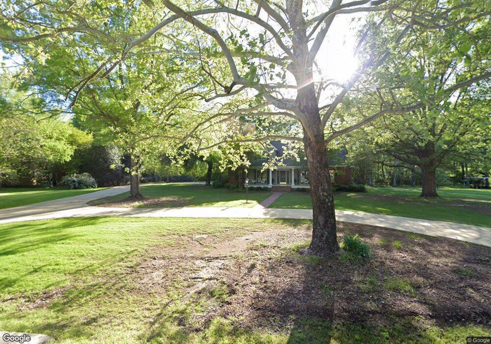
1417 Stevens Grove Rd West Point, MS 39773
Estimated Value: $292,000 - $772,000
3
Beds
--
Bath
4,412
Sq Ft
$110/Sq Ft
Est. Value
About This Home
This home is located at 1417 Stevens Grove Rd, West Point, MS 39773 and is currently estimated at $484,471, approximately $109 per square foot. 1417 Stevens Grove Rd is a home located in Clay County with nearby schools including East Side Elementary School, West Clay Elementary School, and Church Hill Elementary School.
Ownership History
Date
Name
Owned For
Owner Type
Purchase Details
Closed on
Nov 30, 2020
Sold by
Montgomery Steve and Montgomery Kathy
Bought by
Shirley Rebecca R and Shirley James Arthur
Current Estimated Value
Home Financials for this Owner
Home Financials are based on the most recent Mortgage that was taken out on this home.
Original Mortgage
$220,000
Outstanding Balance
$155,518
Interest Rate
2.8%
Mortgage Type
Unknown
Estimated Equity
$328,953
Purchase Details
Closed on
Feb 21, 2006
Sold by
Childress Donald E and Childress Wendy
Bought by
Montgomery Steve and Montgomery Kathy
Home Financials for this Owner
Home Financials are based on the most recent Mortgage that was taken out on this home.
Original Mortgage
$110,000
Interest Rate
6.04%
Create a Home Valuation Report for This Property
The Home Valuation Report is an in-depth analysis detailing your home's value as well as a comparison with similar homes in the area
Purchase History
| Date | Buyer | Sale Price | Title Company |
|---|---|---|---|
| Shirley Rebecca R | -- | -- | |
| Montgomery Steve | -- | -- |
Source: Public Records
Mortgage History
| Date | Status | Borrower | Loan Amount |
|---|---|---|---|
| Open | Shirley Rebecca R | $220,000 | |
| Previous Owner | Montgomery Steve | $110,000 | |
| Previous Owner | Montgomery Steve | $99,925 |
Source: Public Records
Tax History
| Year | Tax Paid | Tax Assessment Tax Assessment Total Assessment is a certain percentage of the fair market value that is determined by local assessors to be the total taxable value of land and additions on the property. | Land | Improvement |
|---|---|---|---|---|
| 2025 | $1,890 | $37,622 | $4,500 | $33,122 |
| 2024 | $1,890 | $37,622 | $4,500 | $33,122 |
| 2023 | $3,958 | $28,449 | $4,500 | $23,949 |
| 2022 | $1,400 | $28,449 | $4,500 | $23,949 |
| 2021 | $1,397 | $28,449 | $4,500 | $23,949 |
| 2020 | $1,396 | $28,449 | $4,500 | $23,949 |
| 2019 | $1,391 | $29,815 | $4,500 | $25,315 |
| 2018 | $1,326 | $29,815 | $4,500 | $25,315 |
| 2017 | $1,326 | $29,815 | $4,500 | $25,315 |
| 2016 | $1,270 | $29,815 | $4,500 | $25,315 |
| 2015 | $1,204 | $27,465 | $4,500 | $22,965 |
| 2014 | $1,022 | $27,465 | $4,500 | $22,965 |
| 2013 | $1,022 | $27,465 | $4,500 | $22,965 |
Source: Public Records
Map
Nearby Homes
- Lot 2 Waverly Rd
- Lot 6 Waverly Rd
- Lot 5 Waverly Rd
- Lot 3 Waverly Rd
- Lot 10 Waverly Rd
- Lot 8 Waverly Rd
- Lot 7 Waverly Rd
- Lot 9 Waverly Rd
- Lot 4 Waverly Rd
- Lot 11 Waverly Rd
- 0 Old Tibbee Rd
- 161 Mapleview Rd
- 264 Mapleview Rd
- 389 Mapleview Rd
- 15 David St
- 3986 E Church Hill Rd
- 1046 E Brame Ave
- 405 S Eshman Ave
- 44 Torbert Dr
- 9 Scotland Yard
- 1419 Stevens Grove Rd
- 1415 Stevens Grove Rd
- 1405 Stevens Grove Rd
- 425 Stevens Grove Rd
- 1407 Stevens Grove Rd
- 235 Stevens Grove Rd
- 716 Waverly Rd
- 1409 Stevens Grove Rd
- 640 Waverly Rd
- 278 Stevens Grove Rd
- 693 Waverly Rd
- 547 Waverly Rd
- 1015 Waverly Rd
- 1068 Section Cir
- 1230 Hickory Dr
- 4040 Old Tibbee Rd
- 305 Section Cir
- 1218 Hickory Dr
- 1232 Hickory Dr
- 1211 Hickory Dr
Your Personal Tour Guide
Ask me questions while you tour the home.