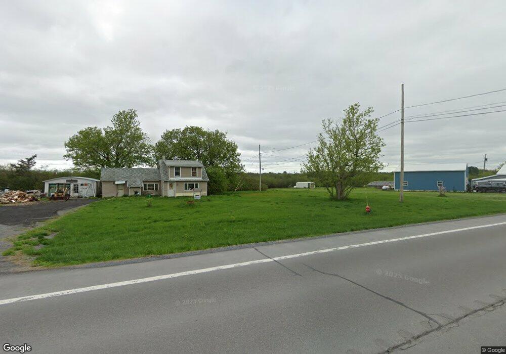
14175 State Route 3 Sackets Harbor, NY 13685
Estimated Value: $204,000 - $248,000
3
Beds
1
Bath
1,208
Sq Ft
$183/Sq Ft
Est. Value
About This Home
This home is located at 14175 State Route 3, Sackets Harbor, NY 13685 and is currently estimated at $220,642, approximately $182 per square foot. 14175 State Route 3 is a home with nearby schools including Sackets Harbor Central School.
Ownership History
Date
Name
Owned For
Owner Type
Purchase Details
Closed on
Jul 25, 2025
Sold by
Gregory Lisa M and Lane Lisa M
Bought by
Lane Harold J and Lane Loverna V
Current Estimated Value
Home Financials for this Owner
Home Financials are based on the most recent Mortgage that was taken out on this home.
Original Mortgage
$89,300
Interest Rate
6.25%
Mortgage Type
New Conventional
Purchase Details
Closed on
Sep 7, 2000
Sold by
Denny James
Bought by
Gregory Lisa M
Purchase Details
Closed on
Apr 29, 1999
Create a Home Valuation Report for This Property
The Home Valuation Report is an in-depth analysis detailing your home's value as well as a comparison with similar homes in the area
Home Values in the Area
Average Home Value in this Area
Purchase History
| Date | Buyer | Sale Price | Title Company |
|---|---|---|---|
| Lane Harold J | $94,000 | None Listed On Document | |
| Gregory Lisa M | $59,000 | -- | |
| -- | -- | -- |
Source: Public Records
Mortgage History
| Date | Status | Borrower | Loan Amount |
|---|---|---|---|
| Previous Owner | Lane Harold J | $89,300 |
Source: Public Records
Tax History Compared to Growth
Tax History
| Year | Tax Paid | Tax Assessment Tax Assessment Total Assessment is a certain percentage of the fair market value that is determined by local assessors to be the total taxable value of land and additions on the property. | Land | Improvement |
|---|---|---|---|---|
| 2024 | $3,689 | $155,400 | $45,400 | $110,000 |
| 2023 | $3,648 | $155,400 | $45,400 | $110,000 |
| 2022 | $4,139 | $142,700 | $21,500 | $121,200 |
| 2021 | $4,142 | $142,700 | $21,500 | $121,200 |
| 2020 | $3,317 | $142,700 | $21,500 | $121,200 |
| 2019 | $3,252 | $142,700 | $21,500 | $121,200 |
| 2018 | $3,252 | $142,700 | $21,500 | $121,200 |
| 2017 | $3,141 | $142,700 | $21,500 | $121,200 |
| 2016 | $3,066 | $142,700 | $21,500 | $121,200 |
| 2015 | -- | $142,700 | $21,500 | $121,200 |
| 2014 | -- | $142,700 | $21,500 | $121,200 |
Source: Public Records
Map
Nearby Homes
- 314 Dodge Ave
- NE of E Main Street E Main St
- 108 Mill Creek Ln
- 133 Vollum - Lot 5 Rd
- 109 Funnycide Dr
- 20467 Morin Ln
- 401 Pike St
- 209 Monroe St
- 209 E Main St
- 14269 County Route 62
- 20304 Burton Rd
- 17695 County Route 59
- 18121 Howe Shore Dr
- 17869 County Route 59
- 17619 Hy Knoll Dr
- 12622 State Route 3
- 12897 Ridge Rd
- 17106 State Route 3
- 23652 Ackerman Rd Unit 656
- 15541 Foster Park Rd
- 14245 State Route 3
- 14250 State Route 3
- 14192 New York 3
- 14150 County Route 75 Unit 54
- 14337 State Route 3
- 14023 County Route 75
- 13981 County Route 75
- 14202 County Route 75 Unit 212
- 13961 County Route 75
- 14049 County Route 75
- 13731 Hess Rd
- 14432 County Route 75
- 13737 Hess Rd
- 417 Adams Rd
- 414 Dodge Ave
- 411 Dodge Ave
- 412 Dodge Ave
- 13790 Hess Rd
- 410 Dodge Ave
- 14502 County Route 75