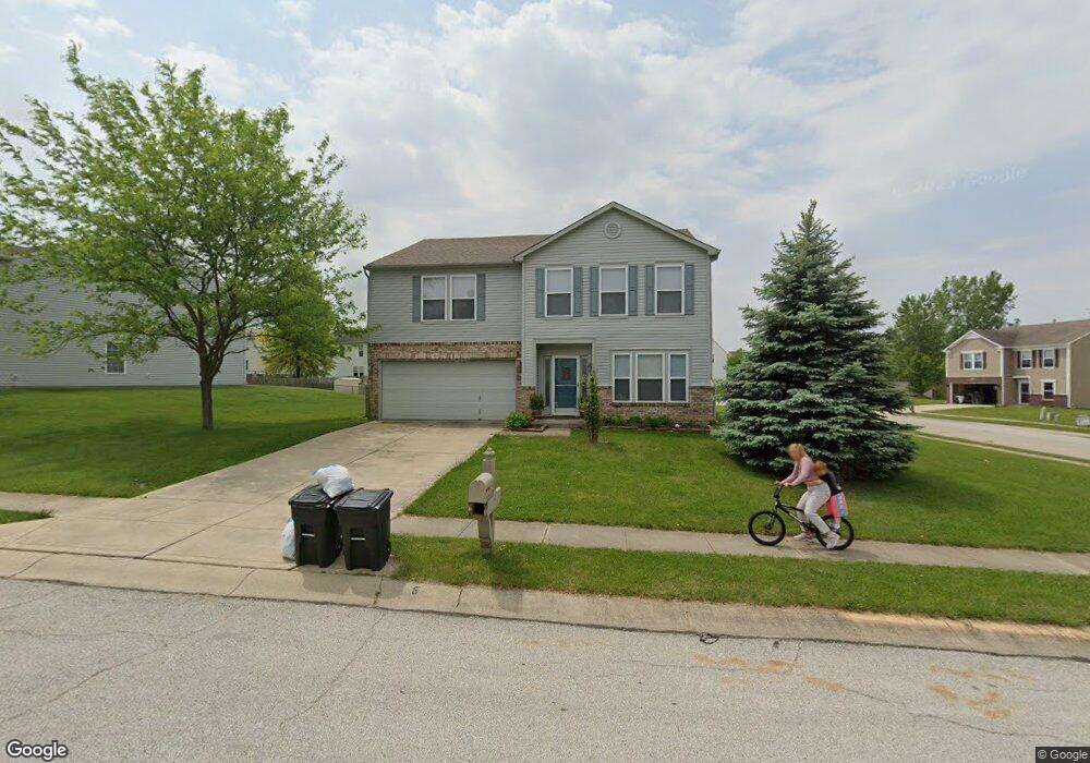
1419 Backwater Dr Danville, IN 46122
Estimated Value: $292,000 - $315,000
4
Beds
3
Baths
2,516
Sq Ft
$121/Sq Ft
Est. Value
About This Home
This home is located at 1419 Backwater Dr, Danville, IN 46122 and is currently estimated at $305,610, approximately $121 per square foot. 1419 Backwater Dr is a home located in Hendricks County with nearby schools including North Elementary School, Danville Middle School, and South Elementary School.
Ownership History
Date
Name
Owned For
Owner Type
Purchase Details
Closed on
Mar 15, 2010
Sold by
Secretary Of Housing & Urban Development
Bought by
Farhadi Arezoo
Current Estimated Value
Purchase Details
Closed on
Sep 30, 2009
Sold by
Bac Home Loans Servicing Lp
Bought by
Secretary Of Housing & Urban Development
Purchase Details
Closed on
Aug 20, 2009
Sold by
Cooley Aben R and Weaver Suzanne M
Bought by
Bac Home Loans Servicing Lp
Create a Home Valuation Report for This Property
The Home Valuation Report is an in-depth analysis detailing your home's value as well as a comparison with similar homes in the area
Home Values in the Area
Average Home Value in this Area
Purchase History
| Date | Buyer | Sale Price | Title Company |
|---|---|---|---|
| Farhadi Arezoo | -- | None Available | |
| Secretary Of Housing & Urban Development | -- | None Available | |
| Bac Home Loans Servicing Lp | $148,926 | None Available |
Source: Public Records
Tax History Compared to Growth
Tax History
| Year | Tax Paid | Tax Assessment Tax Assessment Total Assessment is a certain percentage of the fair market value that is determined by local assessors to be the total taxable value of land and additions on the property. | Land | Improvement |
|---|---|---|---|---|
| 2024 | $5,264 | $263,200 | $40,800 | $222,400 |
| 2023 | $4,576 | $228,800 | $37,100 | $191,700 |
| 2022 | $4,390 | $219,500 | $35,300 | $184,200 |
| 2021 | $3,880 | $194,000 | $33,300 | $160,700 |
| 2020 | $3,624 | $181,200 | $33,300 | $147,900 |
| 2019 | $3,330 | $166,500 | $32,000 | $134,500 |
| 2018 | $3,190 | $159,500 | $32,000 | $127,500 |
| 2017 | $2,972 | $148,600 | $30,500 | $118,100 |
| 2016 | $2,910 | $145,500 | $30,500 | $115,000 |
| 2014 | $2,776 | $138,800 | $28,700 | $110,100 |
Source: Public Records
Map
Nearby Homes
- 1348 McCormicks Cir
- 1331 McCormicks Cir
- 317 Backwood Dr
- Harmony Plan at Miles Farm
- Johnstown Plan at Miles Farm
- Cortland Plan at Miles Farm
- Holcombe Plan at Miles Farm
- Dayton Plan at Miles Farm
- Chatham Plan at Miles Farm
- Stamford Plan at Miles Farm
- Freeport Plan at Miles Farm
- Campton Plan at Miles Farm
- Henley Plan at Miles Farm
- Bellamy Plan at Miles Farm
- 1509 Adios Butler Ct
- 1515 Adios Butler Ct
- 1521 Adios Butler Ct
- 1533 Adios Butler Ct
- 1534 Adios Butler Ct
- 1546 Adios Butler Ct
- 1417 Backwater Dr
- 1443 Ripplewood Dr
- 1427 Ripplewood Dr
- 1415 Backwater Dr
- 1447 Ripplewood Dr
- 1438 Ripplewood Dr
- 1446 Ripplewood Dr
- 1416 Backwater Dr
- 1434 Ripplewood Dr
- 1423 Ripplewood Dr
- 1411 Backwater Dr
- 1451 Ripplewood Dr
- 1450 Ripplewood Dr
- 1412 Backwater Dr
- 1454 Ripplewood Dr
- 1421 Ripplewood Dr
- 1458 Ripplewood Dr
- 1453 Ripplewood Dr
- 1408 Backwater Dr
- 197 Creekside Dr