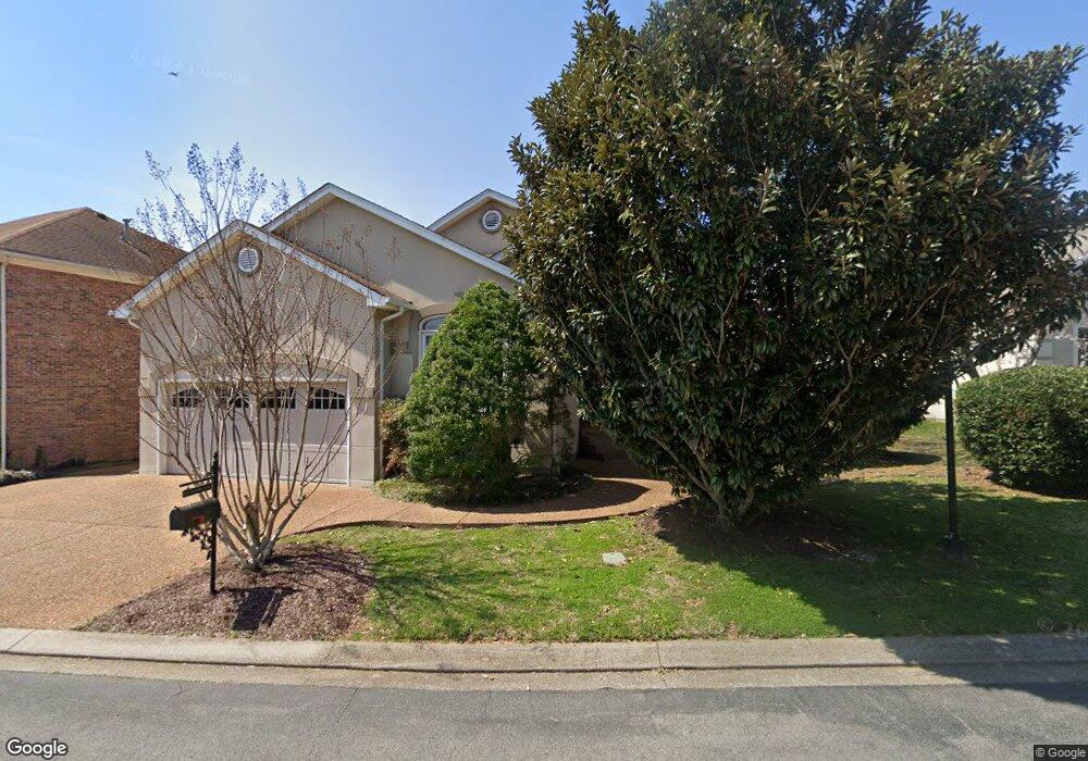
1419 Mohawk Trail Murfreesboro, TN 37129
Estimated Value: $396,177 - $457,000
Studio
3
Baths
1,980
Sq Ft
$217/Sq Ft
Est. Value
About This Home
This home is located at 1419 Mohawk Trail, Murfreesboro, TN 37129 and is currently estimated at $428,794, approximately $216 per square foot. 1419 Mohawk Trail is a home located in Rutherford County with nearby schools including Northfield Elementary School, Siegel Middle School, and Siegel High School.
Ownership History
Date
Name
Owned For
Owner Type
Purchase Details
Closed on
Feb 6, 2007
Sold by
Bell Angela H
Bought by
Fletcher Felicia D
Current Estimated Value
Home Financials for this Owner
Home Financials are based on the most recent Mortgage that was taken out on this home.
Original Mortgage
$154,500
Outstanding Balance
$91,181
Interest Rate
6.17%
Mortgage Type
Purchase Money Mortgage
Estimated Equity
$337,613
Purchase Details
Closed on
Dec 17, 2001
Sold by
Maxey Jack F and Maxey Susan L
Bought by
Bell Angela H
Purchase Details
Closed on
Aug 7, 1995
Sold by
Mcdonald Debbie L
Bought by
Maxey Jack S
Purchase Details
Closed on
Oct 13, 1994
Sold by
Tony Rhodes
Bought by
Mcdonald Debbie L
Create a Home Valuation Report for This Property
The Home Valuation Report is an in-depth analysis detailing your home's value as well as a comparison with similar homes in the area
Home Values in the Area
Average Home Value in this Area
Purchase History
| Date | Buyer | Sale Price | Title Company |
|---|---|---|---|
| Fletcher Felicia D | $206,000 | -- | |
| Bell Angela H | $167,000 | -- | |
| Maxey Jack S | $18,000 | -- | |
| Mcdonald Debbie L | -- | -- |
Source: Public Records
Mortgage History
| Date | Status | Borrower | Loan Amount |
|---|---|---|---|
| Open | Mcdonald Debbie L | $154,500 | |
| Closed | Mcdonald Debbie L | $51,500 |
Source: Public Records
Tax History
| Year | Tax Paid | Tax Assessment Tax Assessment Total Assessment is a certain percentage of the fair market value that is determined by local assessors to be the total taxable value of land and additions on the property. | Land | Improvement |
|---|---|---|---|---|
| 2025 | $2,524 | $89,200 | $13,750 | $75,450 |
| 2024 | $2,524 | $89,200 | $13,750 | $75,450 |
| 2023 | $1,674 | $89,200 | $13,750 | $75,450 |
| 2022 | $1,442 | $89,200 | $13,750 | $75,450 |
| 2021 | $1,439 | $64,850 | $11,875 | $52,975 |
| 2020 | $1,439 | $64,850 | $11,875 | $52,975 |
| 2019 | $1,439 | $64,850 | $11,875 | $52,975 |
| 2018 | $1,977 | $64,850 | $0 | $0 |
| 2017 | $1,882 | $48,425 | $0 | $0 |
| 2016 | $1,882 | $48,425 | $0 | $0 |
| 2015 | $1,882 | $48,425 | $0 | $0 |
| 2014 | $1,204 | $48,425 | $0 | $0 |
| 2013 | -- | $49,575 | $0 | $0 |
Source: Public Records
Map
Nearby Homes
- 1434 Sioux Place
- 1403 Cree Ct
- 1416 Mohawk Trail
- 1407 Ottawa Place
- 1454 Indian Place
- 2701 Slatewood Way
- 1426 Indian Place
- 1606 Balsawood Ln
- 1604 Burlwood Ct
- 1430 Arrowhead Place
- 2910 Sulphur Springs Rd
- 2707 Bertram Ct
- 2250 Wiltshire Dr
- 1706 Wiltshire Dr
- 2606 Battleground Dr
- 1719 Waterford Rd
- 1611 Saltlick Place
- 2242 Surrey Dr
- 2009 Moccasin Trail
- 1802 Somerset Dr
- 1415 Mohawk Trail
- 1423 Mohawk Trail
- 1420 Mohawk Trail
- 1424 Mohawk Trail
- 2510 Tomahawk Trace
- 2514 Tomahawk Trace
- 1511 Yuma Ct
- 1503 Mohawk Trail
- 1428 Mohawk Trail
- 1427 Dakota Dr
- 1510 Yuma Ct
- 2518 Tomahawk Trace
- 1407 Cree Ct
- 1506 Yuma Ct
- 2438 Tomahawk Trace
- 2522 Tomahawk Trace
- 1423 Dakota Dr
- 1507 Mohawk Trail
- 1430 Sioux Place
- 2506 Apache Trail
Your Personal Tour Guide
Ask me questions while you tour the home.