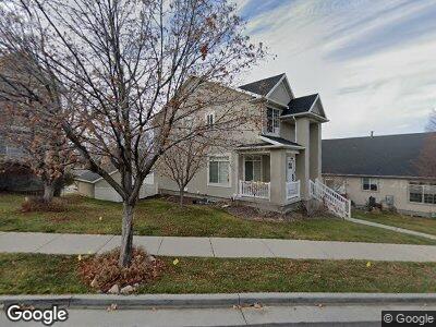
14196 Orgill Band Rd Draper, UT 84020
Estimated Value: $732,000 - $787,000
6
Beds
3
Baths
2,952
Sq Ft
$258/Sq Ft
Est. Value
About This Home
This home is located at 14196 Orgill Band Rd, Draper, UT 84020 and is currently estimated at $761,781, approximately $258 per square foot. 14196 Orgill Band Rd is a home located in Salt Lake County with nearby schools including Oak Hollow School, Draper Park Middle School, and Corner Canyon High School.
Ownership History
Date
Name
Owned For
Owner Type
Purchase Details
Closed on
Jun 16, 2023
Sold by
Kroneberger Keri
Bought by
Munoz Andrew and Adams Ashlyn
Current Estimated Value
Home Financials for this Owner
Home Financials are based on the most recent Mortgage that was taken out on this home.
Original Mortgage
$672,600
Outstanding Balance
$662,255
Interest Rate
6.39%
Mortgage Type
Construction
Purchase Details
Closed on
Jun 24, 1999
Sold by
Best Ron S and Best Kelly M
Bought by
Kroneberger Keri
Home Financials for this Owner
Home Financials are based on the most recent Mortgage that was taken out on this home.
Original Mortgage
$179,250
Interest Rate
7.05%
Mortgage Type
Seller Take Back
Purchase Details
Closed on
Oct 31, 1996
Sold by
Pulte Home Corp
Bought by
Best Ron S and Best Kelly M
Create a Home Valuation Report for This Property
The Home Valuation Report is an in-depth analysis detailing your home's value as well as a comparison with similar homes in the area
Home Values in the Area
Average Home Value in this Area
Purchase History
| Date | Buyer | Sale Price | Title Company |
|---|---|---|---|
| Munoz Andrew | -- | Us Title | |
| Kroneberger Keri | -- | United Title Services | |
| Best Ron S | -- | -- |
Source: Public Records
Mortgage History
| Date | Status | Borrower | Loan Amount |
|---|---|---|---|
| Open | Munoz Andrew | $672,600 | |
| Previous Owner | Kroneberger Keri | $137,000 | |
| Previous Owner | Kroneberger Keri | $181,000 | |
| Previous Owner | Kroneberger Keri | $179,250 |
Source: Public Records
Tax History Compared to Growth
Tax History
| Year | Tax Paid | Tax Assessment Tax Assessment Total Assessment is a certain percentage of the fair market value that is determined by local assessors to be the total taxable value of land and additions on the property. | Land | Improvement |
|---|---|---|---|---|
| 2023 | $2,448 | $464,200 | $153,200 | $311,000 |
| 2022 | $2,544 | $466,000 | $150,200 | $315,800 |
| 2021 | $2,376 | $371,700 | $110,100 | $261,600 |
| 2020 | $2,251 | $333,800 | $92,200 | $241,600 |
| 2019 | $2,264 | $328,100 | $90,800 | $237,300 |
| 2018 | $2,008 | $297,400 | $87,900 | $209,500 |
| 2017 | $2,019 | $286,500 | $72,900 | $213,600 |
| 2016 | $2,015 | $277,800 | $72,900 | $204,900 |
| 2015 | $2,038 | $260,200 | $70,800 | $189,400 |
| 2014 | $1,961 | $244,600 | $67,200 | $177,400 |
Source: Public Records
Map
Nearby Homes
- 955 E Senior Band Rd
- 14112 S Senior Band Rd
- 857 E Park School Rd
- 932 E Kaseys Cir
- 13941 S Jarvie Ln
- 14051 S Deer Trail Ln
- 14118 Winfield Scott Way
- 14028 S Candy Pull Dr
- 14038 S New Saddle Rd
- 764 Southfork Dr
- 13994 S New Saddle Rd
- 13189 S City Point Cove E Unit 4
- 15211 S Eagle Dr Unit 141
- 15219 S Eagle Dr Unit 141
- 2202 E Eagle Dr Unit 141
- 2196 E Eagle Dr Unit 141
- 15193 S Eagle Dr Unit 141
- 15183 S Eagle Dr Unit 141
- 1324 E Victor Ln
- 1314 E Victor Ln
- 14196 Orgill Band Rd
- 14196 S Orgill Band Rd
- 14186 Orgill Band Rd
- 14180 Orgill Band Rd
- 14204 Orgill Band Rd
- 14212 Orgill Band Rd
- 14205 S Orgill Band Rd
- 14201 Adobe School Dr
- 14205 Orgill Band Rd
- 14195 Orgill Band Rd
- 14209 Adobe School Dr
- 14209 S Adobe School Dr
- 14185 Orgill Band Rd
- 14185 S Orgill Band Rd
- 14215 Orgill Band Rd
- 14220 Orgill Band Rd
- 14220 S Orgill Band Rd
- 14217 Adobe School Dr
- 917 Spiers Ln
- 917 E Spiers Ln