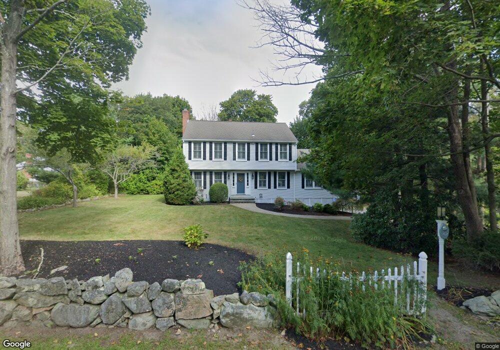
142 Captain Pierce Rd Scituate, MA 02066
Estimated Value: $897,000 - $1,097,000
4
Beds
3
Baths
2,036
Sq Ft
$489/Sq Ft
Est. Value
About This Home
This home is located at 142 Captain Pierce Rd, Scituate, MA 02066 and is currently estimated at $995,637, approximately $489 per square foot. 142 Captain Pierce Rd is a home located in Plymouth County with nearby schools including Cushing Elementary School, Lester J. Gates Middle School, and Scituate High School.
Ownership History
Date
Name
Owned For
Owner Type
Purchase Details
Closed on
Jun 15, 2007
Sold by
Cushing Nancy W and Keyes Dorothy B
Bought by
Neviera Julie Anne
Current Estimated Value
Home Financials for this Owner
Home Financials are based on the most recent Mortgage that was taken out on this home.
Original Mortgage
$348,000
Interest Rate
6.19%
Mortgage Type
Purchase Money Mortgage
Create a Home Valuation Report for This Property
The Home Valuation Report is an in-depth analysis detailing your home's value as well as a comparison with similar homes in the area
Home Values in the Area
Average Home Value in this Area
Purchase History
| Date | Buyer | Sale Price | Title Company |
|---|---|---|---|
| Neviera Julie Anne | $435,000 | -- |
Source: Public Records
Mortgage History
| Date | Status | Borrower | Loan Amount |
|---|---|---|---|
| Open | Neviera Julie Anne | $388,000 | |
| Closed | Neviera Julie Anne | $348,000 | |
| Closed | Neviera Julie Anne | $43,500 |
Source: Public Records
Tax History
| Year | Tax Paid | Tax Assessment Tax Assessment Total Assessment is a certain percentage of the fair market value that is determined by local assessors to be the total taxable value of land and additions on the property. | Land | Improvement |
|---|---|---|---|---|
| 2025 | $7,855 | $786,300 | $378,200 | $408,100 |
| 2024 | $7,759 | $748,900 | $343,800 | $405,100 |
| 2023 | $7,808 | $705,500 | $329,900 | $375,600 |
| 2022 | $7,808 | $618,700 | $299,600 | $319,100 |
| 2021 | $7,126 | $534,600 | $285,300 | $249,300 |
| 2020 | $6,908 | $511,700 | $274,300 | $237,400 |
| 2019 | $6,774 | $493,000 | $268,900 | $224,100 |
| 2018 | $6,752 | $484,000 | $279,700 | $204,300 |
| 2017 | $6,549 | $464,800 | $268,500 | $196,300 |
| 2016 | $6,257 | $442,500 | $246,200 | $196,300 |
| 2015 | $5,650 | $431,300 | $235,000 | $196,300 |
Source: Public Records
Map
Nearby Homes
- 124 Captain Peirce Rd
- 49 Whittier Dr
- 629 Country Way
- 59 Captain Peirce Rd
- 54 Woodland Rd
- 701 Country Way
- 7 3 Ring Rd
- 11 Forest Ln
- 9 Forest Ln Unit 9
- 74 Branch St Unit 15
- 26 Mordecai Lincoln Rd
- 430 Hatherly Rd
- 430 Hatherly Rd Unit Exhibit “A”
- 430 Hatherly Rd Unit Exhibit “B”
- 327 Country Way
- 20 Lawson Rd
- 49 Jackson Rd
- 34 Cudworth Rd
- 817 Country Way
- 20 Lee Ave
- 140 Captain Peirce Rd
- 140 Captain Pierce Rd
- 148 Captain Peirce Rd
- 560 Country Way
- 145 Captain Pierce Rd
- 566 Country Way
- 126 Captain Peirce Rd
- 126 Captain Pierce Rd
- 147 Captain Pierce Rd
- 60 Captain Pierce Rd
- 158 Captain Pierce Rd
- 157 Captain Pierce Rd
- 574 Country Way
- 561 Country Way
- 563 Country Way
- 125 Captain Pierce Rd
- 546 Country Way
- 575 Country Way
- 543R Country Way
- 543 rear Country Way
Your Personal Tour Guide
Ask me questions while you tour the home.