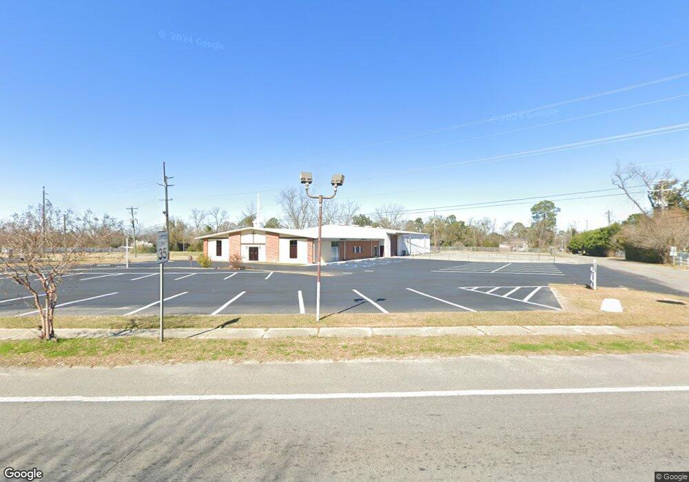
142 Curry St NE Pelham, GA 31779
Estimated Value: $528,498
--
Bed
--
Bath
5,110
Sq Ft
$103/Sq Ft
Est. Value
About This Home
This home is located at 142 Curry St NE, Pelham, GA 31779 and is currently estimated at $528,498, approximately $103 per square foot. 142 Curry St NE is a home located in Mitchell County with nearby schools including Pelham Elementary School, Pelham City Middle School, and Pelham High School.
Ownership History
Date
Name
Owned For
Owner Type
Purchase Details
Closed on
Sep 18, 2023
Sold by
Georgia Arch Partners Llc
Bought by
St Lewis Missionary Baptist Church
Current Estimated Value
Purchase Details
Closed on
Jul 31, 2012
Sold by
Herring Anthony G
Bought by
St Lewis Missionary Baptist Ch
Purchase Details
Closed on
Jul 7, 2005
Sold by
Spivey Joel
Bought by
Herring Anthony G
Create a Home Valuation Report for This Property
The Home Valuation Report is an in-depth analysis detailing your home's value as well as a comparison with similar homes in the area
Home Values in the Area
Average Home Value in this Area
Purchase History
| Date | Buyer | Sale Price | Title Company |
|---|---|---|---|
| St Lewis Missionary Baptist Church | $8,000 | -- | |
| St Lewis Missionary Baptist Ch | $170,000 | -- | |
| Herring Anthony G | $685,000 | -- |
Source: Public Records
Tax History Compared to Growth
Tax History
| Year | Tax Paid | Tax Assessment Tax Assessment Total Assessment is a certain percentage of the fair market value that is determined by local assessors to be the total taxable value of land and additions on the property. | Land | Improvement |
|---|---|---|---|---|
| 2024 | -- | $157,589 | $16,814 | $140,775 |
| 2023 | $6,989 | $157,589 | $16,814 | $140,775 |
| 2022 | $6,989 | $157,589 | $16,814 | $140,775 |
| 2021 | $7,125 | $157,589 | $16,814 | $140,775 |
| 2020 | $7,125 | $157,589 | $16,814 | $140,775 |
| 2019 | $7,174 | $158,674 | $16,814 | $141,860 |
| 2018 | $7,174 | $158,674 | $16,814 | $141,860 |
| 2017 | $7,174 | $158,674 | $16,814 | $141,860 |
| 2016 | -- | $158,674 | $16,814 | $141,860 |
| 2015 | -- | $158,674 | $16,814 | $141,860 |
| 2014 | -- | $158,674 | $16,814 | $141,860 |
| 2013 | -- | $158,674 | $16,814 | $141,860 |
Source: Public Records
Map
Nearby Homes
- 199 Carroll St NE
- 210 Castleberry St NW
- 323 Curry St NE
- 212 Hand Ave W
- 335 Curry St NE
- 233 Cannon St NW
- 209 McDonald St SW
- 183 Baggs Ave SE
- 135 Baggs Ave SE
- 354 Bennett St NW
- 438 Dogwood Dr NE
- 375 Baggs Ave SE
- 3** Youngs Mill Rd
- 482 Curry St NE
- 547 Cotton Rd NE
- 277 Saunders St SW
- 589 Liberia St NW
- 389 Stewart St SW
- 410 Hollis St SW
- 425 Hollis St SW
- 198 E Railroad St NE
- 170 Curry St NE
- 208 E Railroad St NE
- 188 Curry St NE
- 218 E Railroad St NE
- 171 Tennyson St NE
- 220 Hollingsworth St NE
- 226 W Railroad St N
- 198 Curry St NE
- 231 Hollingsworth St NE
- 185 Curry St NE
- 185 Tennyson St NE
- 163 Upson St NE
- 230 E Railroad St NE
- 0000 Back Nine Road (190 Acres)
- 167 Upson St NE
- 208 Curry St NE
- 171 Upson St NE
- 144 Upson St NE
- 199 Tennyson St NE