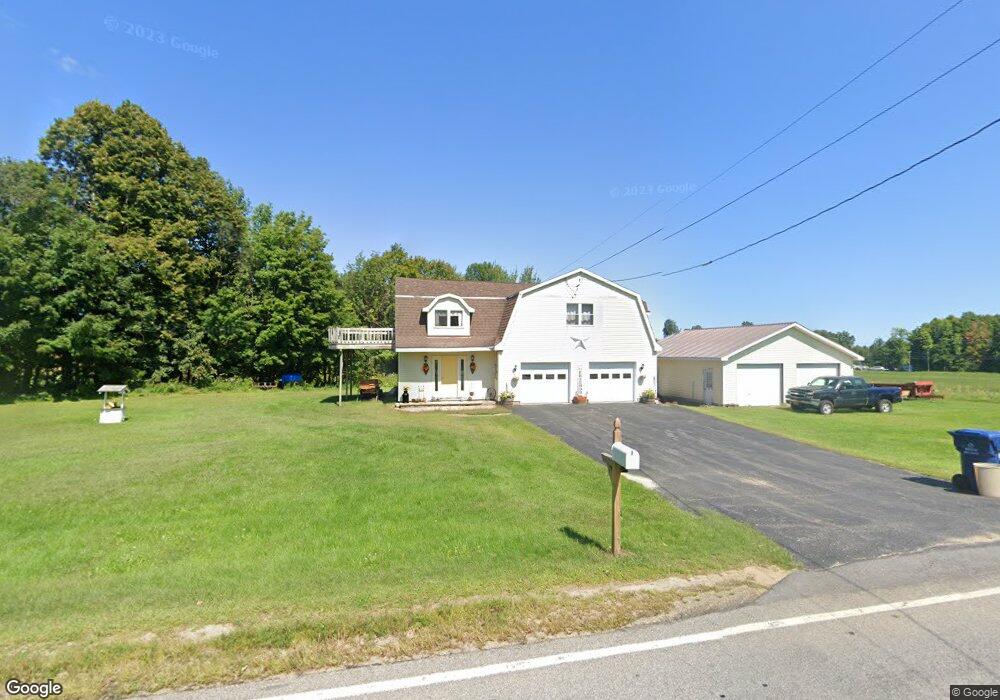
142 Davison Rd Mooers Forks, NY 12959
Estimated Value: $214,411 - $255,000
3
Beds
1
Bath
1,792
Sq Ft
$127/Sq Ft
Est. Value
About This Home
This home is located at 142 Davison Rd, Mooers Forks, NY 12959 and is currently estimated at $228,103, approximately $127 per square foot. 142 Davison Rd is a home located in Clinton County with nearby schools including Northeastern Clinton Senior High School.
Ownership History
Date
Name
Owned For
Owner Type
Purchase Details
Closed on
Sep 21, 2022
Sold by
Relation Michael
Bought by
Relation Michael H and Relation Michelle L
Current Estimated Value
Home Financials for this Owner
Home Financials are based on the most recent Mortgage that was taken out on this home.
Original Mortgage
$70,000
Outstanding Balance
$52,678
Interest Rate
5.22%
Mortgage Type
New Conventional
Estimated Equity
$175,425
Purchase Details
Closed on
Jun 25, 2002
Sold by
Lavalley Timothy
Bought by
Relation Michael
Create a Home Valuation Report for This Property
The Home Valuation Report is an in-depth analysis detailing your home's value as well as a comparison with similar homes in the area
Home Values in the Area
Average Home Value in this Area
Purchase History
| Date | Buyer | Sale Price | Title Company |
|---|---|---|---|
| Relation Michael H | -- | None Available | |
| Relation Michael H | -- | None Available | |
| Relation Michael | $55,000 | None | |
| Relation Michael | $55,000 | None |
Source: Public Records
Mortgage History
| Date | Status | Borrower | Loan Amount |
|---|---|---|---|
| Open | Relation Michael H | $70,000 | |
| Closed | Relation Michael H | $70,000 |
Source: Public Records
Tax History Compared to Growth
Tax History
| Year | Tax Paid | Tax Assessment Tax Assessment Total Assessment is a certain percentage of the fair market value that is determined by local assessors to be the total taxable value of land and additions on the property. | Land | Improvement |
|---|---|---|---|---|
| 2024 | $4,579 | $191,000 | $27,000 | $164,000 |
| 2023 | $4,747 | $191,000 | $27,000 | $164,000 |
| 2022 | $4,303 | $177,600 | $23,000 | $154,600 |
| 2021 | $3,467 | $106,100 | $16,000 | $90,100 |
| 2020 | $2,707 | $106,100 | $16,000 | $90,100 |
| 2019 | $2,682 | $106,100 | $16,000 | $90,100 |
| 2018 | $2,682 | $106,100 | $16,000 | $90,100 |
| 2017 | $2,532 | $101,900 | $16,000 | $85,900 |
| 2016 | $2,497 | $101,900 | $16,000 | $85,900 |
| 2015 | -- | $100,000 | $16,000 | $84,000 |
| 2014 | -- | $100,000 | $8,000 | $92,000 |
Source: Public Records
Map
Nearby Homes
- 3107 U S 11
- 188 Blackman Corners Rd
- 0 N Star Rd Unit 202564
- 3373 U S 11
- 1428 N Star Rd
- 391 Gilbert Rd
- 0 Unit 178956
- 2344 U S 11
- 1328 N Star Rd
- 00 Route 11
- 1335 Hemmingford Rd
- 2247 State Route 11
- 235 Letson Rd
- 2030 Alder Bend Rd
- 2949 Miner Farm Rd
- 3 Romat Ln
- 107 Pinewood Dr
- 57 Pinewood Dr
- 48 Pinewood Dr
- 9047 New York 22
- 139 Davison Rd
- 131 Davison Rd
- 121 Davison Rd
- 87 Blackman Corners Rd
- 180 Davison Rd
- 59 Blackman Corners Rd
- 106 Blackman Corners Rd
- 127 Blackman Corners Rd
- 56 Blackman Corners Rd
- 122 Blackman Corners Rd
- 50 Blackman Corners Rd
- 130 Blackman Corners Rd
- 196 Davison Rd Unit 198
- 88 Davison Rd
- 48 Blackman Corners Rd
- 42-44 Blackman Corners Rd
- 42 Blackman Corners Rd
- 37 Blackman Corners Rd
- 204 Davison Rd
- 29 Blackman Corners Rd