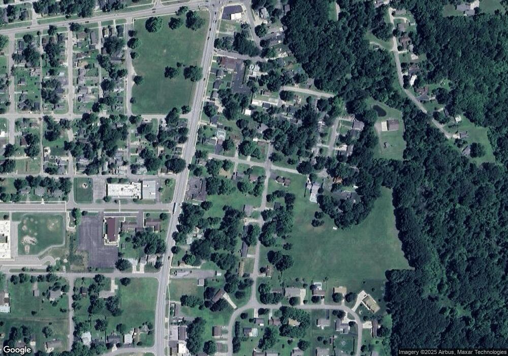
142 E Division Watervliet, MI 49098
Estimated Value: $96,610 - $179,000
2
Beds
1
Bath
1,245
Sq Ft
$115/Sq Ft
Est. Value
About This Home
This home is located at 142 E Division, Watervliet, MI 49098 and is currently estimated at $143,653, approximately $115 per square foot. 142 E Division is a home located in Berrien County with nearby schools including South Elementary School, North Elementary School, and Watervliet Middle School.
Ownership History
Date
Name
Owned For
Owner Type
Purchase Details
Closed on
Aug 21, 2014
Sold by
Kehrer James M and Kehrer Janice E
Bought by
Kehrer James M and Kehrer Amy L
Current Estimated Value
Purchase Details
Closed on
Jul 15, 2014
Sold by
Langston Sharon A and Langston Brett J
Bought by
Kehrer James M
Purchase Details
Closed on
Jun 5, 2007
Sold by
Scheid Theodore J and Estate Of Mary Frances Scheid
Bought by
Langston Sharon A and Langston Brett J
Home Financials for this Owner
Home Financials are based on the most recent Mortgage that was taken out on this home.
Original Mortgage
$82,650
Interest Rate
6.21%
Mortgage Type
Purchase Money Mortgage
Create a Home Valuation Report for This Property
The Home Valuation Report is an in-depth analysis detailing your home's value as well as a comparison with similar homes in the area
Home Values in the Area
Average Home Value in this Area
Purchase History
| Date | Buyer | Sale Price | Title Company |
|---|---|---|---|
| Kehrer James M | $50,000 | None Available | |
| Kehrer James M | $71,500 | None Available | |
| Langston Sharon A | $87,000 | None Available |
Source: Public Records
Mortgage History
| Date | Status | Borrower | Loan Amount |
|---|---|---|---|
| Previous Owner | Langston Sharon A | $82,650 |
Source: Public Records
Tax History
| Year | Tax Paid | Tax Assessment Tax Assessment Total Assessment is a certain percentage of the fair market value that is determined by local assessors to be the total taxable value of land and additions on the property. | Land | Improvement |
|---|---|---|---|---|
| 2025 | $1,064 | $32,100 | $0 | $0 |
| 2024 | $783 | $29,900 | $0 | $0 |
| 2023 | $752 | $24,600 | $0 | $0 |
| 2022 | $604 | $23,400 | $0 | $0 |
| 2021 | $950 | $22,700 | $3,000 | $19,700 |
| 2020 | $940 | $20,200 | $0 | $0 |
| 2019 | $736 | $15,600 | $3,300 | $12,300 |
| 2018 | $718 | $15,600 | $0 | $0 |
| 2017 | $753 | $16,300 | $0 | $0 |
| 2016 | $754 | $16,500 | $0 | $0 |
| 2015 | $815 | $17,600 | $0 | $0 |
| 2014 | $706 | $17,700 | $0 | $0 |
Source: Public Records
Map
Nearby Homes
- 0 Highway M-140
- 8203 Verlynda Dr
- 0 Red Arrow Hwy Unit 25050745
- 323 S Pleasant St
- 127 N Pleasant St
- 340 High View St
- 422 Paw Ave
- 518 Dogwood Ln Unit 18
- 924 Richard Ave
- 909 Western Ave
- 915 & 927 Western Ave
- 4875 N Watervliet Rd
- 0 Huntoon Ave
- 704 & 712 Courtyard Place
- 4958 Forest Park Ave
- 4862 Knoll Ct
- 4874 Knoll Ct
- 7039 Curtis Dr
- 21 Harlan Dr
- 1 Harlan Dr
- 142 E Division
- 134 E Division
- 3956 Sutherland Ave
- 8201 E Division
- 3961 Sutherland Ave
- 348 Sutherland Ave
- 118 E Division
- 3940 Sutherland Ave
- 3951 Sutherland Ave
- 337 S Main St
- 127 E Division
- 339 Sutherland Ave
- 3937 Sutherland Ave
- 3939 N M 140
- 348 Bluffview
- 3924 Sutherland Ave
- 303 S Main St
- 340 Bluffview
- 3959 N M 140
- 249 S Main St
Your Personal Tour Guide
Ask me questions while you tour the home.
