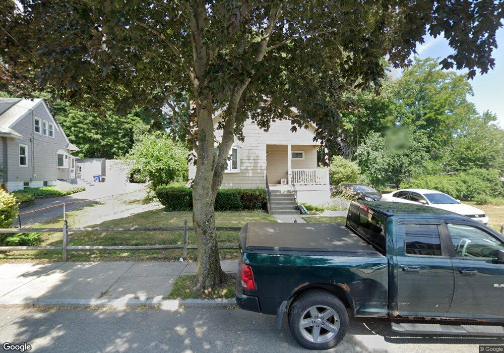
142 Laurie Ave West Roxbury, MA 02132
Upper Washington-Spring Street NeighborhoodEstimated Value: $551,000 - $674,000
2
Beds
1
Bath
1,058
Sq Ft
$587/Sq Ft
Est. Value
About This Home
This home is located at 142 Laurie Ave, West Roxbury, MA 02132 and is currently estimated at $621,300, approximately $587 per square foot. 142 Laurie Ave is a home located in Suffolk County with nearby schools including St Theresa School, Catholic Memorial School, and The Roxbury Latin School.
Ownership History
Date
Name
Owned For
Owner Type
Purchase Details
Closed on
Jun 11, 2003
Sold by
Donohoe Paul I and Donohoe Carol A
Bought by
Humphreys Jeanne
Current Estimated Value
Home Financials for this Owner
Home Financials are based on the most recent Mortgage that was taken out on this home.
Original Mortgage
$240,000
Outstanding Balance
$105,055
Interest Rate
5.77%
Mortgage Type
Purchase Money Mortgage
Estimated Equity
$516,245
Purchase Details
Closed on
May 28, 1998
Sold by
Mcphail Jon R and Mcphail Rosemary C
Bought by
Fay Andrew and Fay Elizabeth
Home Financials for this Owner
Home Financials are based on the most recent Mortgage that was taken out on this home.
Original Mortgage
$152,000
Interest Rate
7.12%
Mortgage Type
Purchase Money Mortgage
Purchase Details
Closed on
Jun 25, 1992
Sold by
Donohoe Paul I and Mcdowell Ruth
Bought by
Mcphail Rosemary C and Mcphail Jon R
Create a Home Valuation Report for This Property
The Home Valuation Report is an in-depth analysis detailing your home's value as well as a comparison with similar homes in the area
Home Values in the Area
Average Home Value in this Area
Purchase History
| Date | Buyer | Sale Price | Title Company |
|---|---|---|---|
| Humphreys Jeanne | $300,000 | -- | |
| Fay Andrew | $160,000 | -- | |
| Mcphail Rosemary C | $104,000 | -- |
Source: Public Records
Mortgage History
| Date | Status | Borrower | Loan Amount |
|---|---|---|---|
| Open | Mcphail Rosemary C | $240,000 | |
| Previous Owner | Mcphail Rosemary C | $180,000 | |
| Previous Owner | Mcphail Rosemary C | $152,000 |
Source: Public Records
Tax History Compared to Growth
Tax History
| Year | Tax Paid | Tax Assessment Tax Assessment Total Assessment is a certain percentage of the fair market value that is determined by local assessors to be the total taxable value of land and additions on the property. | Land | Improvement |
|---|---|---|---|---|
| 2025 | $6,467 | $558,500 | $186,400 | $372,100 |
| 2024 | $5,391 | $494,600 | $185,600 | $309,000 |
| 2023 | $5,312 | $494,600 | $185,600 | $309,000 |
| 2022 | $4,892 | $449,600 | $168,700 | $280,900 |
| 2021 | $4,452 | $417,200 | $160,700 | $256,500 |
| 2020 | $4,227 | $400,300 | $149,900 | $250,400 |
| 2019 | $3,982 | $377,800 | $122,300 | $255,500 |
| 2018 | $3,665 | $349,700 | $122,300 | $227,400 |
| 2017 | $3,665 | $346,100 | $122,300 | $223,800 |
| 2016 | $3,368 | $306,200 | $122,300 | $183,900 |
| 2015 | $3,536 | $292,000 | $135,800 | $156,200 |
| 2014 | $3,433 | $272,900 | $135,800 | $137,100 |
Source: Public Records
Map
Nearby Homes
- 63 Johnson St
- 12 Bronx Rd
- 2231 Centre St
- 80 Caledonian Ave
- 1214 Vfw Pkwy Unit 30
- 1214 Vfw Pkwy Unit 37
- 14 Sanborn Ave
- 46 Bayard St
- 27-29 Temple St
- 340 Baker St Unit 1
- 1515 Vfw Pkwy Unit M19
- 28 Dow Rd
- 59 Chesbrough Rd
- 55 Cottage Rd
- 110 New Haven St
- 183 Temple St
- 425 Lagrange St Unit 203
- 14 Arbor Ln
- 348 Lagrange St
- 105 Chesbrough Rd
- 136 Laurie Ave
- 146 Laurie Ave
- 14 Cypress Terrace
- 148 Laurie Ave
- 130 Laurie Ave
- 10 Cypress Terrace
- 135 Laurie Ave
- 139 Laurie Ave
- 143 Laurie Ave
- 147 Laurie Ave
- 131 Laurie Ave
- 15 Cypress Terrace
- 124 Laurie Ave
- 101 Cypress Unit 1,101
- 6 Cypress Terrace
- 104 Baker St
- 127 Laurie Ave
- 120 Baker St
- 9 Cypress Terrace
- 130 Baker St