Estimated Value: $202,000 - $268,000
Studio
2
Baths
1,842
Sq Ft
$124/Sq Ft
Est. Value
About This Home
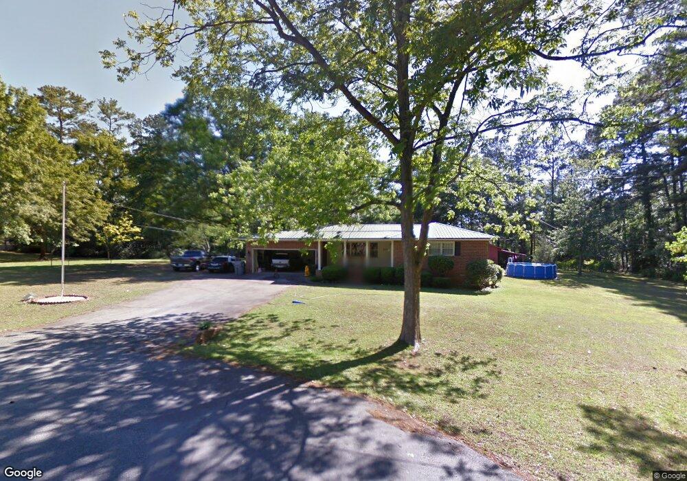
This home is located at 142 Lee St, Gray, GA 31032 and is currently estimated at $229,188, approximately $124 per square foot. 142 Lee St is a home located in Jones County with nearby schools including Gray Elementary School, Gray Station Middle School, and Jones County High School.
Ownership History
Date
Name
Owned For
Owner Type
Purchase Details
Closed on
Oct 13, 2009
Sold by
Foster Lois K
Bought by
Douglas Jason K
Current Estimated Value
Home Financials for this Owner
Home Financials are based on the most recent Mortgage that was taken out on this home.
Original Mortgage
$139,900
Outstanding Balance
$90,047
Interest Rate
5.04%
Mortgage Type
VA
Estimated Equity
$139,141
Purchase Details
Closed on
Apr 15, 2008
Sold by
Foster Frank A
Bought by
Foster Lois K
Create a Home Valuation Report for This Property
The Home Valuation Report is an in-depth analysis detailing your home's value as well as a comparison with similar homes in the area
Home Values in the Area
Average Home Value in this Area
Purchase History
| Date | Buyer | Sale Price | Title Company |
|---|---|---|---|
| Douglas Jason K | $137,000 | -- | |
| Douglas Jason K | $137,000 | -- | |
| Foster Lois K | -- | -- |
Source: Public Records
Mortgage History
| Date | Status | Borrower | Loan Amount |
|---|---|---|---|
| Open | Douglas Jason K | $139,900 | |
| Closed | Douglas Jason K | $139,900 |
Source: Public Records
Tax History
| Year | Tax Paid | Tax Assessment Tax Assessment Total Assessment is a certain percentage of the fair market value that is determined by local assessors to be the total taxable value of land and additions on the property. | Land | Improvement |
|---|---|---|---|---|
| 2025 | $2,593 | $61,295 | $15,954 | $45,341 |
| 2023 | $1,838 | $49,550 | $11,396 | $38,154 |
| 2022 | $1,852 | $49,550 | $11,396 | $38,154 |
| 2021 | $1,854 | $49,550 | $11,396 | $38,154 |
| 2020 | $1,855 | $49,550 | $11,396 | $38,154 |
| 2019 | $1,855 | $49,550 | $11,396 | $38,154 |
| 2018 | $1,855 | $49,550 | $11,396 | $38,154 |
| 2017 | $1,855 | $49,550 | $11,396 | $38,154 |
| 2016 | $1,855 | $49,550 | $11,396 | $38,154 |
| 2015 | $1,758 | $49,550 | $11,396 | $38,154 |
| 2014 | $1,625 | $49,550 | $11,396 | $38,154 |
Source: Public Records
Map
Nearby Homes
- 1023 Boulder Dr Unit LOT 65
- 1023 Boulder Dr
- 1023 Boulder Lot 65 Dr
- 236 Old Clinton Rd
- 0 Bill Conn Pkwy
- 132 Oak Dr
- 122 Oak Dr
- 115 Oak Dr
- 184 Stone Brooke Dr
- 250 Stone Brooke Lot 133 Dr
- 250 Stone Brooke Dr Unit LOT 133
- 250 Stone Brooke Dr
- 0 Sandra Dr Unit M179018
- 0 Sandra Dr Unit 52382
- 0 Sandra Dr Unit 10487926
- 0 Sandra Dr Unit 252106
- 1104 Boulder Dr
- 106 Davis St
- 0 Clinton Crossing Unit 10637924
- 146 Lite N Tie Rd
Your Personal Tour Guide
Ask me questions while you tour the home.