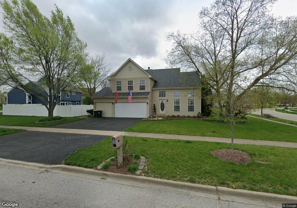
142 Old Post Rd Oswego, IL 60543
North Oswego NeighborhoodEstimated Value: $371,000 - $393,000
3
Beds
3
Baths
1,945
Sq Ft
$198/Sq Ft
Est. Value
About This Home
This home is located at 142 Old Post Rd, Oswego, IL 60543 and is currently estimated at $385,842, approximately $198 per square foot. 142 Old Post Rd is a home located in Kendall County with nearby schools including Old Post Elementary School, Thompson Jr. High School, and Oswego High School.
Ownership History
Date
Name
Owned For
Owner Type
Purchase Details
Closed on
Feb 23, 2011
Sold by
Munici Sam A
Bought by
Munici Sam A and Munici Karen L
Current Estimated Value
Home Financials for this Owner
Home Financials are based on the most recent Mortgage that was taken out on this home.
Original Mortgage
$160,000
Outstanding Balance
$110,003
Interest Rate
4.88%
Mortgage Type
New Conventional
Estimated Equity
$275,839
Purchase Details
Closed on
Jul 10, 2001
Sold by
Munici Donna F
Bought by
Munici Sam A
Purchase Details
Closed on
Mar 1, 1994
Bought by
Munici Sam A and Munici Donna F
Create a Home Valuation Report for This Property
The Home Valuation Report is an in-depth analysis detailing your home's value as well as a comparison with similar homes in the area
Home Values in the Area
Average Home Value in this Area
Purchase History
| Date | Buyer | Sale Price | Title Company |
|---|---|---|---|
| Munici Sam A | -- | Citywide Title Corporation | |
| Munici Sam A | -- | -- | |
| Munici Sam A | $159,900 | -- |
Source: Public Records
Mortgage History
| Date | Status | Borrower | Loan Amount |
|---|---|---|---|
| Open | Munici Sam A | $160,000 | |
| Closed | Munici Sam A | -- |
Source: Public Records
Tax History
| Year | Tax Paid | Tax Assessment Tax Assessment Total Assessment is a certain percentage of the fair market value that is determined by local assessors to be the total taxable value of land and additions on the property. | Land | Improvement |
|---|---|---|---|---|
| 2024 | -- | $113,587 | $23,745 | $89,842 |
| 2023 | $8,327 | $100,519 | $21,013 | $79,506 |
| 2022 | $8,327 | $92,219 | $19,278 | $72,941 |
| 2021 | $7,430 | $90,411 | $18,900 | $71,511 |
| 2020 | $7,569 | $86,106 | $18,000 | $68,106 |
| 2019 | $7,561 | $84,771 | $18,000 | $66,771 |
| 2018 | $7,416 | $82,532 | $18,112 | $64,420 |
| 2017 | $7,183 | $76,066 | $16,693 | $59,373 |
| 2016 | $6,875 | $72,101 | $15,823 | $56,278 |
| 2015 | $6,628 | $66,760 | $14,651 | $52,109 |
| 2014 | -- | $62,981 | $13,822 | $49,159 |
| 2013 | -- | $64,928 | $14,249 | $50,679 |
Source: Public Records
Map
Nearby Homes
- 225 Mondovi Dr
- 129 Seton Creek Dr
- 109 Old Post Rd
- 510 Waterford Dr
- 397 Cascade Ln Unit 2
- 74 Paddock St
- 521 Waterford Dr
- 135 Chesterfield Dr
- 404 Kent Ct
- 122 Longbeach Rd
- 34 Sonora Dr
- 232 Julep Ave
- 86 Circle Dr E
- 40 Chatham Place
- 27 Winrock Rd
- 309 Springbrook Trail S
- 611 Paris Ave
- 209 Huntington Ct
- 307 Huntington Ct
- 0000 Fifth St
- 225 Wollmington Dr
- 532 Waubonsee Cir
- 223 Wollmington Dr
- 533 Waubonsee Cir
- 530 Waubonsee Cir
- 531 Waubonsee Circle Dr
- 531 Waubonsee Cir
- 221 Wollmington Dr
- 224 Wollmington Dr
- 420 Stonemill Ln
- 219 Wollmington Dr
- 529 Waubonsee Cir Unit 2
- 418 Stonemill Ln
- 222 Wollmington Dr
- 416 Stonemill Ln
- 400 Gloria Ln Unit 4
- 527 Waubonsee Cir
- 217 Wollmington Dr
- 402 Gloria Ln Unit 4
- 220 Wollmington Dr
Your Personal Tour Guide
Ask me questions while you tour the home.