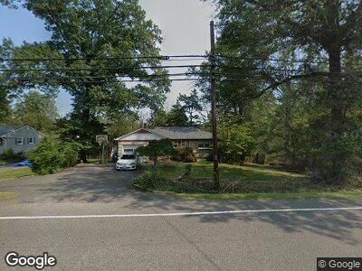
142 Oldwick Rd Whitehouse Station, NJ 08889
Tewksbury NeighborhoodEstimated Value: $419,010 - $558,000
--
Bed
--
Bath
1,100
Sq Ft
$453/Sq Ft
Est. Value
About This Home
This home is located at 142 Oldwick Rd, Whitehouse Station, NJ 08889 and is currently estimated at $498,503, approximately $453 per square foot. 142 Oldwick Rd is a home located in Hunterdon County with nearby schools including Old Turnpike School, Tewksbury Elementary School, and Voorhees High School.
Ownership History
Date
Name
Owned For
Owner Type
Purchase Details
Closed on
Sep 26, 2003
Sold by
Devletter Ernest and Devletter Patricia J
Bought by
D3 Realty Llc
Current Estimated Value
Home Financials for this Owner
Home Financials are based on the most recent Mortgage that was taken out on this home.
Original Mortgage
$228,000
Interest Rate
5.98%
Mortgage Type
Purchase Money Mortgage
Purchase Details
Closed on
Jun 13, 2000
Sold by
Richmond Henry
Bought by
Devletter Ernest and Devletter Patricia
Home Financials for this Owner
Home Financials are based on the most recent Mortgage that was taken out on this home.
Original Mortgage
$161,000
Interest Rate
8.28%
Purchase Details
Closed on
Jul 9, 1993
Sold by
Richmond Henry and Richmond Alice
Bought by
Richmond Henry
Create a Home Valuation Report for This Property
The Home Valuation Report is an in-depth analysis detailing your home's value as well as a comparison with similar homes in the area
Home Values in the Area
Average Home Value in this Area
Purchase History
| Date | Buyer | Sale Price | Title Company |
|---|---|---|---|
| D3 Realty Llc | $285,000 | -- | |
| Devletter Ernest | $191,000 | -- | |
| Richmond Henry | -- | -- |
Source: Public Records
Mortgage History
| Date | Status | Borrower | Loan Amount |
|---|---|---|---|
| Previous Owner | D3 Realty Llc | $228,000 | |
| Previous Owner | Devletter Ernest | $161,000 |
Source: Public Records
Tax History Compared to Growth
Tax History
| Year | Tax Paid | Tax Assessment Tax Assessment Total Assessment is a certain percentage of the fair market value that is determined by local assessors to be the total taxable value of land and additions on the property. | Land | Improvement |
|---|---|---|---|---|
| 2024 | $7,710 | $326,400 | $156,500 | $169,900 |
| 2023 | $7,710 | $326,400 | $156,500 | $169,900 |
| 2022 | $7,419 | $326,400 | $156,500 | $169,900 |
| 2021 | $5,049 | $326,400 | $156,500 | $169,900 |
| 2020 | $7,240 | $326,400 | $156,500 | $169,900 |
| 2019 | $5,049 | $195,300 | $111,700 | $83,600 |
| 2018 | $4,972 | $195,300 | $111,700 | $83,600 |
| 2017 | $4,916 | $195,300 | $111,700 | $83,600 |
| 2016 | $4,756 | $195,300 | $111,700 | $83,600 |
| 2015 | $4,603 | $195,300 | $111,700 | $83,600 |
| 2014 | $4,541 | $195,300 | $111,700 | $83,600 |
Source: Public Records
Map
Nearby Homes
- 45 Cedar Rd
- 19 Old Turnpike Rd
- 15 Cold Brook Rd
- 9 Trimmer Rd
- 24 Hunters Cir
- 10 Hunters Cir
- 6 Wintermute Farm Ln
- 18 Bissell Rd
- 72 Welsh Rd
- 11 Oldwick Rd
- 474 Rt 22
- 17 Uptom Pine Rd
- 474 U S 22
- 474 Us Highway 22 and 3
- 12 Glory Rd
- 2 Wayside Ln
- 31 Sanderson Ct
- 207 Teasel Ct Unit B207
- 10 Concord Rd
- 37 Sanderson Ct