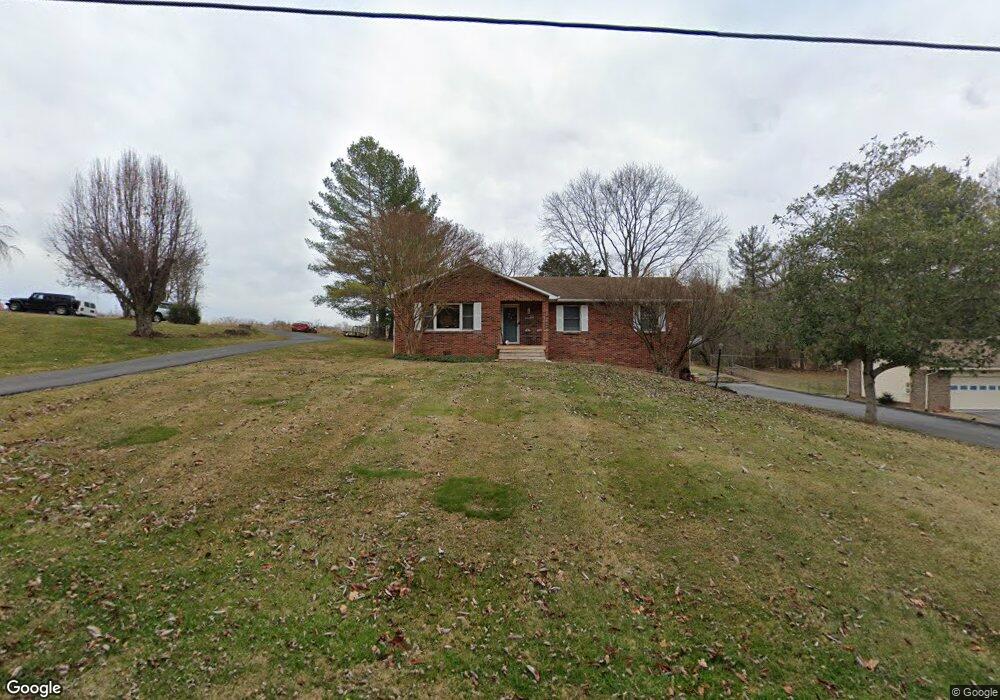
142 Park Dr Jonesborough, TN 37659
Estimated Value: $305,000 - $334,000
3
Beds
2
Baths
1,434
Sq Ft
$222/Sq Ft
Est. Value
About This Home
This home is located at 142 Park Dr, Jonesborough, TN 37659 and is currently estimated at $318,374, approximately $222 per square foot. 142 Park Dr is a home located in Washington County with nearby schools including Cherokee Elementary School, Liberty Bell Middle School, and Indian Trail Middle School.
Ownership History
Date
Name
Owned For
Owner Type
Purchase Details
Closed on
Feb 3, 2006
Sold by
Williams Robert P
Bought by
Woodson Michael S
Current Estimated Value
Home Financials for this Owner
Home Financials are based on the most recent Mortgage that was taken out on this home.
Original Mortgage
$112,000
Outstanding Balance
$62,827
Interest Rate
6.14%
Estimated Equity
$255,547
Purchase Details
Closed on
Aug 22, 2003
Sold by
Hill Clint and Hill Kathryn
Bought by
Williams Robert P
Purchase Details
Closed on
Jun 9, 1998
Sold by
Woods Kim A
Bought by
Hill Clint
Purchase Details
Closed on
Jan 1, 1986
Bought by
Woods Kim A and Woods J
Create a Home Valuation Report for This Property
The Home Valuation Report is an in-depth analysis detailing your home's value as well as a comparison with similar homes in the area
Home Values in the Area
Average Home Value in this Area
Purchase History
| Date | Buyer | Sale Price | Title Company |
|---|---|---|---|
| Woodson Michael S | $140,000 | -- | |
| Williams Robert P | $113,500 | -- | |
| Hill Clint | $109,900 | -- | |
| Woods Kim A | $57,500 | -- |
Source: Public Records
Mortgage History
| Date | Status | Borrower | Loan Amount |
|---|---|---|---|
| Open | Woods Kim A | $112,000 |
Source: Public Records
Tax History Compared to Growth
Tax History
| Year | Tax Paid | Tax Assessment Tax Assessment Total Assessment is a certain percentage of the fair market value that is determined by local assessors to be the total taxable value of land and additions on the property. | Land | Improvement |
|---|---|---|---|---|
| 2024 | $1,007 | $58,875 | $7,850 | $51,025 |
| 2023 | $780 | $36,300 | $0 | $0 |
| 2022 | $1,408 | $36,300 | $6,275 | $30,025 |
| 2021 | $1,408 | $36,300 | $6,275 | $30,025 |
| 2020 | $1,401 | $36,300 | $6,275 | $30,025 |
| 2019 | $841 | $36,300 | $6,275 | $30,025 |
| 2018 | $1,509 | $35,325 | $6,275 | $29,050 |
| 2017 | $1,509 | $35,325 | $6,275 | $29,050 |
| 2016 | $1,502 | $35,325 | $6,275 | $29,050 |
| 2015 | $1,360 | $35,325 | $6,275 | $29,050 |
| 2014 | $1,272 | $35,325 | $6,275 | $29,050 |
Source: Public Records
Map
Nearby Homes
- 3536 W Walnut St
- 3512 W Walnut St
- 107 Sunset Cir
- 3411 W Walnut St
- 624 Matson Rd
- 119 Woodland Dr
- 250 Green Pond Rd
- 132 Tamarack Dr
- 435 Matson Rd
- 3424 Street Dr
- 4 Haver Hill Ct
- 3419 Street Dr
- Darwin Plan at Beechwood Meadows
- Hanover Plan at Beechwood Meadows
- Richland Plan at Beechwood Meadows
- Elston Plan at Beechwood Meadows
- Penwell Plan at Beechwood Meadows
- Salem Plan at Beechwood Meadows
- Craig Plan at Beechwood Meadows
- Cali Plan at Beechwood Meadows
- 140 Park Dr
- 146 Park Dr
- 137 Park Dr
- 3653 W Walnut St
- 123 Park Dr
- 3623 W Walnut St
- 102 Silver Maple Dr
- 3643 Old Jonesborough Rd
- 3627 W Walnut St
- 3645 W Walnut St
- 3635 W Walnut St
- 3637 W Walnut St
- 113 Park Dr
- 3643 W Walnut St
- 3621 W Walnut St
- 3651 W Walnut St
- 126 Silver Maple Dr
- 114 Park Dr
- 3539 W Walnut St
- Lot 8 Silver Maple Dr